
Quick report
No instability noted.
Weather
- Air Temp
- 30
- Cloud Cover
- broken
- Wind Loading
- none
- Rain Elevation
- n/app
- Recent Snowfall
- 0
- Snow Avail For Transport
- small smounts
Mild weather overall. Temps in the high 20s, low 30s. Minimal wind, and no direct sun.
Snowpack
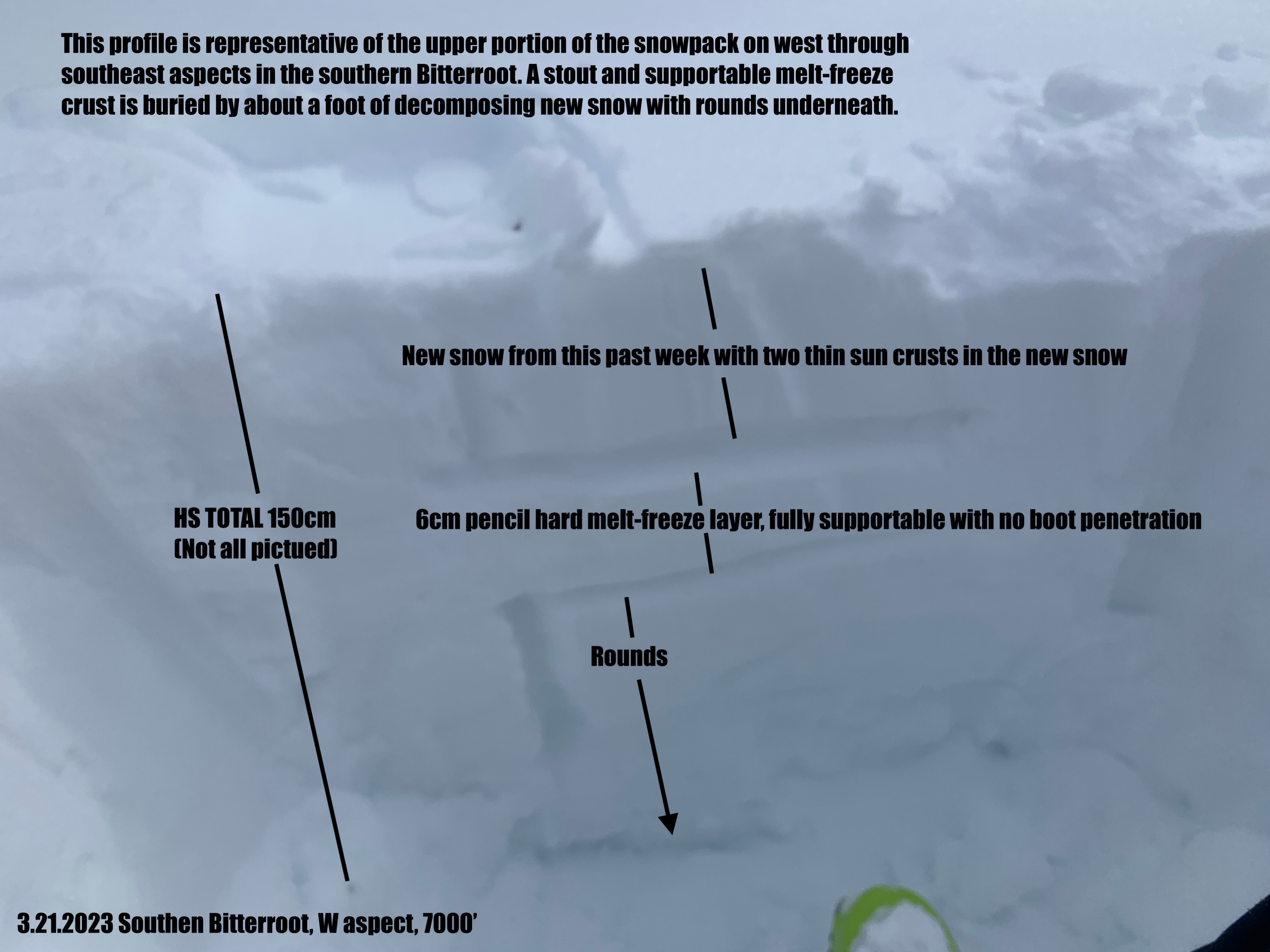
Todays goal was to re visit areas affected by melt layer recrystalization that produced collapsing and whumfing last week. I dug into a few similar areas and found a much stronger snowpack. Snow depths have shrunk from the warm temperatures with 7000' snow depths avaraging 130cm. There is a very stout, 4-8cm thick crust buried about a foot down on west through southeast aspects. It is fully supportable and you can walk around on it with no skis and not break through. There are facets above it but they are non reactive and unlikely to produce an avalanche.
Deeper in the snowpack there is poor stucture around a buried melt freeze crust that formed over presidents day weekend. The facets around it are more developed. It would be very difficult to impact this layer and trigger an avalanche due to the thick crust in the upper portion of the snowpack. It would probably take a large cornice or dropping a sled off a cliff to impact this deep layer.
Overall, the hazard of last week has diminished in the southern Bitterroot and avalanche danger has gone to low today. No new avanches were observed in upper elevation terrain along the pass. Any danger tomorrow will likely be isolated to new snow overnight tonight.