
Quick report
- Cracking
- widespread
Considerable today, likely high by tomorrow.
Easily able to trigger wind slabs along north facing ridge. Cracking in the new snow where it had settled into a slab.Weather
- Air Temp
- 25
- Cloud Cover
- obscured
- Wind Loading
- moderate
- Rain Elevation
- n/app
- Recent Snowfall
- 6" overnight, storm total around 18-20 inches.
- Snow Avail For Transport
- large amounts
Snowy start to the day, a break with ligher snowfall mid day, then 1" per hour snowfall in the afternoon.
Snowpack
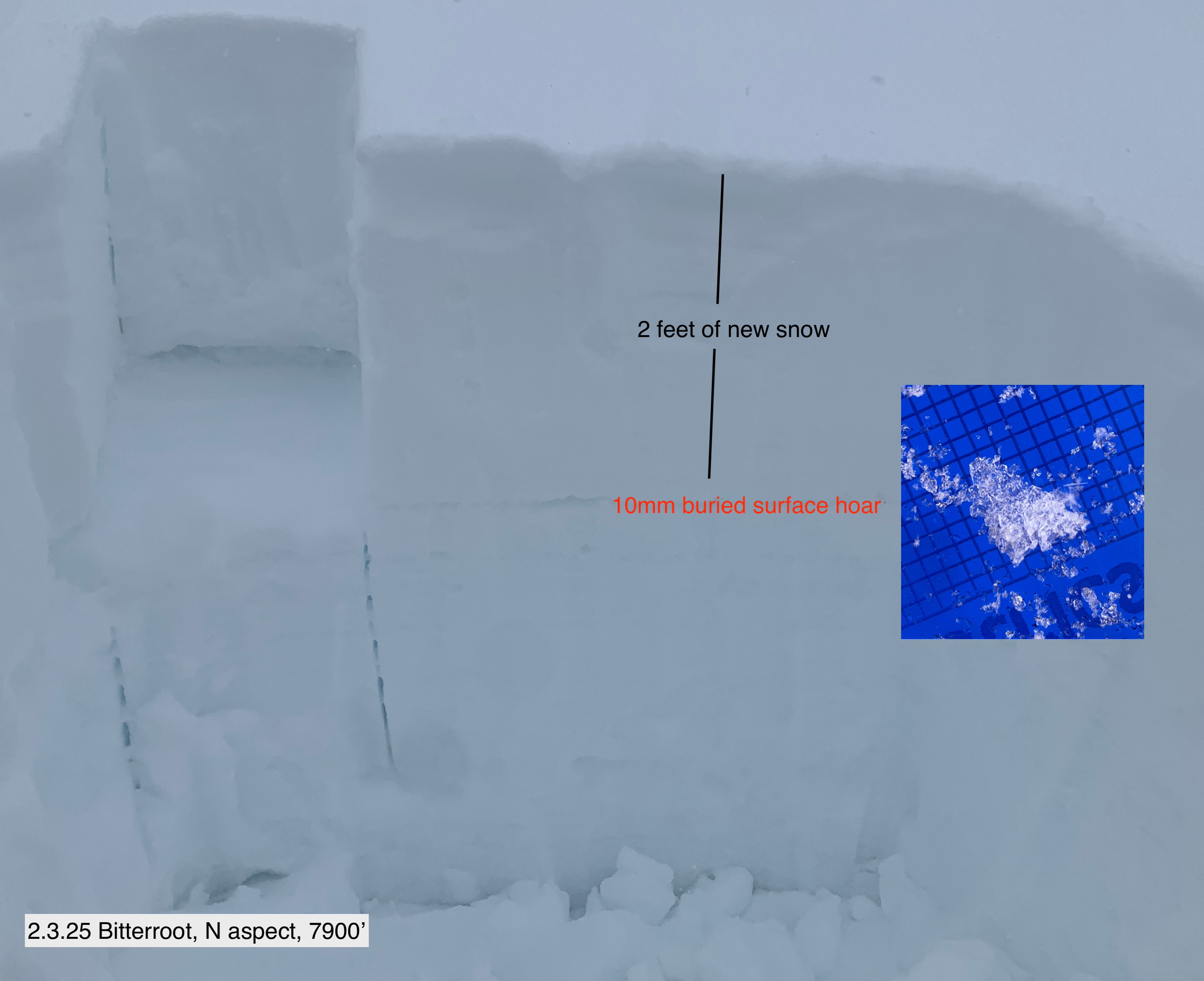
Incremental loading vs rapid loading of the weak layer and when will it reach the tipping point. That was and still is the question of the day. We have a well preserved layer of buried surface hoar on northerly aspects, and on solar aspects with a 1cm melt freeze crust, sensitive facets below the crust. By now there is almost 2 inches of water on them. Why no widespread avalanches? The slow incremental loading over the past few days has not tipped the weak layers where if all this water weight fell within 24 hours, we would probably be seing natural avalanches today.
That being said, the slab continues to incrementally build. Once the natural cycle begins, it should be widespread.
Of note:
- ECTPs on the buried surface hoar in the 15-20 tap range. The new snow is settling into a slab where yesterday it was still light and uncohesive new snow with no slab properties.
- Multiple failures on isolation of the column on south aspects at mid elevation where a 1cm crust sits on top of facets.
Avalanche
D1 wind slabs along riddgelines. D1 dry loose on road cuts.