
Quick report
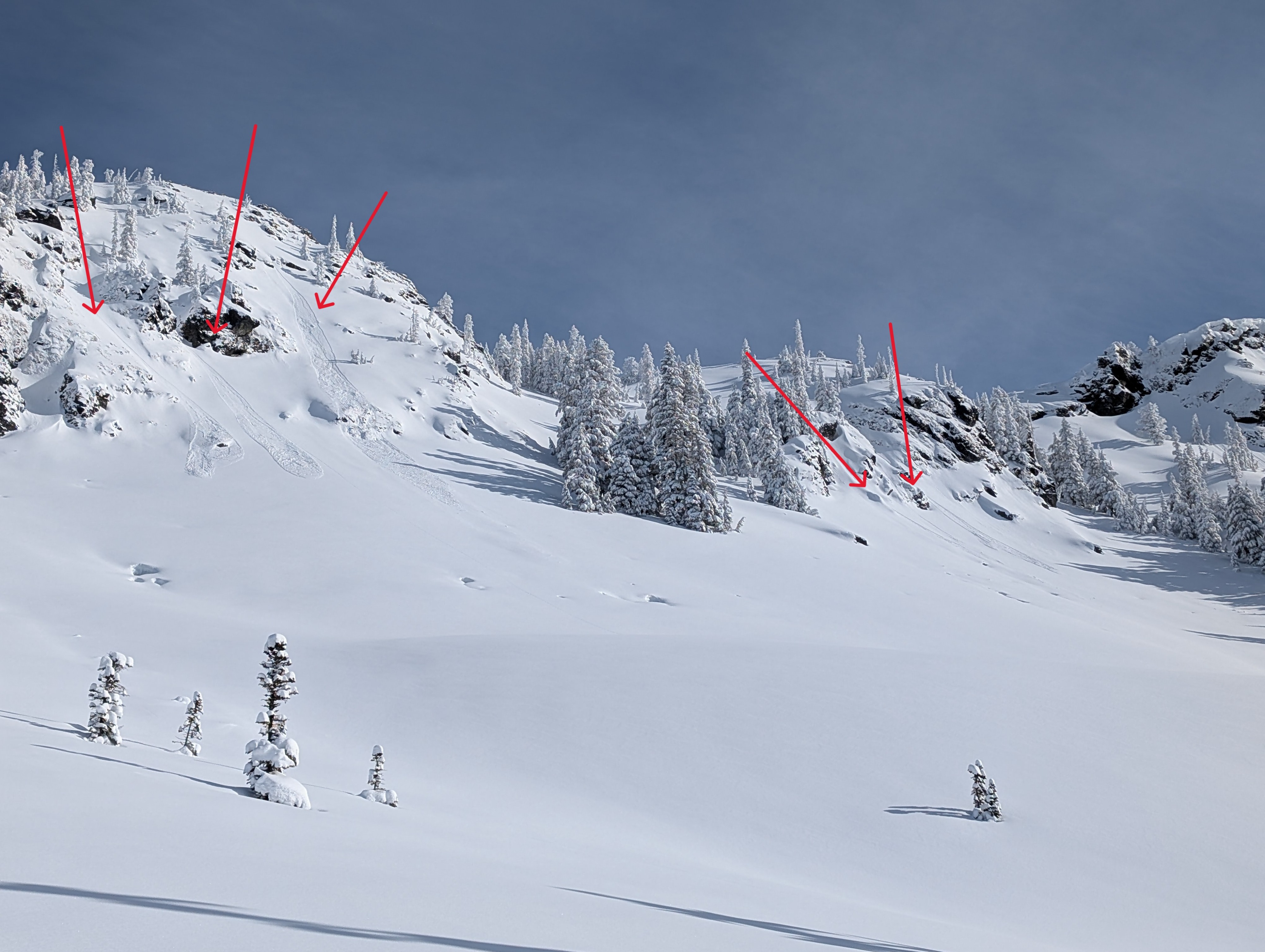
We took a rocket run up Kendall this morning before forecasting to look at our persistent weak layers and the recent storm snow. Overall, travel conditions are in good shape with adequate coverage. A few creek holes are still out here and there. Coverage increases as you ascend in elevation and is downright deep up high with arduous trail breaking. We spotted a few loose avalanches and small slabs on Upper Kendall, but that was it for avalanche activity today. We didn't cover much terrain on foot, but we did have some views around the valley, which we spyglassed. There were a few debris piles in the usual locations - below cliff bands or on sun-exposed slopes, but overall, not too many recent slabs were spotted. Digging near the top of the trees, the snowpack set up was similar to what I've seen in other locations with an easily identifiable and weak JDL and robust 1/10 complex below it. We elected to skip on some terrain we had previously had on the table. Partially due to what we saw in the pit and partially due to a time crunch.
The sun was warming the surface and triggering some tree bombs, which were large enough to ring your bell if you got hit directly.
Weather
Mid-level clouds with bright sunshine above! Very little wind, but cold temps.
Snowpack
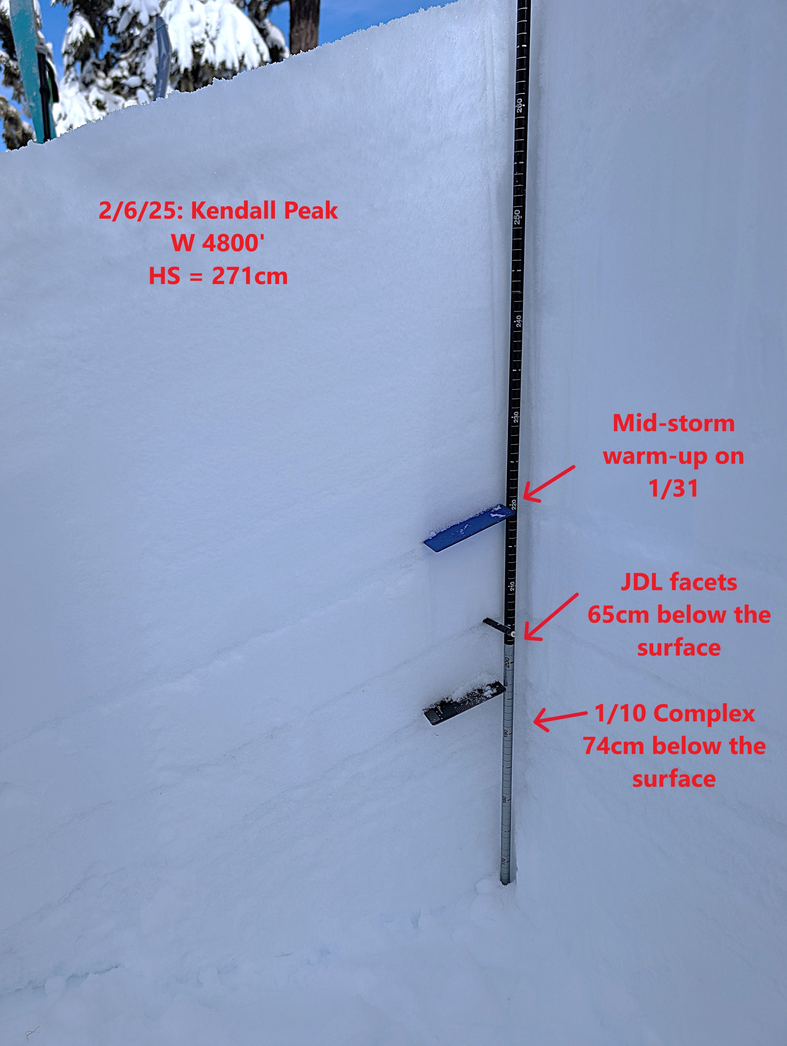
Only had time for one hole this morning. I dug in the meadows near the top of the trees, W 4800'; HS=271cm
The storm snow is generally right-side-up, but I did find a few interfaces failed in compression and extended column tests (without propagation - ECTN). They were 30 and 45 cm below the surface with the 45 cm deep one producing more consistent results and showing a slight density change.
The JDL was 65cm down and the 1/10 was 74cm down, both were easy to identify. CT28 SC, PST 34/100 END and PST 36/100 END all within the JDL.
Avalanche
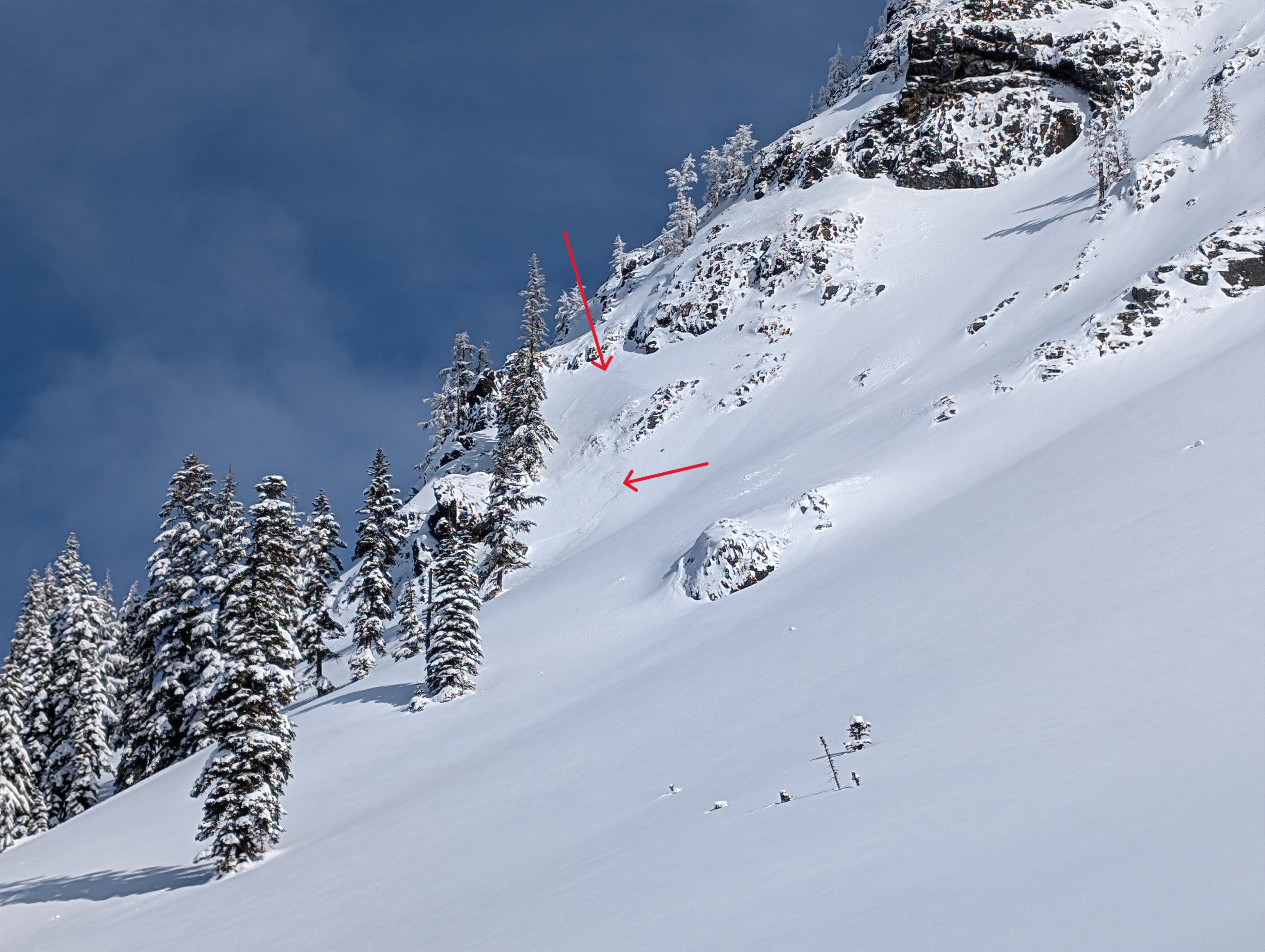
There were a handful of dry loose avalanches originating from the upper slopes on Kendall. They looked to be solar-induced. There was also a shallow slab in complex, rocky terrain. It may have been a wind slab.