
Quick report
There was about 10" of new snow on the surface that was high density and warming quickly. The snowpack on southerly slopes is still hanging onto moisture from hot and sunny days last week. I found a layer of rounding facets that could become a new persistent slab problem if conditions remain cold.
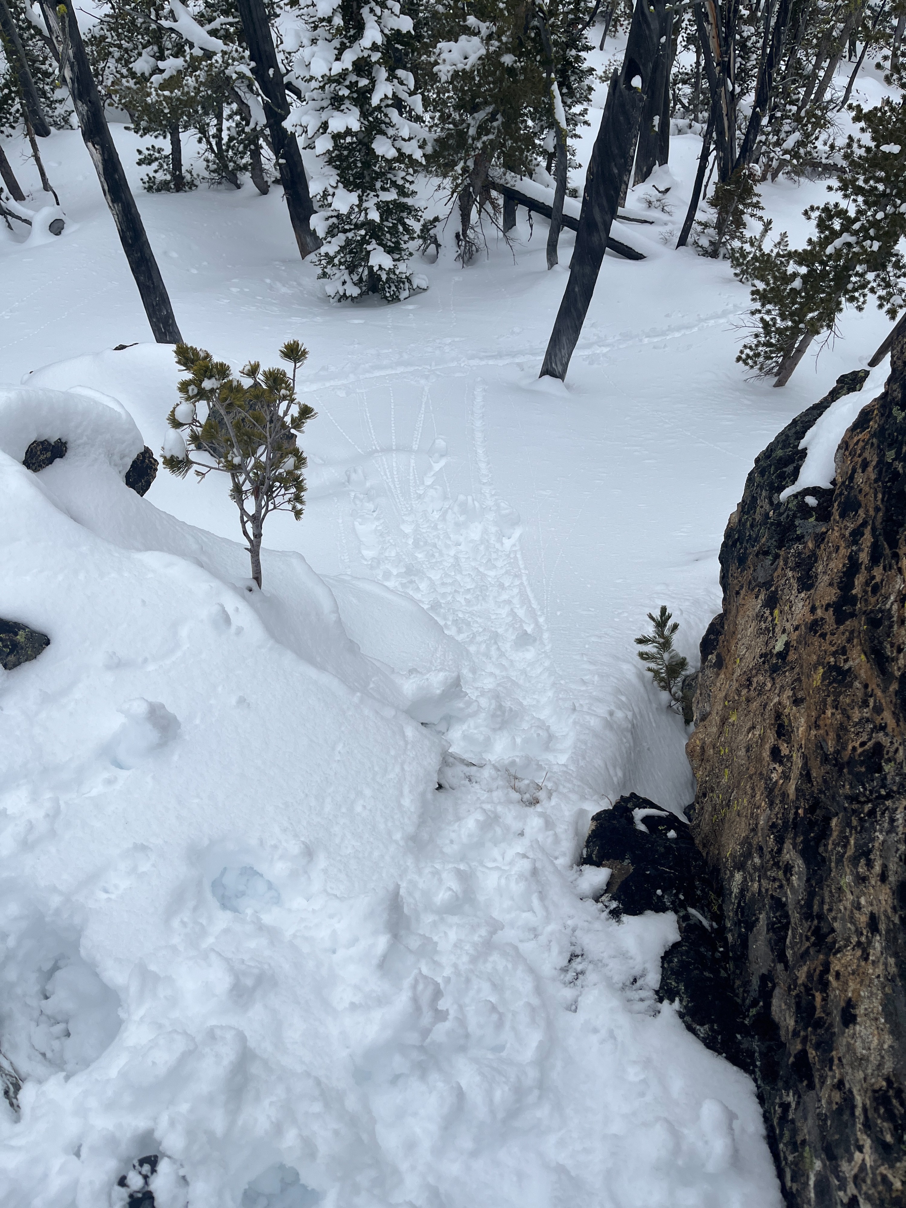
I observed roller balls easily forming in the rapidly warming surface snow.Weather
- Air Temp
- 18 at ridgeline
- Cloud Cover
- broken
- Wind Loading
- none
- Recent Snowfall
- 25
- Snow Avail For Transport
- moderate amounts
The clouds moved quickly throughout the day. There were brief periods of sunshine. Temperatures felt warm at lower and middle elevations but dropped significantly at upper elevations. The wind was calm and from the east with occasional gusts of light wind. There was intermittent very light-light snowfall throughout the day.
Snowpack
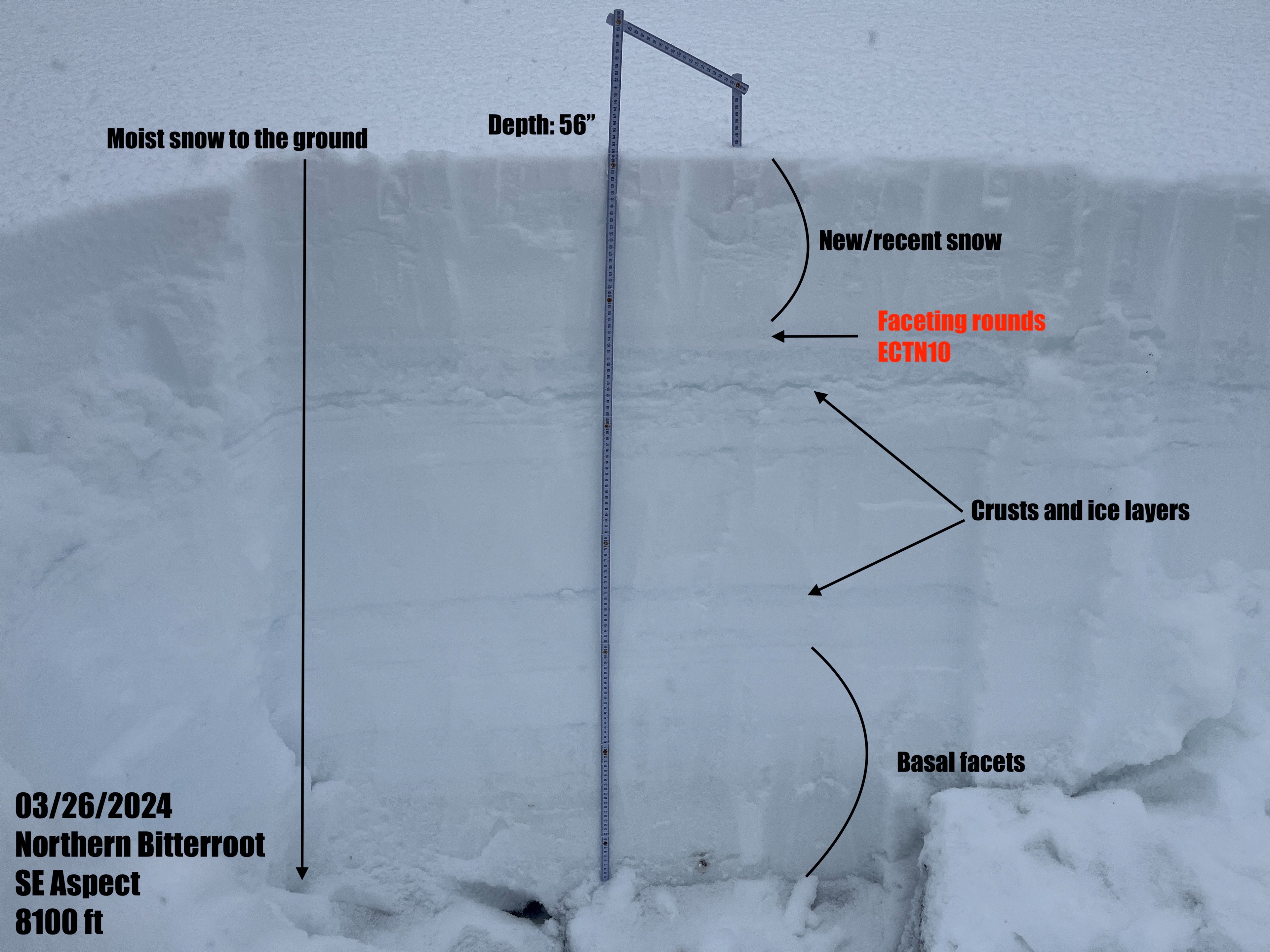
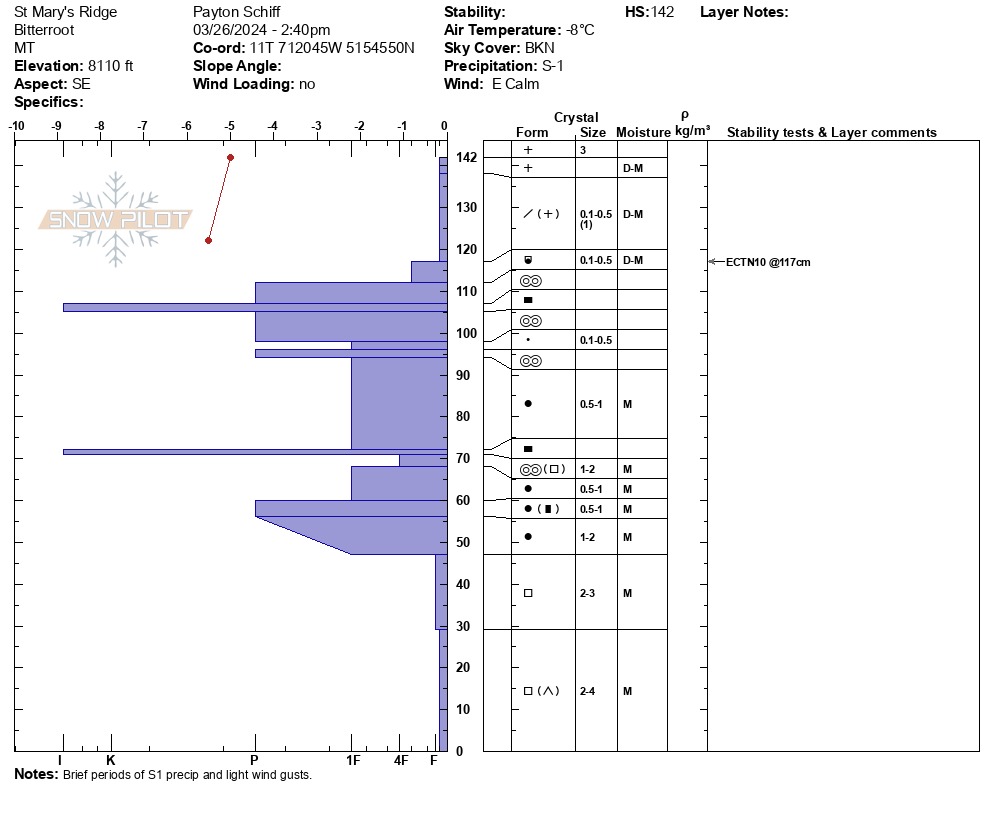
I dug a pit on a southeast aspect around 8100'. The depth of this pit was 56" (142cm). I found about 10" (25cm) of new and recent snow at the surface. The new/recent snow had a lot of moisture. After being influenced by periods of sunshine and warmer daytime temperatures, it got very sticky quickly, making for some difficult skinning conditions. Below this, I found a small layer of what appeared to be faceting rounds overlaying a thick layering of multiple melt freeze crusts and ice layers. I performed an extended column test and got a moderate non-propagating result at the top of this faceting rounds layer (ECTN10). Below this, I found layers of rounds and more crusts/ice layers. I found weak basal facets and depth hoar at the ground. The snowpack was still moist throughout.