
Quick report
Winter has returned to the mountains! It was really great to see snow in the trees and find so much powder on the ground. The amount of new snow increased markedly as we ascended. Overall, the storm snow is right-side-up and moderately well bonded to the old interface 2/24. Even still, there's a lot of snow and some uncertainty about the 2/24 interface. We kept our terrain selection reigned in and looked for small slopes, treed areas, and lower-angled terrain.
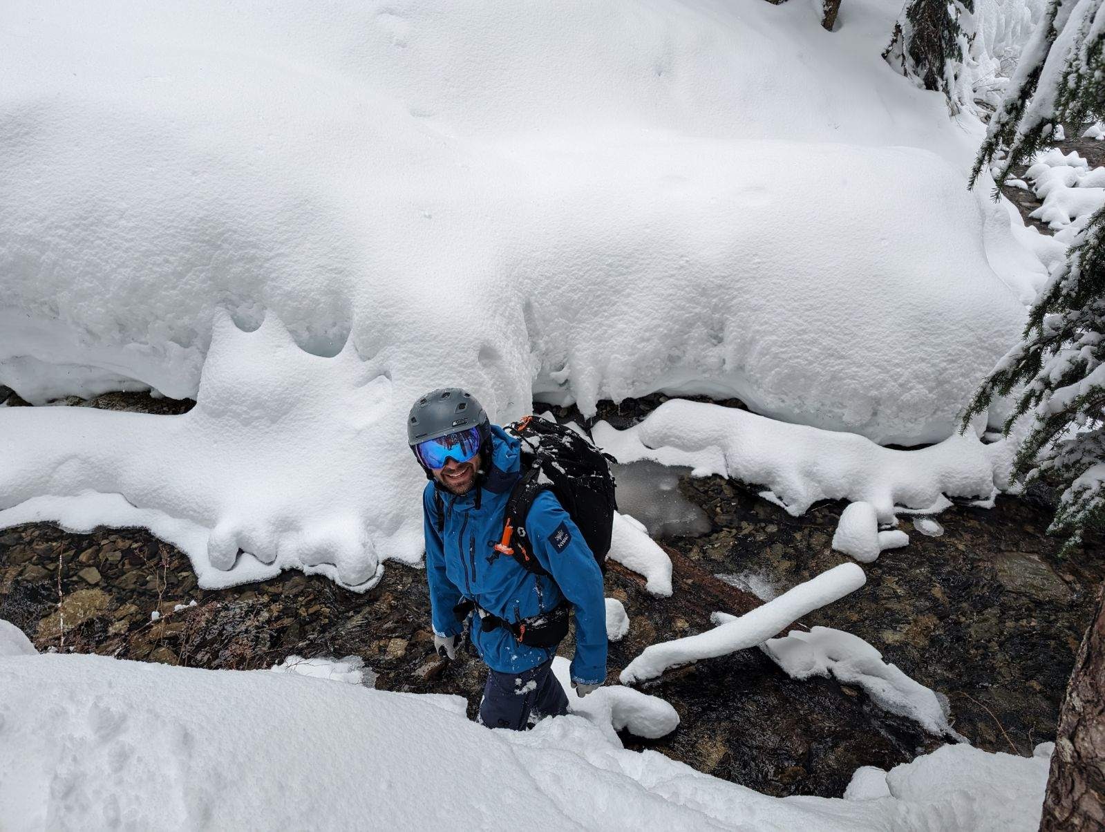
While the new snow has greatly improved conditions, creek crossings remain a very real challenge.
Any cracking was limited to very soft wind-loaded features or the uphill sides of steep tree wells.Weather
- Cloud Cover
- broken
- Wind Loading
- light
- Rain Elevation
- 500
- Recent Snowfall
- 65
- Snow Avail For Transport
- large amounts
It was a much nicer day than we expected. Broken skies led to moments of sunshine and good visibility. A few flurries in the morning, but the snow really picked up around 130pm with 1-2cm an hour rates in the afternoon. WInds were generally light out of the NW, but a few moderate gust drifted a bit of snow at ridgelines.
Snowpack
The snowpack changed significantly as we ascended in elevations. At 3000ft near the trailhead, there was about 1ft (30cm) of soft snow over a noticeable but soft crust. By 4000ft the depth over the 2/24 crust had increased to 16in (40cm). At 4500 ft the 2/24 crust disappeared. At 5000ft, there was over 2ft (65cm) of snow over the 2/24 interface.
We used several tests as we traveled today to look at the snow. Down low, where the new snow was shallower, we used uptrack and small slope tests. As the snow got deeper, we turned to hand pits, hand shears, and shovel tilt tests. In general, the most consistent storm layer was about 1in (2-3cm) above the 2/24 interface. While it failed repeatedly, the failures were typically resistant and didn't show signs of propagating. We mainly found right-side-up storm snow. We also looked in several locations for surface hoar, facets, and other weak snow at the 2/24 interface, but didn't find it where we traveled.
In more exposed areas, occasional moderate gust lightly drifted snow into soft wind features. Occasionally, we'd see some short cracks in these pillows, but none failed, and over all wind transport was minimal.
Below the new snow, we were still concerned about the upper snowpack over the Early February Crust. At this point, it sits 4 feet or so below the surface on shaded aspects at middle and upper elevations. While we can still easily identify the 2/19, 2/14, and EFC, snowpack tests did not show any concerning results.
Avalanche
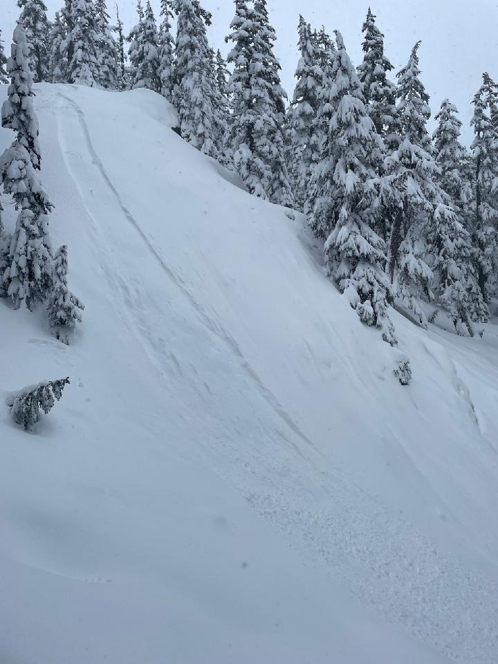
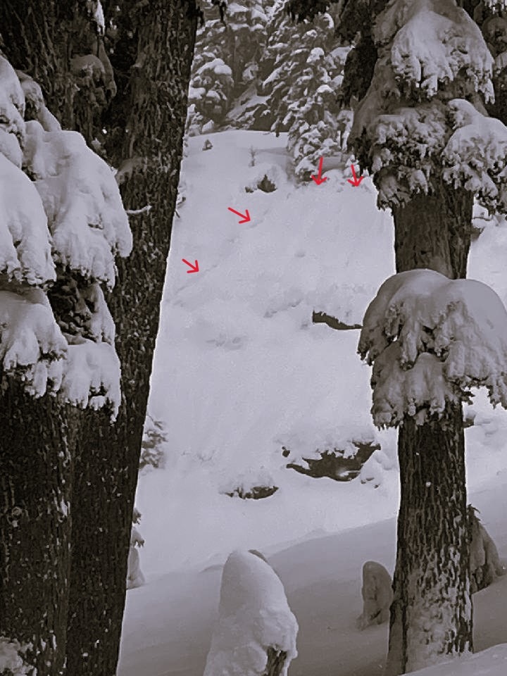
We saw 3 small natural storm slabs. Each was in very steep and generally rocky terrain . (E-S, 4800-5100ft, SS-N-D1-R1). We also intentionally triggered a small loose dry avalanche on a very steep open slope (E, 4600ft).