
Quick report
- Aspect
- North
- Red Flags
- Wind Loading
- Elevation
- 3353 m
- Slope Angle
- 27°
- Red Flags Comment
- <p>There was some wind loading during the last storm that was isolated to the lee side of ridge tops and terrain features. I think that it is important to keep this in mind this weekend, but the overall snow condition seems to be stable and set up from last weeks spring like weather.</p>
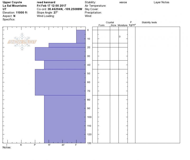
The snow pack seems to have set up very well after the spring like temps we have had the past few weeks. I dug a pit on a north facing 27 degree slope at around 11,000'. I found 15 cm of soft dry snow on top of 115 cm of snow that varied between 1 finger and pencil hard. I performed two compression test and both times was unable to get the column to noticeably fail. With that said I was able to get the column to separate with a shovel shear afterwards and both times it was a clean separation at 85 to 90 cm.
Probe deep snow pack!
Not the best photo, but you can see the clean separation of the column and the one finger pokes.
Snowpack
- Instability Comment
- <p>I would expect the avalanche danger to increase relative to the amount of snow this next round of storms brings in. Be aware of rapidly changing conditions if you are out over the weekend.</p> <p>The winds are expected to increase tonight and tomorrow as this next round of disturbances moves through the area. Be on the lookout for newly formed wind slabs on the lee side of slopes and terrain features if we see some good snow fall out of this system. </p>
The snow seams to have dried out a little from last weekends dose of Pacific Southwest conditions, and although you can still feel the bottom, the skiing is quite good in sheltered areas. Any thing that receives sun during the day has a good melt freeze crust on it. I pulled up a chunk in the Laurel meadows and it was about 2 inches thick. I also found some isolated areas of thin wind crust on north facing slopes above tree line.