
Quick report
- Aspect
- North
- Red Flags
- Recent Avalanches, Wind Loading
- Elevation
- 2560 m
- Slope Angle
- 23°
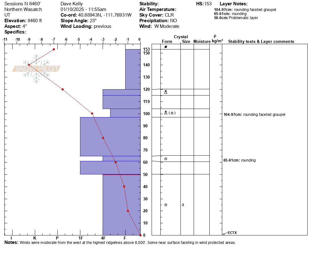
The above snow profile was on a north facing slope at 8,460' . The height of snow was 5' (153cm). The temperature gradient showed that this snowpit had facets turning to rounds and our extended column test in this location showed no propagation. In thinner areas less than 3' (100cm) the weak facets on the ground were drier and more developed. We observed no cracking or collapsing and avoided steep connected slopes over 30 ° in steepness.
We saw signs of wind loading and recent avalanche activity on north and west facing aspects. See photos below. The west facing avalanche was a wind drifted avalanche on a steep bank above the skyline road. This avalanche was 2' deep x 100' wide x 40 'vertical with impressive blocks.
The second avalanche we saw was on a north facing slope around 8,500'. This looked to be an avalanche that was older that failed on buried facets.
Photo Z. Thompson
Where we traveled today it felt like LOW danger at lower elevations and MODERATE danger at mid elevations. For now, I'm still avoiding steep terrain with a thinner snowpack out of the wind zone and will back off even further with any additional new snow or wind loading.
Snowpack
- Instability Comment
- <p>Wind drifted snow on the east and west facing slopes. Many of these slopes over 8,000' in elevation showed both wind loading and wind scouring. </p> <p>Weak faceted crystals in thinner snowpack areas are still dry. </p>
Snow surface was a mixed bag of wind crust and faceted loose or soft surface powder in the protected tree zones. There were more areas that were heavily wind affected above 8,000' than not.
Photo below of wind affected snow on a ridgeline at 8,500' in elevation