
Quick report
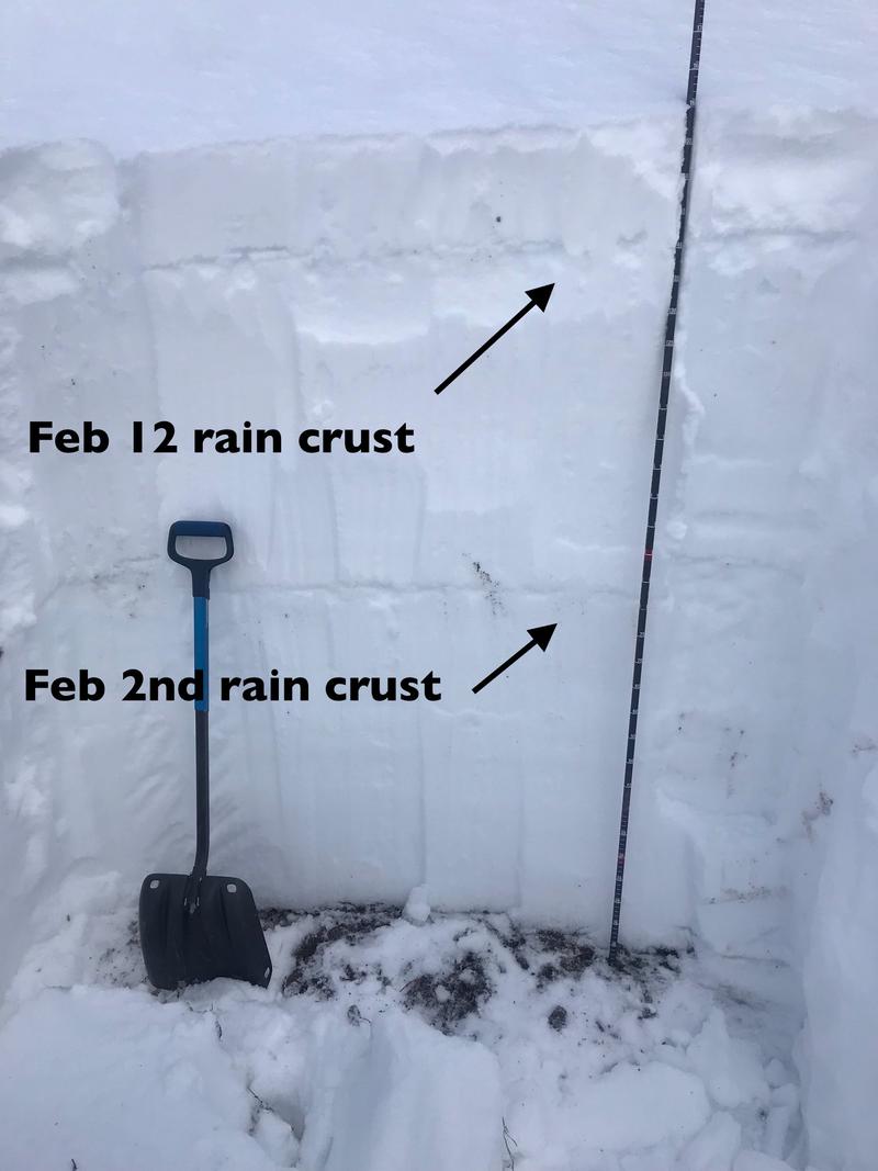
Above - used Trent's great pit from Saturday for a quick look at the snowpack - 8,400 feet, north facing. Too cold for my toes to stop and dig anything that deep!
My focus was switching to the widespread weakening surface snow. Both near surface facets and surface hoar. Below - some different looking surface facets. Perhaps rimed? Sadly, the upcoming week of cold, powder preserving temperatures will also rapidly weaken the low density surface snow.
Lower photo - piece of the buried rain crust, currently it seems well bonded to the snow below, a cleaner shear above. A layer to keep an eye on at mid to low elevations.
Photos below: top 2 photos: a very shallow, small several day old slide, 8,800,. Makes sense - super shallow, weak snowpack over rocks. Typical of a rocky, wind swept ridge line, what to avoid in bigger terrain.
Looking into Stairs. Lots of evidence of avalanche activity, older slabs and debris in the gulch bottom; lots of newer small dry sluffs.
Snowpack
Right side up powder above denser snow about 8,300'. Powder over a rain crust, thinning with elevation and disappearing between 8,300 and 8.500 feet.