
Quick report
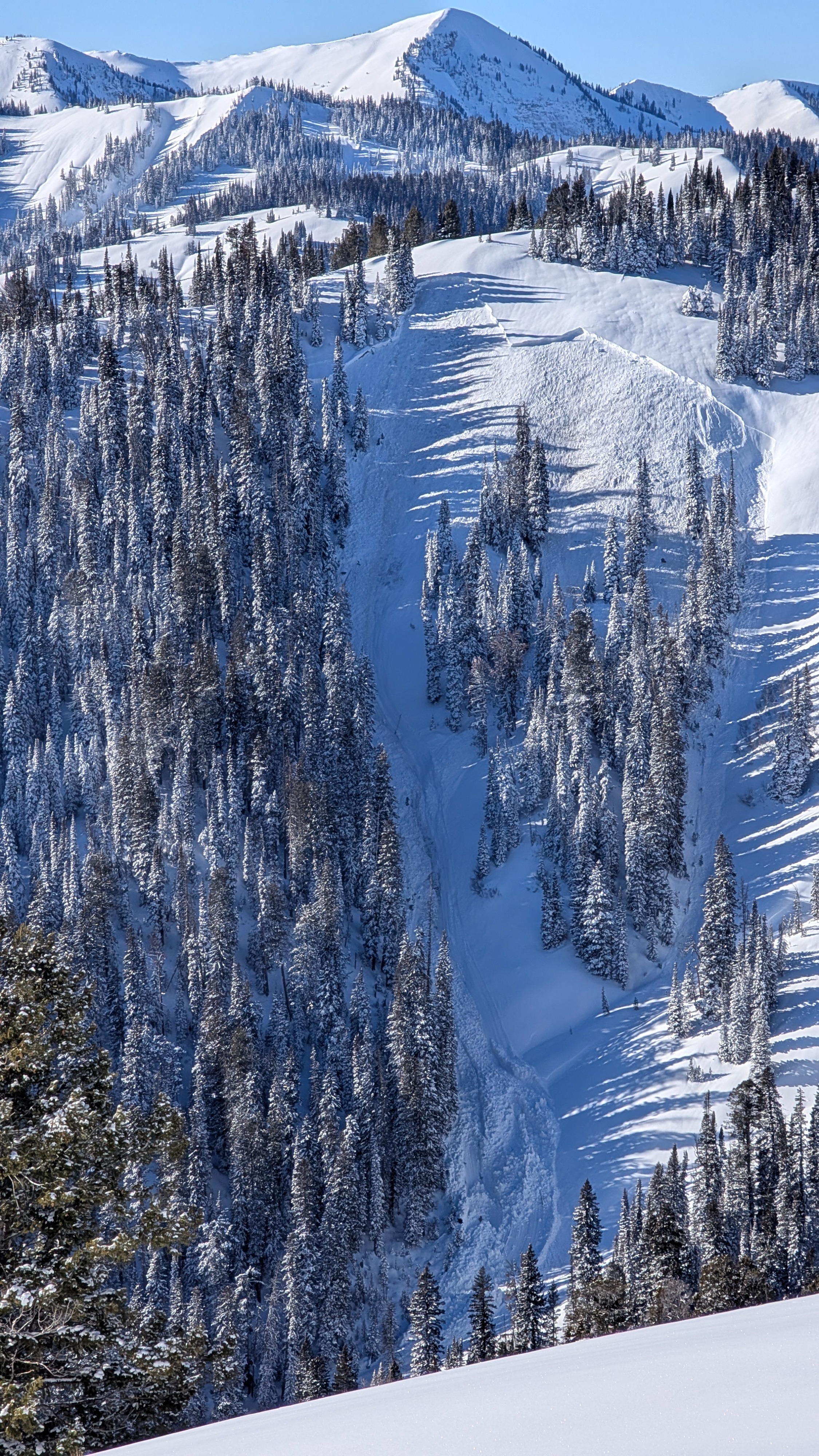
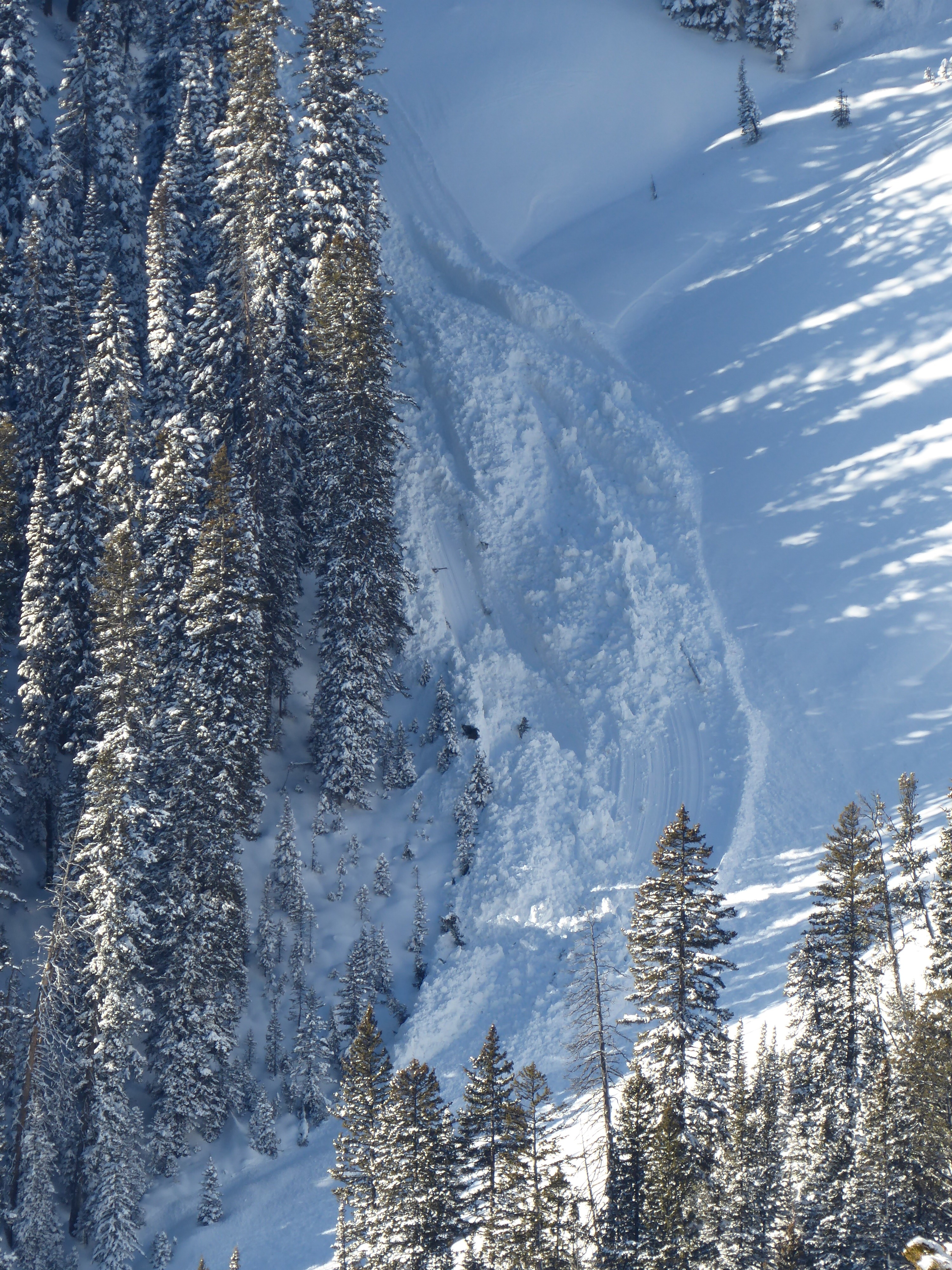
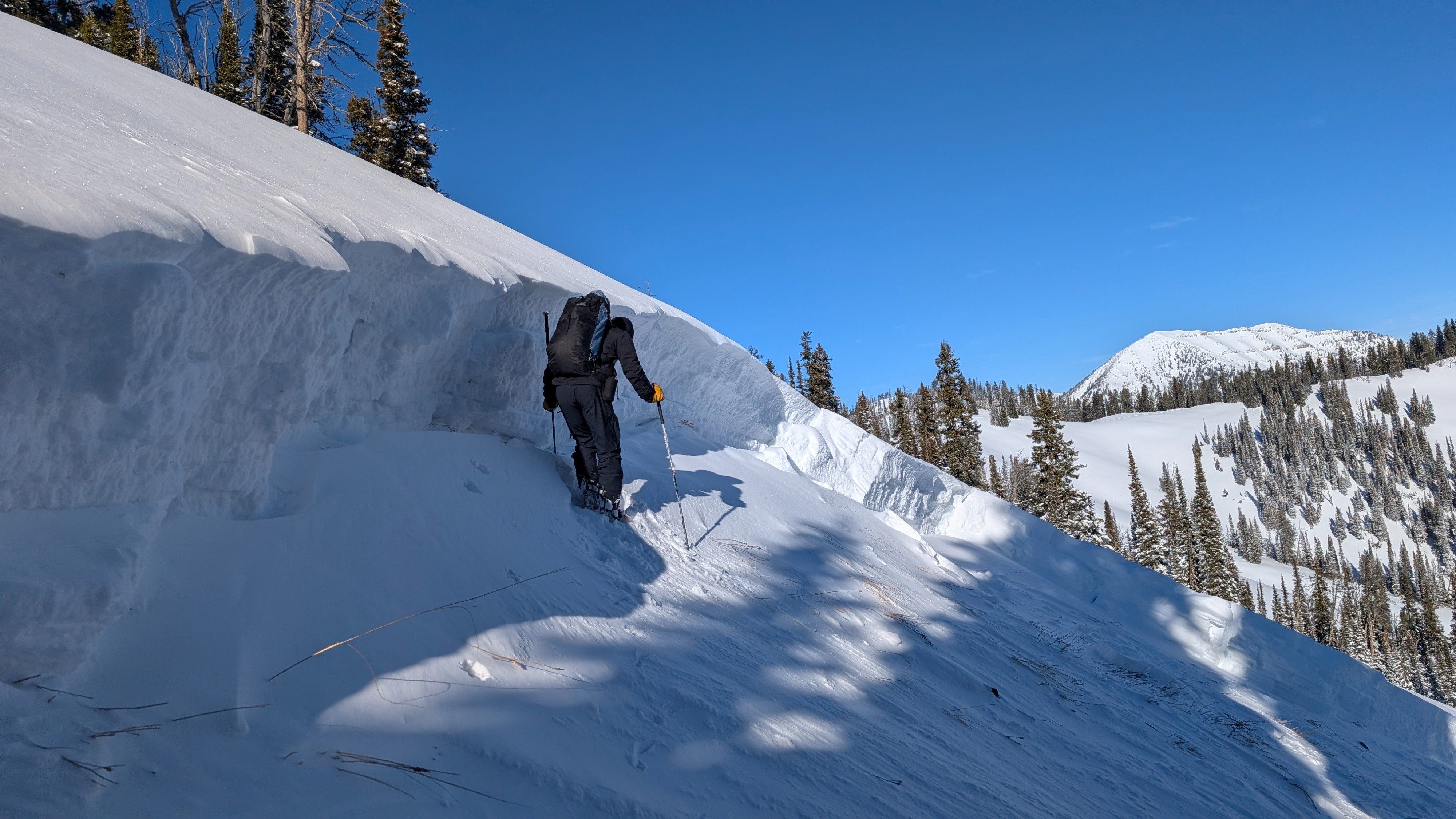
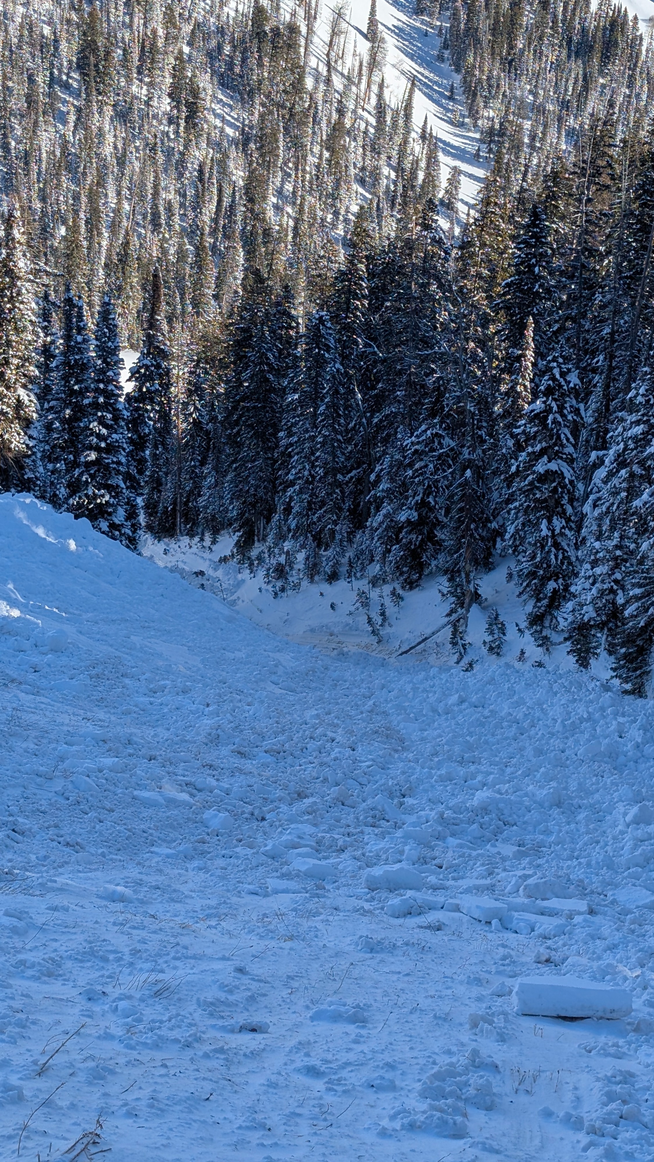
Went to investigate the large avalanche reported yesterday at 8800' on a NE aspect above the north fork of Mosquito. Where we travelled today, from 8400' to 9000' (mostly along broad ridges but occasionally dipping down into multiple aspects), the 12/26 crust was prevalent. Depending on the location, it was buried anywhere from 14 inches (35cm) to just below the surface, where wind had moved snow. Hand shears showed good bonding between the crust and new snow. Despite some obvious wind transport, the wind effect on snow surfaces was minimal. There were some stiffer drifts/surfaces in exposed areas, but no significant wind slab development, and we saw no cracking or collapsing despite testing multiple drifts and pillows. Snow surfaces on steeper sunny slopes were moistening by late morning despite the cool temps and low sun angle.
Weather
- Recent Snowfall
- 20
- Snow Avail For Transport
- moderate amounts
Cold and clear. No wind.
Avalanche
- Size
- D3 R4
- Type
- HS
- Aspect
- NE
- Trigger
- N
- Elevation
- 8800 ft
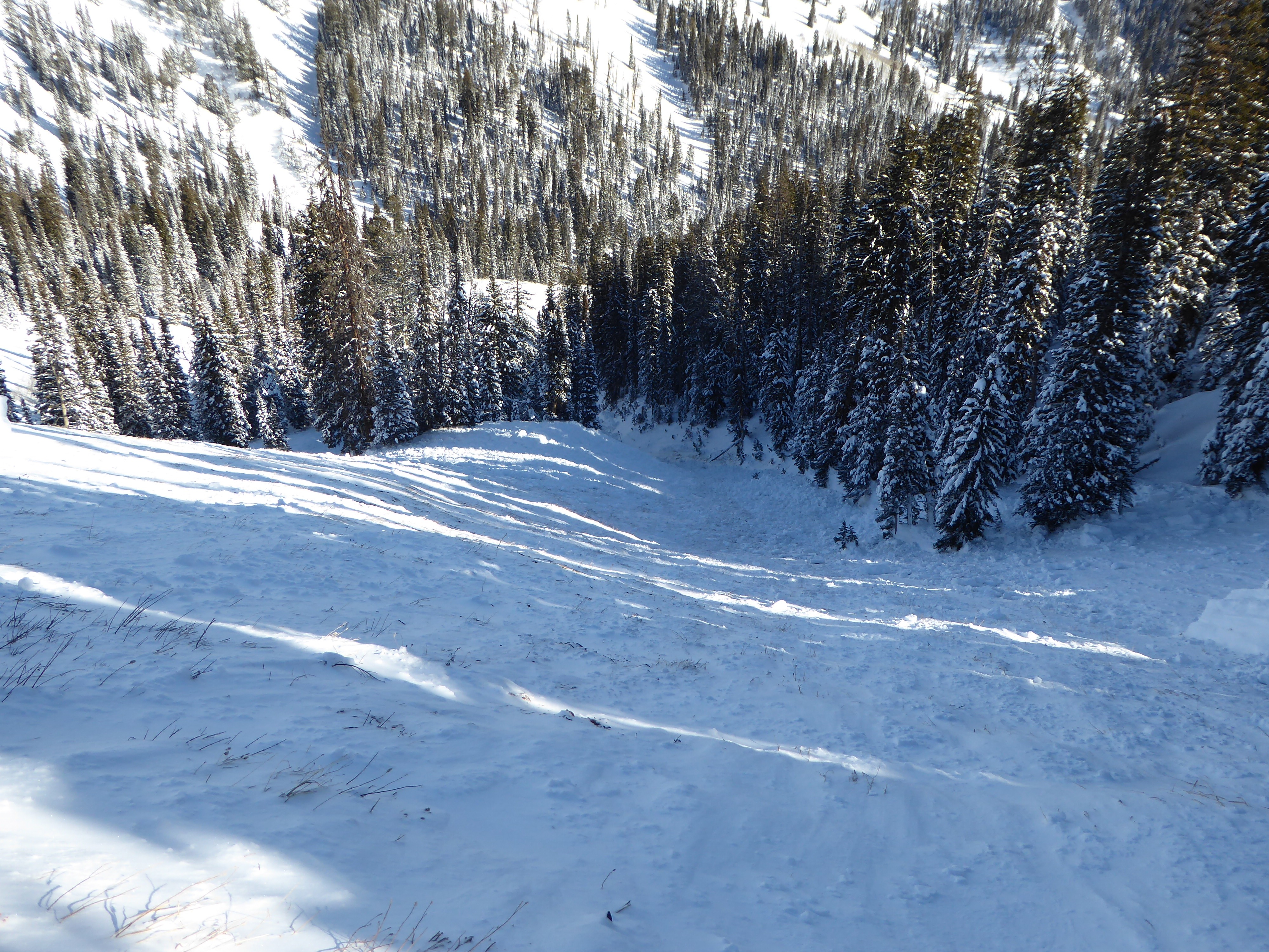
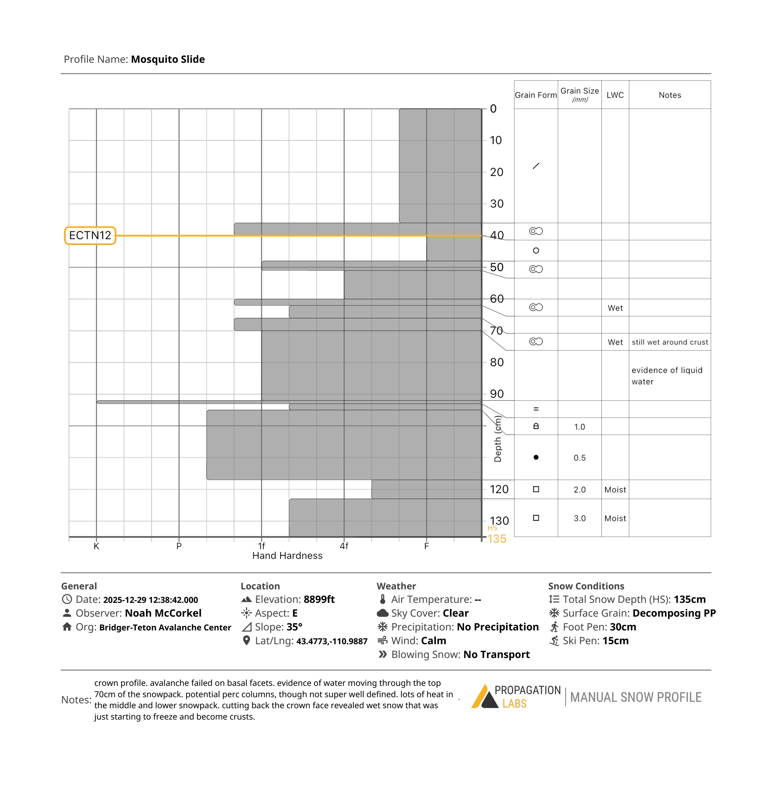
This avalanche is an anomaly when compared to recent observations. It is the only avalanche we have observed at a mid-elevation that ran on the ground without any indication of a step-down (e.g., being triggered above the 12/26 crust or the 12/10 crust and then stepping into deeper weak layers). The entire crown and flank walls all went to the basal facets. What really jumped out at us was the amount of moisture in the snowpack. There were multiple layers above the 12/10 crust that we originally thought were crusts, but when we dug into the crown to do a profile and ECT, several of these layers were very moist and the only obvious crusts were the 12/10 (18 inches above the ground) and a few crusts in the upper snowpack underneath recent snow. Regardless, we speculate that a combination of warm temperatures, previous rain, and heavy loading probably tipped the scales just enough. Why we didn't see this type of avalanche on any other mid-elevation, northeast facing slope in the forecast area is a head scratcher. Test results produced an ECTN12 down 16 inches below the 12/26 crust. We did not do a PST, although I suspect it would show propensity to propagate in the basal facets. Given that the last 2 days have been significantly colder and the snowpack has done some adjusting, I think it is very unlikely that we will see a similar event. This type of event probably requires a significant trigger (likely more than a skier) like prolonged heavy loading or another avalanche. Regardless, it should not be dismissed and is a good reminder of the unpredictable nature of deep instabilities when combined with "unusual" weather patterns - in this case very warm and wet followed my heavy snow and strong wind.