
Quick report
- Cracking
- isolated
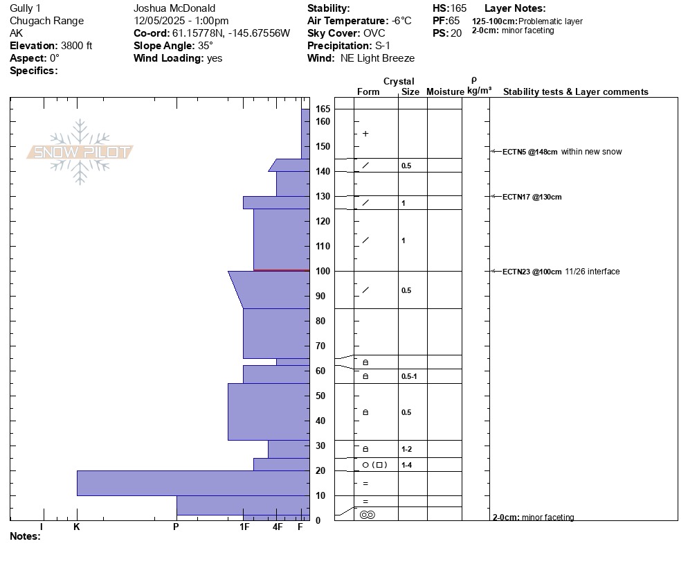
The snowpack is slowly building in depth with 1.5-2 feet of settled storm snow since the 11/26 weather pattern change. The next pattern change is currently underway with North winds slowly building in strength and distribution. The surface snow was still mostly unaffected by wind, except for slopes just below cross-loaded ridges. Small shooting cracks were visible in isolated areas where soft windslabs less than 10 inches deep had formed. We were not able to identify any persistent weak layers at the 11/26 interface or at the ground in a pit at 3800'. Snow grain type at the ground continues to vary from place to place, however the majority of observations over the last 2 weeks have shown more of a rounded meltform rather than faceted depth hoar. (see pit profile for more snowpack and stability test info).
Cracks less than 5 feet long were observed in a few places near the top of cross-loaded slopes.Weather
- Air Temp
- 20
- Cloud Cover
- overcast
- Wind Loading
- none
- Rain Elevation
- N/A
- Recent Snowfall
- 15 overnight
- Snow Avail For Transport
- large amounts
Cloudy and mild with only light North winds that slowly got stronger through the day and were moderate at the valley by 3 pm.
Snowpack
There is a thin rain crust below 3000' from the 12/1 -3 peak in temperatures. The crust is ~10 inches down and is supportable on skis, but not on foot. Above 3000' the crust goes away, and the snowpack becomes generally deeper. At 3800' found a snowpack with fair/good structure, fair stength and moderate stress. ECT tests did not produce propagation at any layers, repeated 2x. Snow at the ground consisted two thick rain crusts and large meltforms and only minor faceting.