
Quick report
- Aspect
- East
- Elevation
- 2987 m
- Slope Angle
- 31°
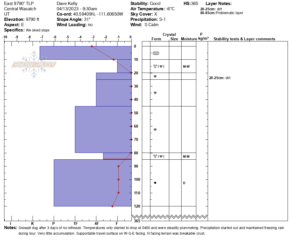
After 3 days of no real refreeze I wanted to see how the structure looked in the top layers of the snowpack. What stands out to me is that the dirt layer that was once close to 5' down is now only 10-12" below the surface. In this location I did not find a crust associated with the dirt layer. The weakest snow was just below the surface ice crust and again where the water had stopped percolating downward 3' down from the surface. Below the water saturated layer was dry pencil hard rounded crystals. With the forecasted cold temperatures I will be watching the layer 3' down to see if it also refreezes. Signs of large wet loose activity triggered by cornice fall on south facing slopes.
Snowpack
Snow temperature rapidly falling. 26˚ F at 0930 and if you watch the Atwater Plot the temperatures are steadily dropping this AM as the surface freezes. Snow surface was runneled un-even surface with deeper impressions in areas of water drainage. There was a skiff of new snow in between the low points that was grippable with skins on. Surface was overall melt-freeze.
Photo of frozen ice on trees.