
Quick report
- Collapsing
- specific
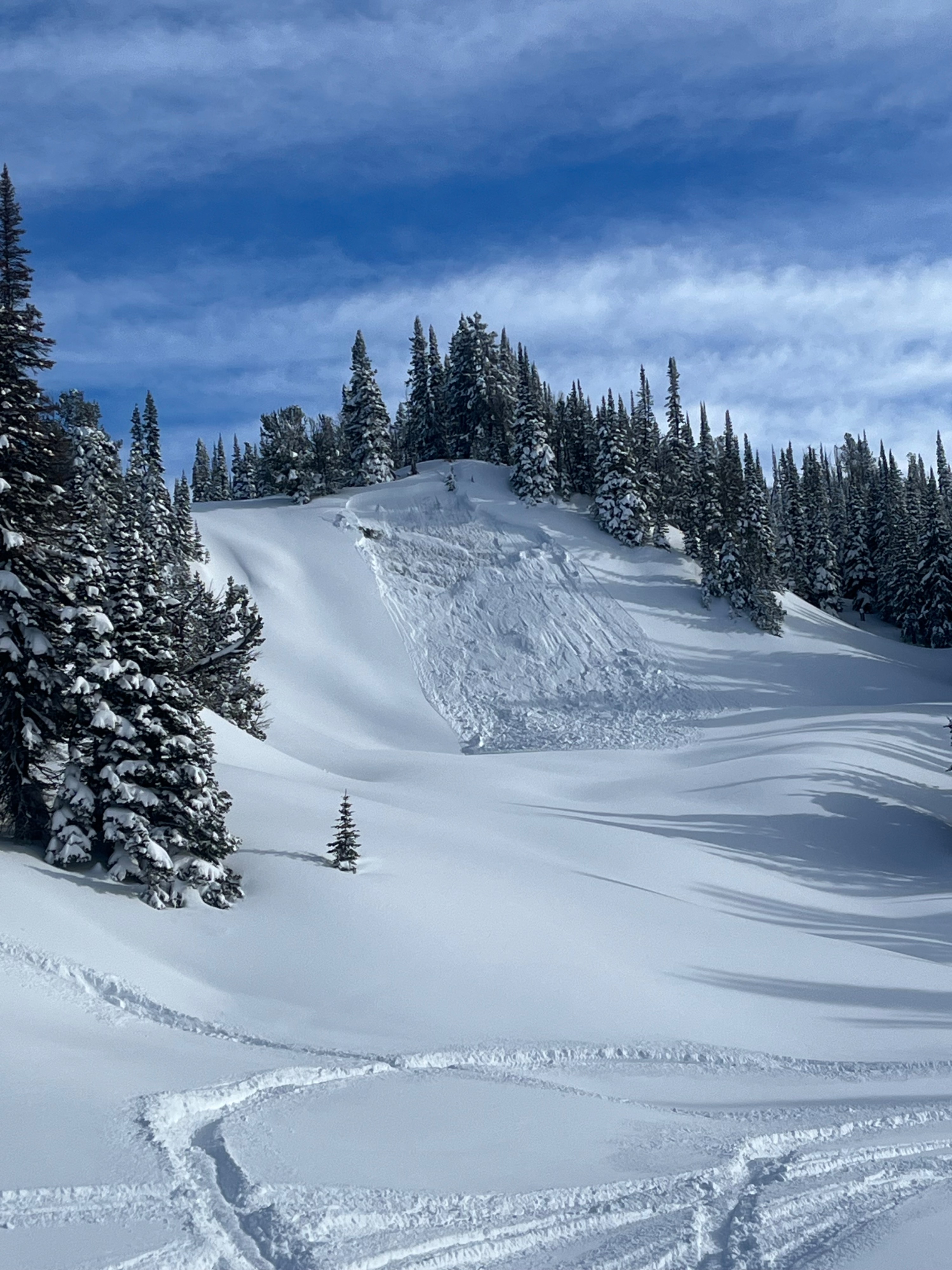
Remote trigger of recent wind loaded snow during mid-day warming on obvious avalanche starting zone by multiple snowmachines traveling above. Only one other natural slide visible in the area on a steep west facing slope with a slope of ~40. Whoomphing observed in multiple areas where multiple snow machines were parked or traveling. Multiple snow machines traveled within 500 yards below the face without triggering. Whoomping observed throughout course of day, particularly with multiple snow machines on wind-blown ridges and smaller convexities. Failure on old, faceted layers from early Jan. And prior.
Weather
- Air Temp
- 25
- Cloud Cover
- clear
- Wind Loading
- moderate
- Snow Avail For Transport
- moderate amounts
Light inversion early, lifting around 11:00. Sunny, light winds from the southwest. Temps increased to ~22F at 9000’.
Snowpack
18”-3’ of New wind loaded snow fell on weak crusts above weak, faceted base appx. 2.5’ deep.
Avalanche
Avalanche triggered remotely. Slope observed and identified as hazard. Multiple snowmachines circumnavigated to to ridge above. Upon circling back, a slide was witnessed with a crown of 18”-2’ in depth, and ran appx. 100 yards. Appx. 50 yards wide. Slope angle ~35 degrees.