
Quick report
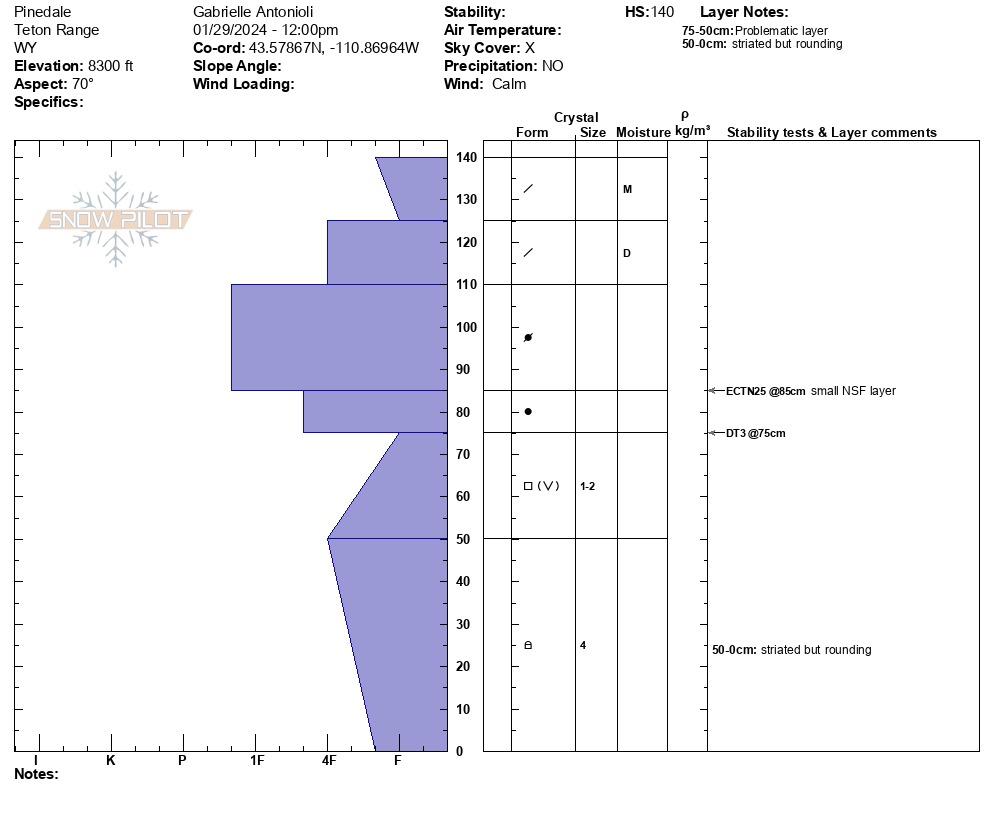
Toured into Rock Springs, Green River, and the side of Pinedale. There were limited options due to low visibility, but the goal was to assess the mid-elevation pack, which might prove to be the trickiest with warming and looking forward. It should be noted that instability (in the form of skier-triggered avalanches and snowpit results) has been observed here throughout the past week, nearly every day. Folks are seeing unstable pit results even with many skier tracks on the slope and where weak snow is deeper in the snowpack. This nods at a difficult-to-trigger but very large if triggered problem. The line between it being a reactive and stubborn problem right now is fine; give yourself a wide buffer between this problem and the terrain you choose to ride. I did not get propagating results in my pit, but I did after I cut the top slab above the weak layer (known as a deep tap test for doing an ECT with a deeper weak snow layer), meaning that a shallower spot holds far higher potential for triggering a large avalanche.
When assessing temperature swings and snow, air temp matters, but direct solar input is what this boils down to. Middle elevation slopes shielded by fog and cloud cover today may not freeze well overnight, and slopes seeing direct sun tomorrow should be assessed carefully or avoided altogether.
Warm snow and changing conditionsWeather
- Air Temp
- 33
- Cloud Cover
- obscured
- Wind Loading
- none
- Recent Snowfall
- Nil
- Snow Avail For Transport
- none
Mid-level fog/clouds increasing throughout the day. Clear above 10K