
Quick report
We toured Beehive Basin up to the Prayer Flags and over into Bear Basin below the flags. There were no obvious signs of instability (cracking, collapsing, etc.) and the crowns of last week's avalanches are filled in.
Snow conditions were incredibly variable and we toured/ skied bullet proof melt freeze crusts, dry powder, and corn snow.
Our objective was to evaluate two things: How the persistent weak layers are adapting to the recent snow and How warm temperatures of the last few days are affecting the snowpack.
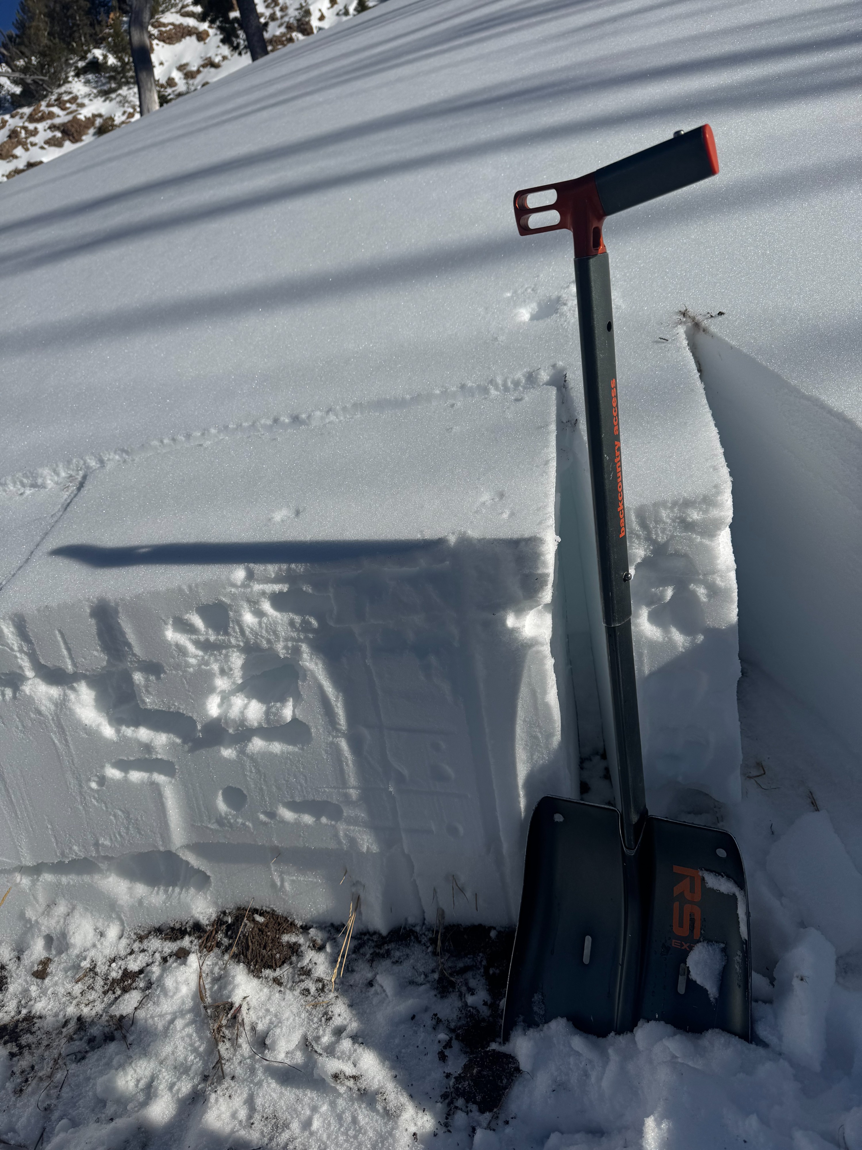
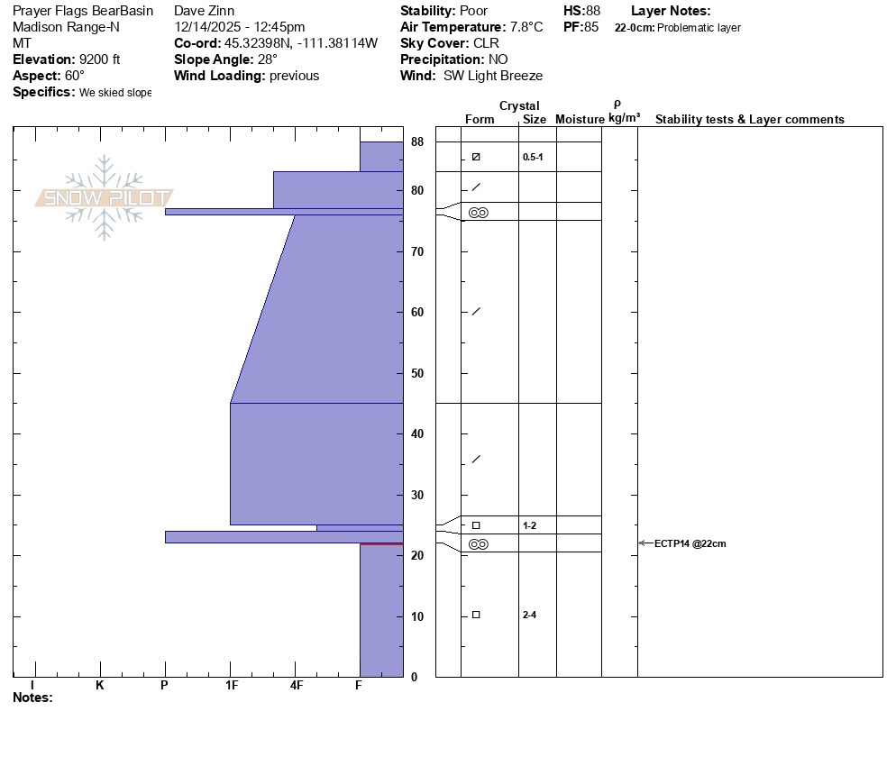
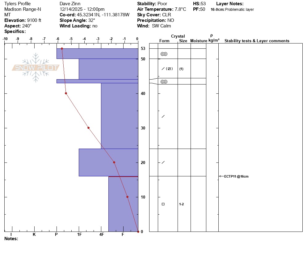
Persistent Weak Layers: We dug on the southwest aspect near the starting zone of Tyler's below the prayer flags. The snowpack was only 53cm deep and there were a couple of pencil hard melt-freeze crusts in the top 6" of the snowpack, but the basal facets remain dry and 4F- hardness. I suspect that there has been some hardening with the warm temps, but they remain a player and we got an ECTP11 on this layer. Over the ridge in Bear Basin, the snowpack was a bit deeper (3 feet - 88 cm). The snow surface remained dry and cold on the northeast aspect and we got an unstable ECTP14 on fist hard basal facets. It seems like a reasonable starting point to assume that on the same slopes where the old October and early November snow survived, temperatures are not warm enough now to put water through the basal facets. NEW FACET LAYER - on the northern half of the compass, the surface snow is faceting. If it survives as I expect it will, it will be a new weak layer when Wednesday's storm comes in.
Warm Up: At low-elevations, the snowpack became isothermal and is locked up. At middle- and upper-elevation starting zones, the basal facets remain dry and weak. South facing slopes have supportable crusts.