
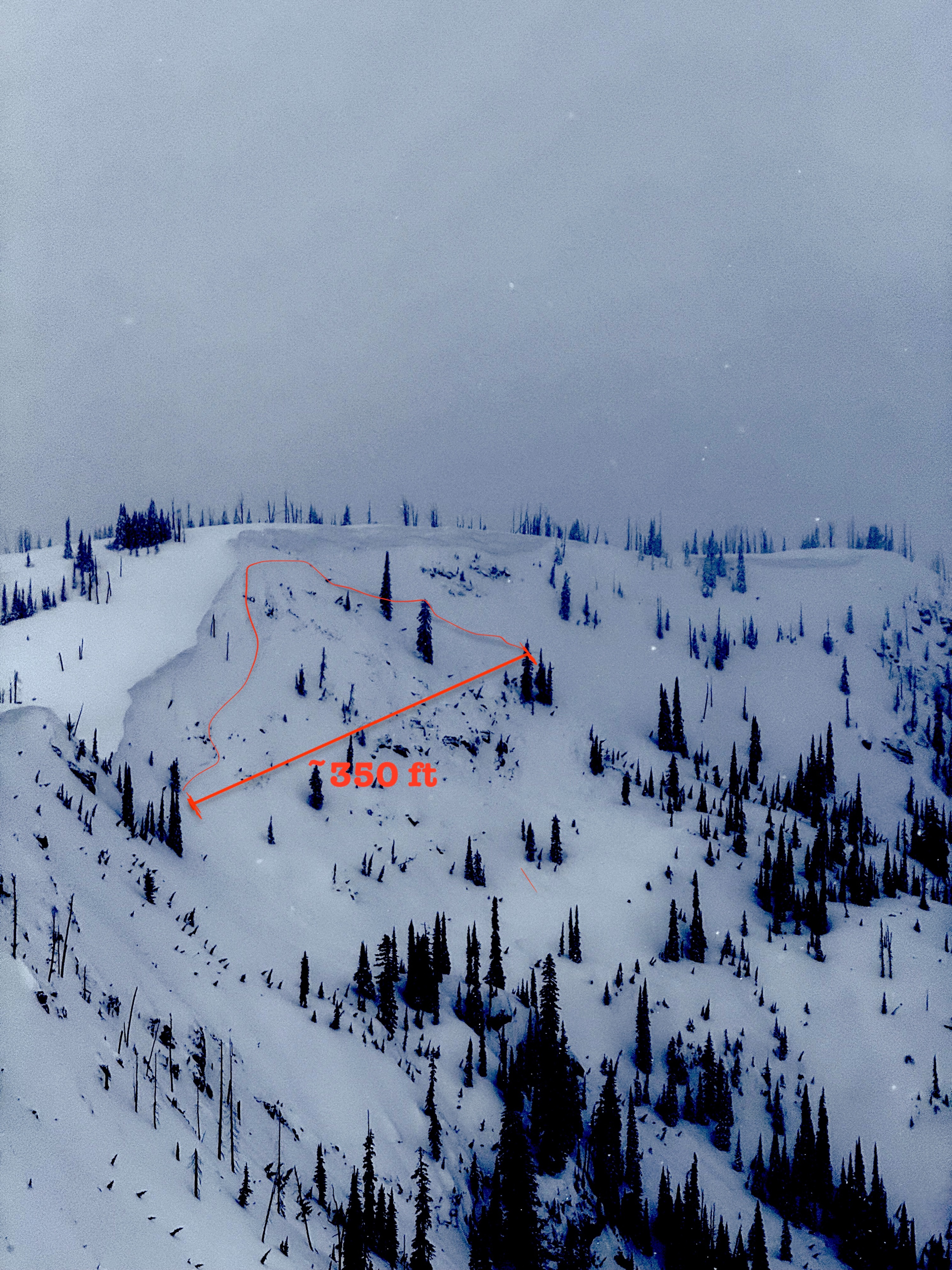
Quick report
We travelled out today hunting PWL sensity. In the process, we laid eyes on all aspects at mid and upper elevation, and dug deeper into the shaded ones. We found Jan drought layer to be stubborn with the current snow above it, but still reactive in PST's. We interprated the natural cornice fall avalanche we saw (likely from Sunday) as a sign of what may be coming with the incoming load. Large PS avalanches are back on the menu with the forecasted water amounts.
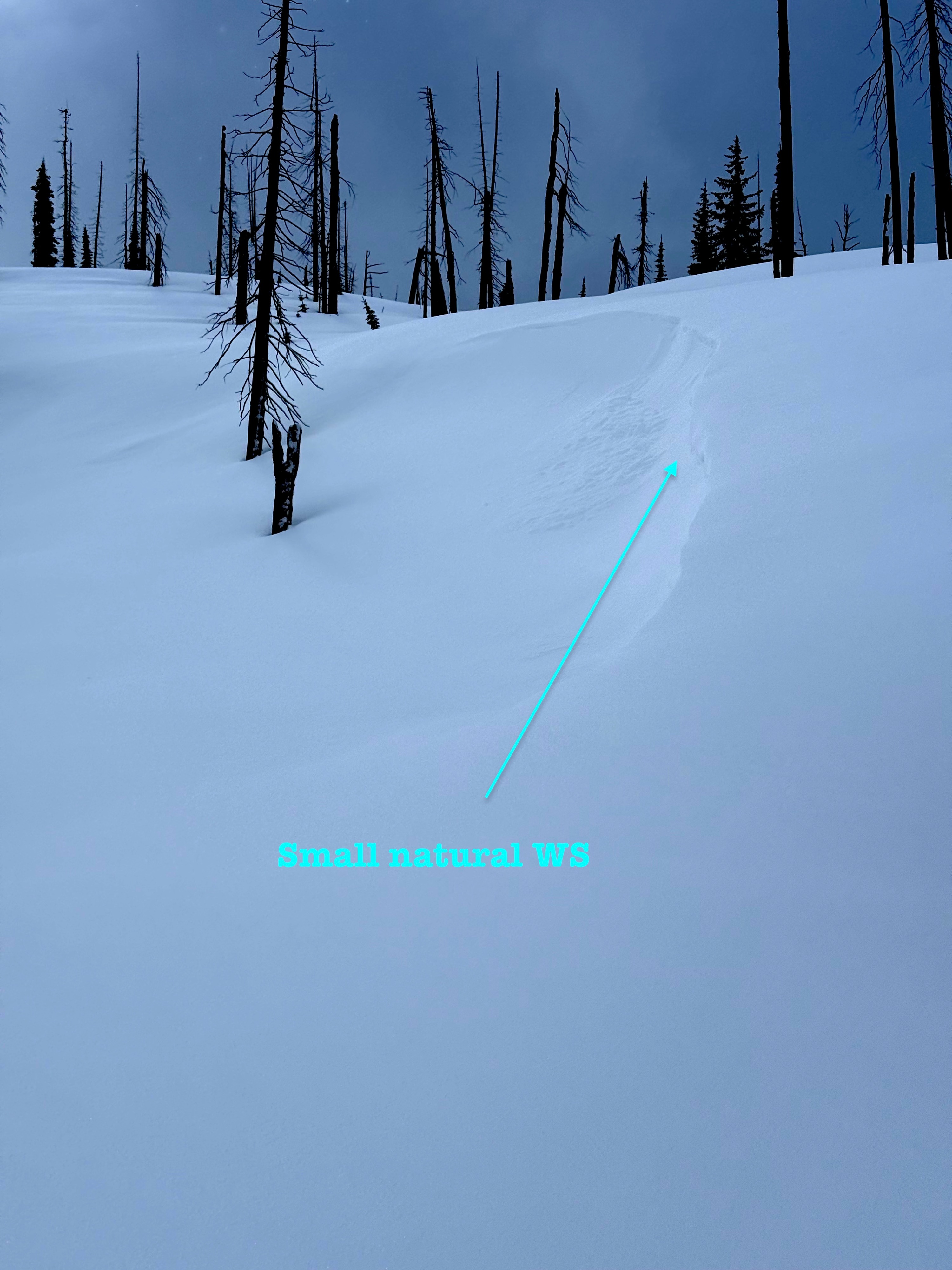
We found 8 inches of light new snow at mid and upper elevations that was easily transported around by winds today and was building small, reactive windslabs. These windslabs were easily triggered on rolls and cornices as we travelled, and grew in size throughout the day with sustained moderate W winds.
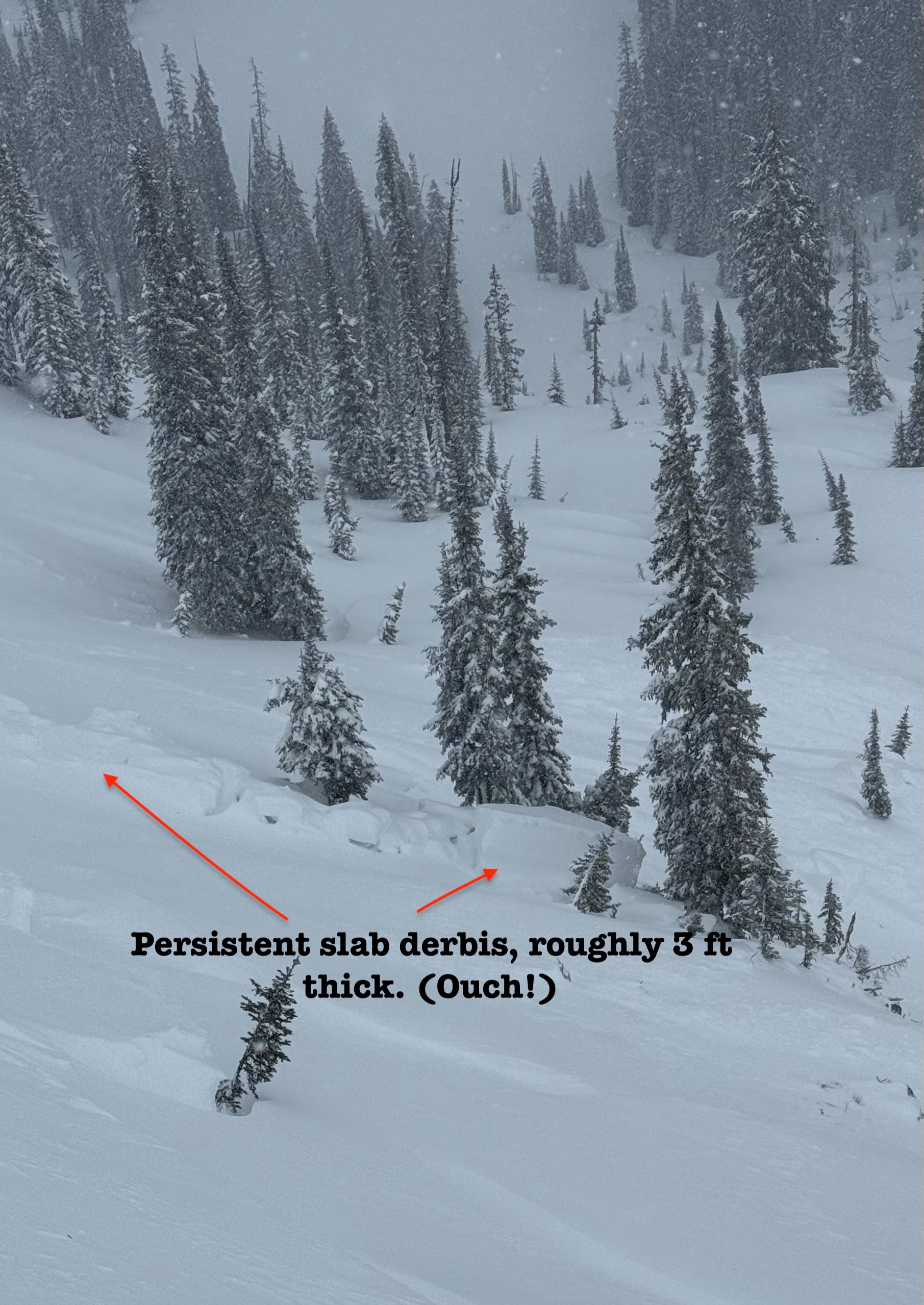
Observed a natural D2 persistant slab that was triggered by a cornice fall, likely on Sunday. And small natural and human triggered windslabs that occured during the day.Weather
- Cloud Cover
- broken
- Wind Loading
- moderate
- Recent Snowfall
- 15-25 cm
- Snow Avail For Transport
- moderate amounts
Cold temps, light to moderate winds with moderate to strong gusts out of the SW-W during the day, and transport was apparent throughout the day. Orographic snowfall throughout the day brought ~2 inches of new snow while we were out in between patches of sun. Precip included graupel, rimed particles and beautiful stellars.
Snowpack
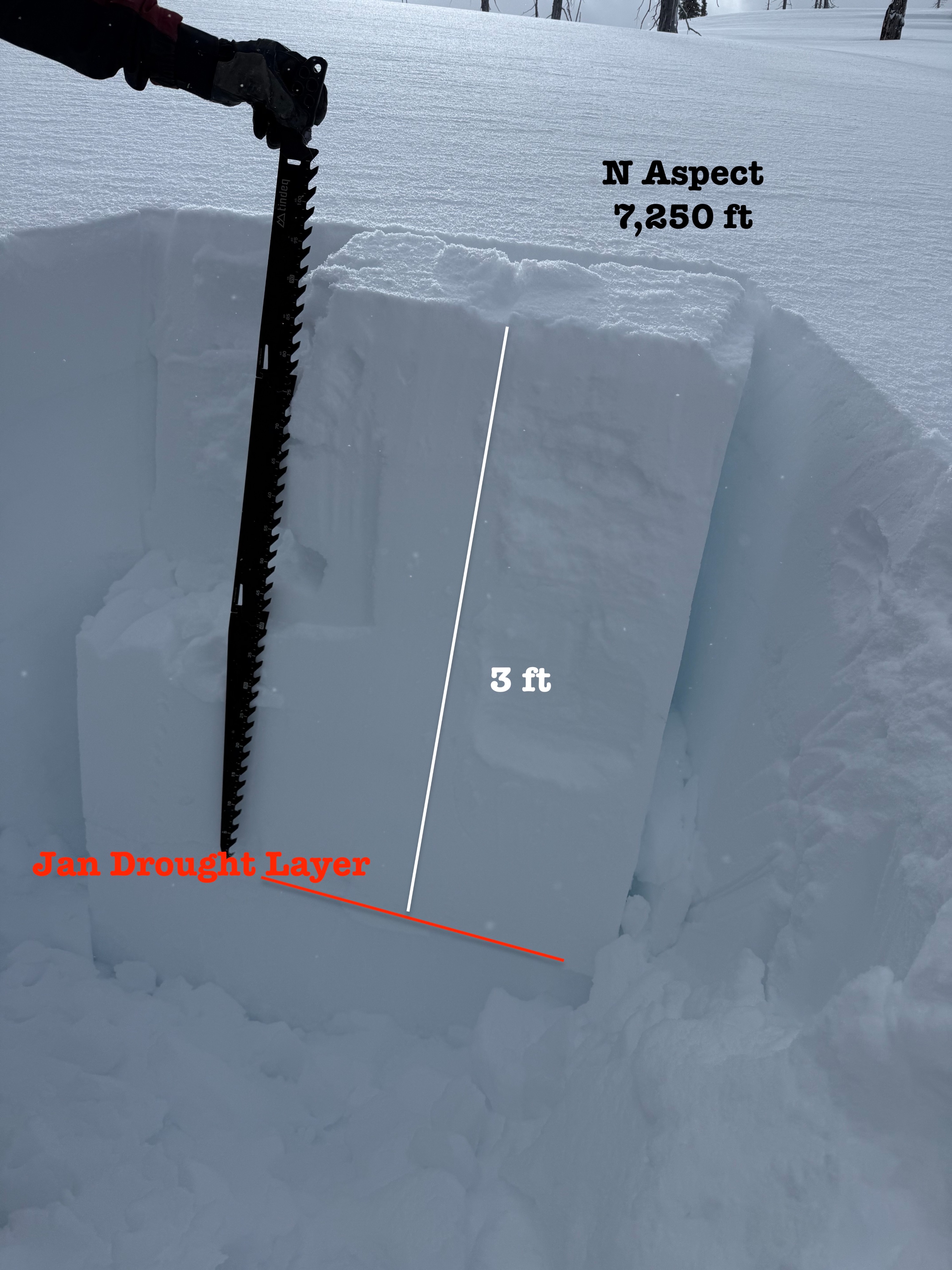
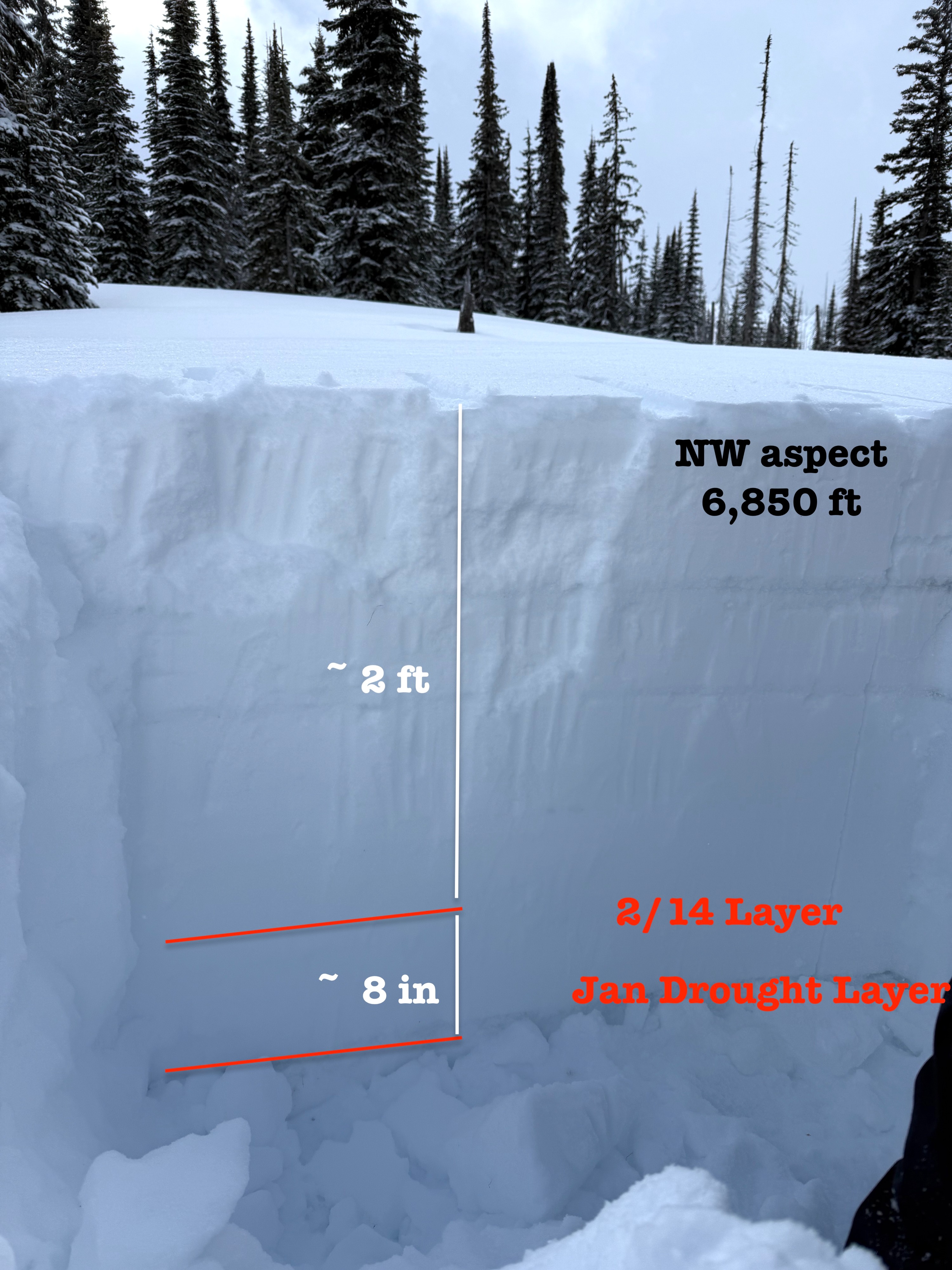
We didn't experience any cracking or collapsing, but that doesn't mean we didn't have weak layers. In the mid and upper elevation areas areas we dug, we found the January drought layer to be well insulated by roughly 3 feet of snow. At 4.8k ft we found 4 inches of new snow, 5.5k we found 6" new snow, and 8" at 7.6k. This new snow all sat on the early March Crust, except low elevation solar aspect where it rest on dirt. At low and mid elevations, the snowpack was moist below the crust.
- A snow pit at 6,850 ft on a NW aspect had the 2/14 PWL down ~2 ft, and Jan drought layer down ~2.5 ft. PST 33/100 End on Jan drought indicated the layer has the ability to propagate.
- A snowpit at 7,250 ft on a N aspect had the Jan drought layer down ~3 ft. PST 40/100 End on Jan drought indicated the layer has the ability to propagate. 2/14 layer was not notable.
The slab resting above the drought layer became firmer as the snow got deeper, transitioning from blower (F-) new snow, to 1 F to P 3 feet down. New snow was easily transported around by wind, building small reactive windslabs throughout the day. Aside from this, we saw the early march MFCr below the new snow, and the 2/23 crust down 1.5 ft.