
Quick report
- Collapsing
- specific
Compared to travel in the south just the day before on this zone's border, the snowpack in sheltered, lower elevation terrain was less reactive. This collapsing only went 50-60' out from our skis, but I would credit this to two other factors rather than an increase in stability. 1) Weak layers on the more southerly terrain we traveled through at the lower end of middle elevations at the beginning of our tour were cooked during our most recent warm up and throughout the season, having little snow coverage other than our most recent snow 2) As we climbed to the upper end of middle elevations to uppers, we were on more wind-exposed terrain that likely had been stripped of much of it's weak snow by wind. This being said, we still experienced collapsing throughout the tour, with collapses radiating 50-60' out from our skis.
Weather
- Air Temp
- Below 32
- Cloud Cover
- broken
- Wind Loading
- moderate
- Rain Elevation
- 7200
- Recent Snowfall
- 25-35
- Snow Avail For Transport
- moderate amounts
Skies were mostly socked in with a thick cloud deck sitting around 8000/8500' when we left the trucks just before 1100. Throughout the day, the cloud deck raised slightyly higher, with sun breaks popping through into the early afternoon. By mid-afternoon, we were able to see some blue skies and views of Cerro Ciento and Easley. As soon as we exited sheltered lower angle terrain, the S/SE wind was moderate and sustained. Large amounts of snow could be seen blowing in plumes near ridgeline in the high peaks of the Boulder Mountains.
Snowpack
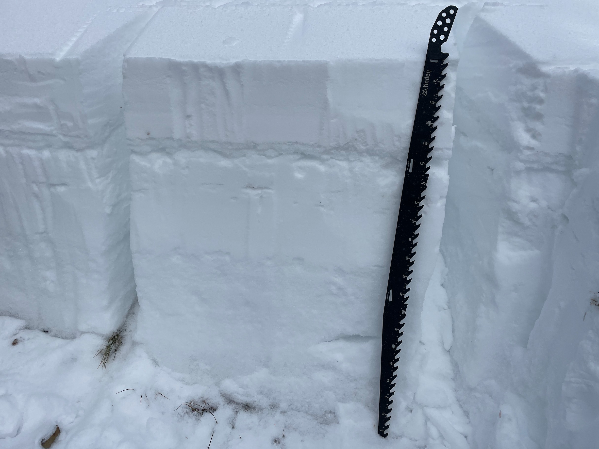
Leaving the trucks near 7000' just before 1100, snow surfaces were moist with a thin rain crust. As we climbed to just above 7200', this rain crust dissipated. Near the bottom of the drainage, we observed surface hoar from the creek upwards onto 7950'. Staying primarily on S and SW aspects as we climbed, we experienced a relatively thin snowpack. There was 20cm-25cm of fresh snow overlying a series of crusts near the base of the snowpack up to 8200', which was only 45-50cm total (HS), with vegetation still visible in a lot of locations. Once in more tree-sheltered terrain from 8200'-8800', the depth of the snowpack (HS) increased dramatically to 90-105cm.
Digging a pit on a SW aspect at 9200' where (HS) was 105cm we found 20-25cm of snow from the day prior, with 30-35cm of total newer snow overlying a stout 2-3cm melt-freeze crust (MFcr) from our warm-up last week. This interface between the crust and new snow is now our 2/1 interface to keep an eye on. Beneath the MFcr I found small (2-3mm) faceted crystals (FC). Beneath this I found a 50-55cm dense, 1F to 1F+ stiffening slab that represents our January snowfall. Beneath our 1/6 interface, we had 30-35cm of our weak F- December drought snow, with faceted crystals (FC) transitioning to depth hoar (DH) 10cm before the ground. The November/October snow was not present near the base of the snowpack, likely burned off by the sun on this solar apsect. Stability tests indicated a likelihood for the 1/6 interface to propagate, and that the 2/1 interface is likely to see some activity with additional loading.