Pretty gross out there
Dec 12th, 2025 11:00 AM
j_nowicki
St. Mary
Details
Type
quick
Coordinates
49.524750, -116.056080
Quick Observation
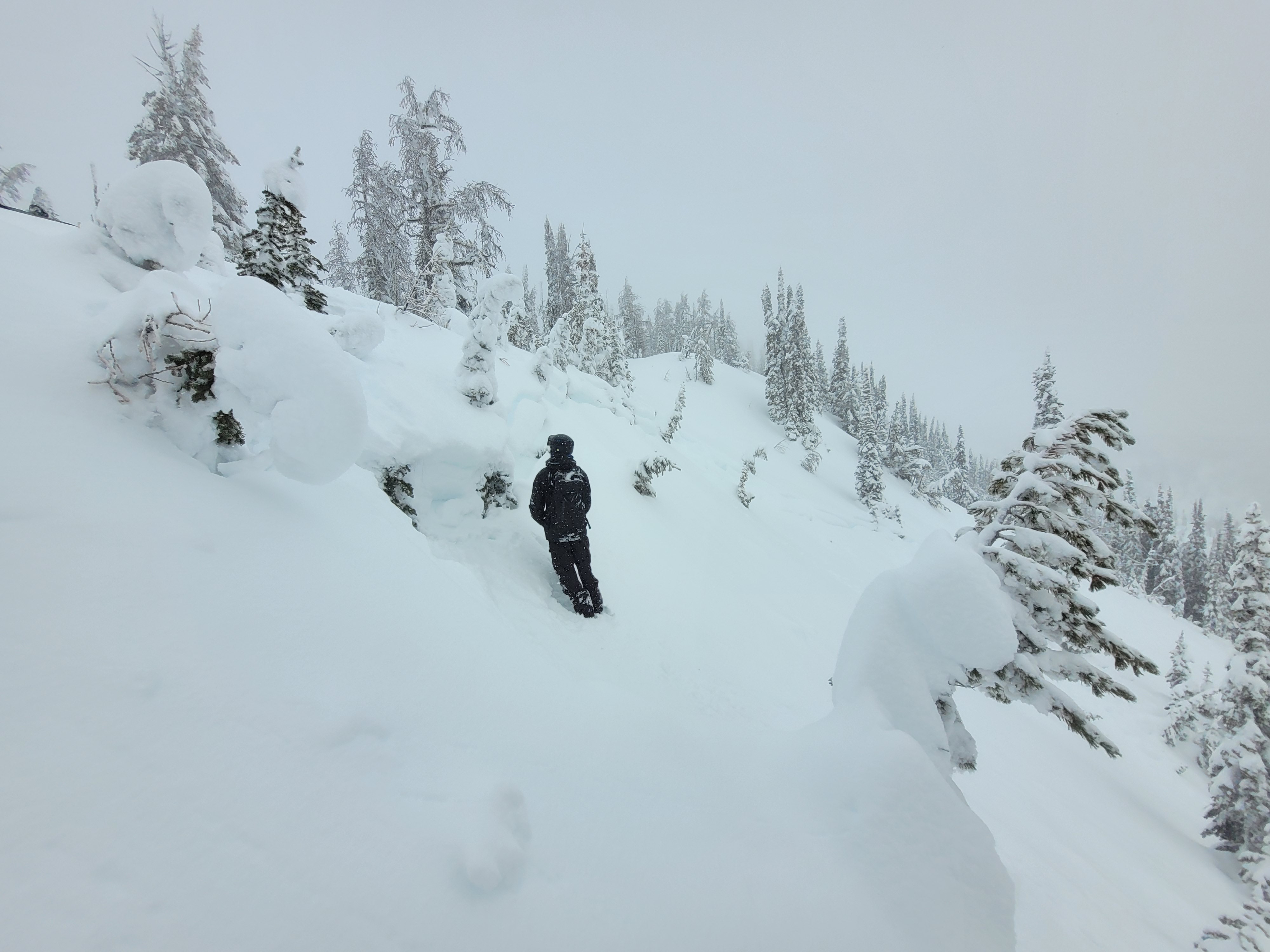
Had to go see what it was like out there in the South Purcells after the mega storm. Turns out freezing levels really did go above 2300m on Weds night.
Thick but breakable crust with saturated wet snow below the crust up to around 2000m. A thinner rain crust (around 2cm) was present all the way up to 2300m with drier storm snow below. Probed around 130-170cm at 2100m. We didn’t do any skiing due to the crust and natural avalanches, stayed on the sleds and took it real easy.
Temps were above freezing again in the valley bottom by the end of the day. Slush town on the road out. Snowed about 5-10cm throughout the afternoon above 1400m.
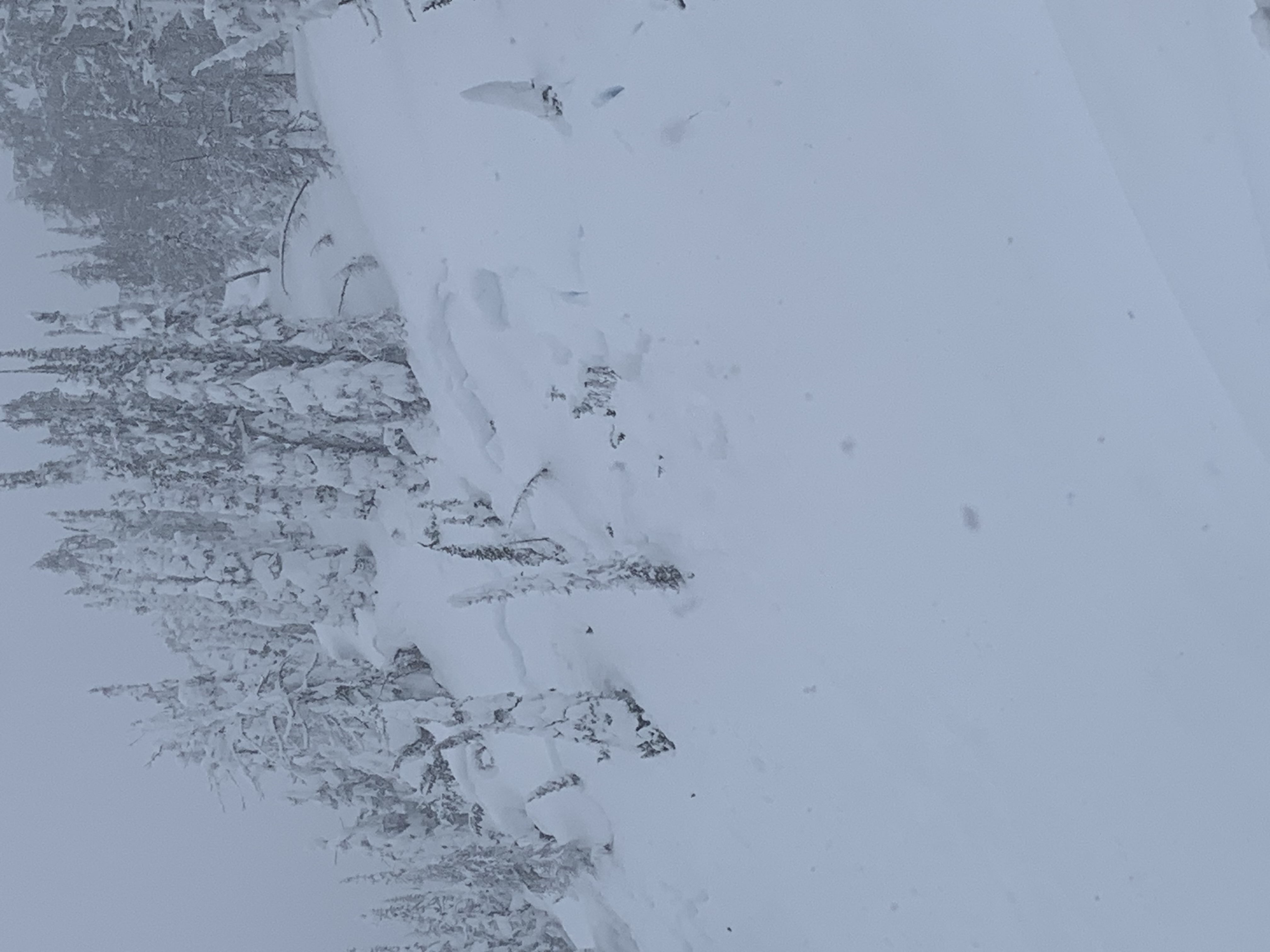
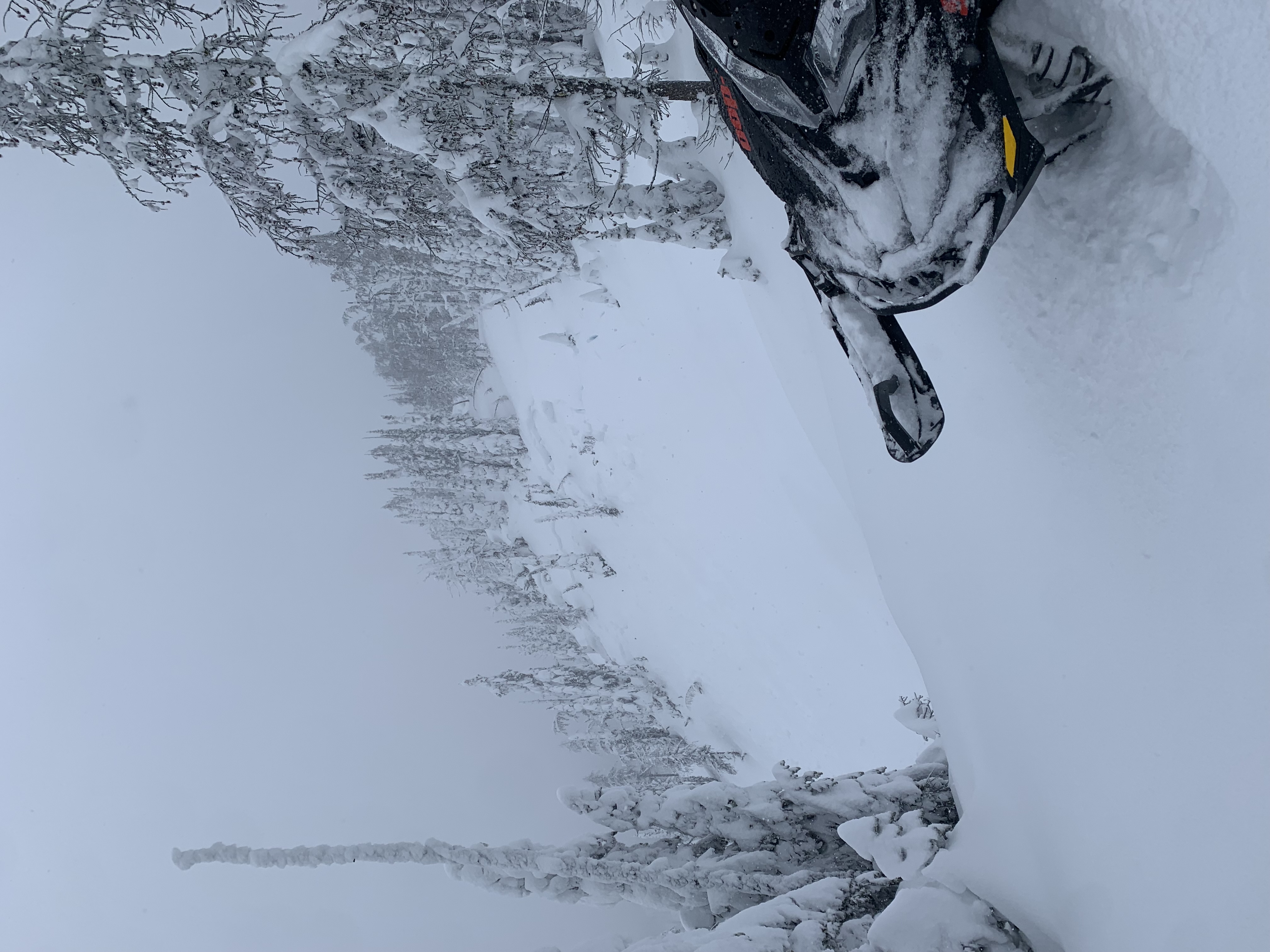
Pics are of two different ~80cm storm slab avalanches we observed on a SE aspect from Weds or Thursday. See snowpack tab for our pit results.
Snowpack
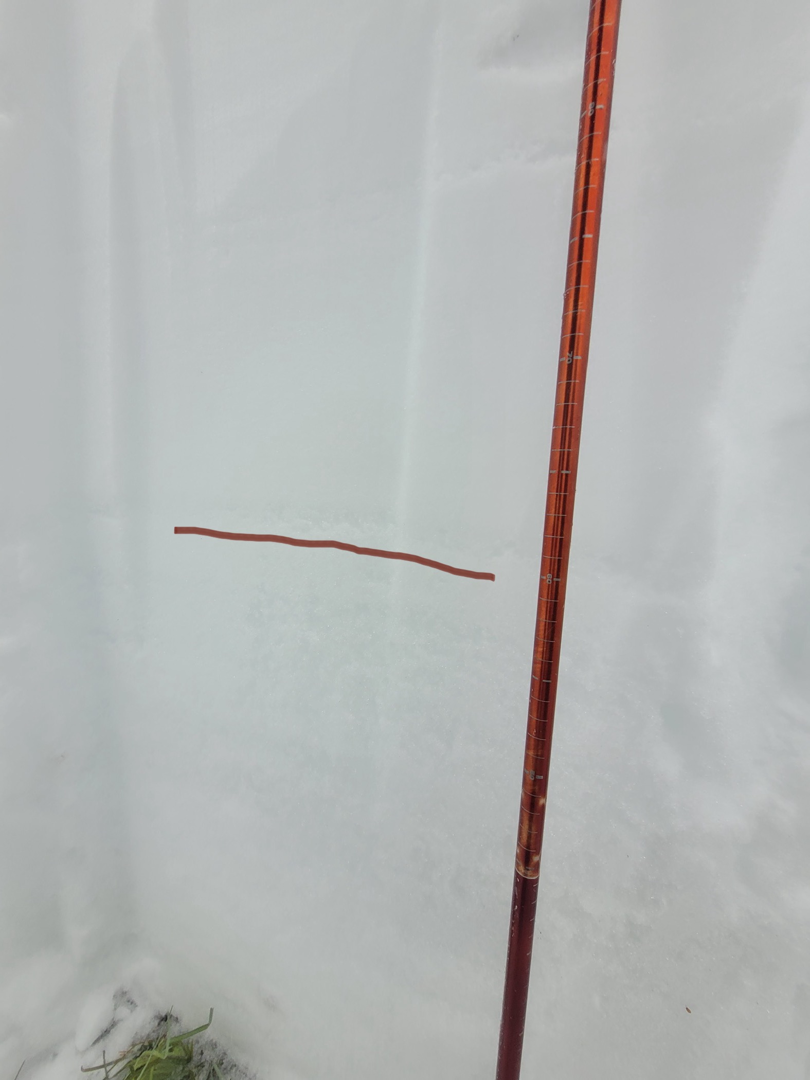
Column test results:
1st test: CTE 1 😳 - 90cm down on small grain facets
2nd test: CTM 12 - 90cm down on small grain facets
Quick density profile (surface at 150cm)
150-130cm: 4 Finger new snow with 3 rain crusts layered in there
130-120: 4F
120-80: 1F
80-60: 4F
60- thin layer of small grain weak facets
60- ground: 1F+ rounding large facets
Photos (4)