
Quick report
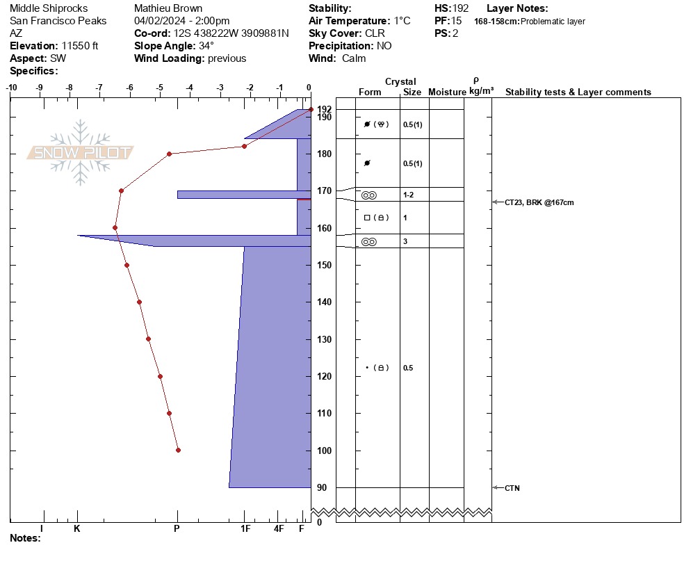
Wx: Sunny and calm. This was preceded by a period of high north winds for the previous 12-24 hours. Wind drifts in the shiprocks area were unreactive. The upper layer of wind-hardened snow was starting to melt on general west and southwest slopes providing grippier and softer conditions. In the pit location (isolated distribution), there was a facet sandwich between two meltfreeze crusts. This layer was generally non-reactive and the fracture character broken. The upper layer of wind transported snow did not produce fracture plains on stability tests, but slid in small chunks upon ski cuts and turns. These melt-freeze crusts are overlaying a thick 80+ cm of 1F rounds and rounding facets. In general the snowpack had high strength, fair structure and low propogation propensity.
Weather
- Air Temp
- 33
- Cloud Cover
- clear
- Wind Loading
- moderate
- Snow Avail For Transport
- small smounts
The high northerly winds from the night before turned to calm around noon and temperatures rapidly increased.
Snowpack
The snow was highly variable based on wind effect, elevation, and aspect. Upper elevation northwest and west aspects were highly wind effected--polished smooth, highly compacted and slick. Wind drifts were hard, cold, and unreactive. On southwest aspects, the sun had begun to melt wind hardened crusts, and these were slightly cracking and releasing in chunks on ski cuts and turns. Snow depths ranged from completely stripped wind affected zones to 80-100 cm in catchment zones and 180-220 in wind-drifted zones. Ski conditions were thick and heavy below 11,500 ft. on southwest slopes and 11,000 on west slopes by 3:00 pm.