
Quick report
- Collapsing
- isolated
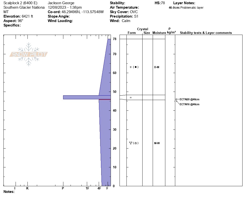
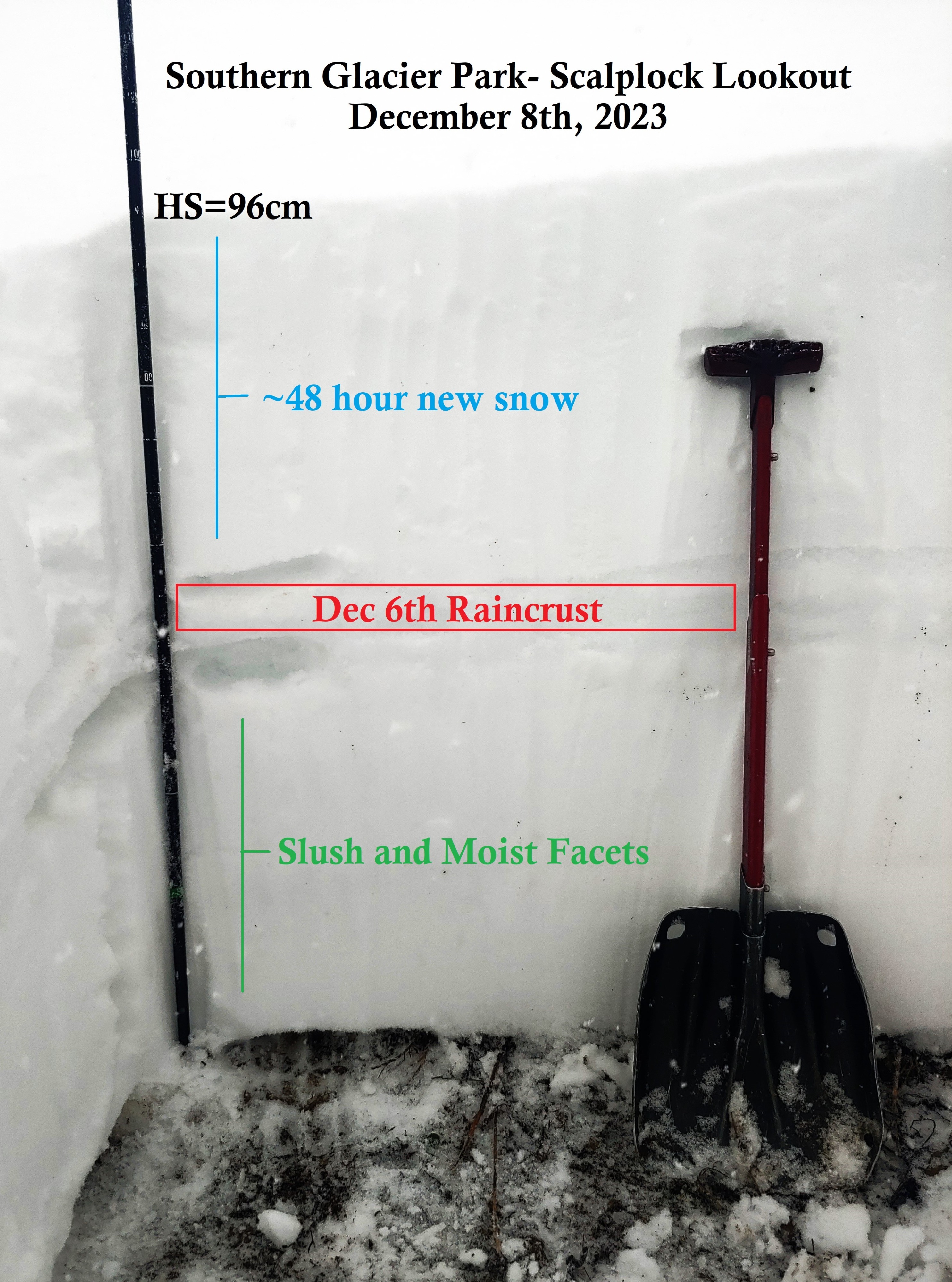
Decided to head out to Southern Glacier Park to help fill some gaps in recent data for the FAC. I had a few questions for the day. • Did it actually rain less in this part of the forecast region? Did it rain at all above 6500? • How has the Dec 1 Surface Hoar responded to recent changes. And how about the other faceted crusts that we had brewing out there last week? • Will I be able to put skis on at my car? I was successful at answering these questions. More information in the snowpack tab. And today's real blessing was that I got to observe my favorite type of snow... The great paradoxal and fleeting crystals known as "moist facets". Riddle me that! Two audible collapses on a flat section of the ridgetop at 6500'. Suspected weak layer is moist facets immediately below the Dec 6th rain crust.
Weather
- Cloud Cover
- overcast
- Wind Loading
- none
- Recent Snowfall
- 10
- Snow Avail For Transport
- moderate amounts
It was a nice calm storm day out in the mountains. Light snowfall (S1) most of the day, and around 230pm snowfall rates picked up at bit (S2-S5). About 4 inches accumulated at Walton Ranger Station during my tour. Calm winds all day, even on ridgetop and up at the lookout.
Snowpack
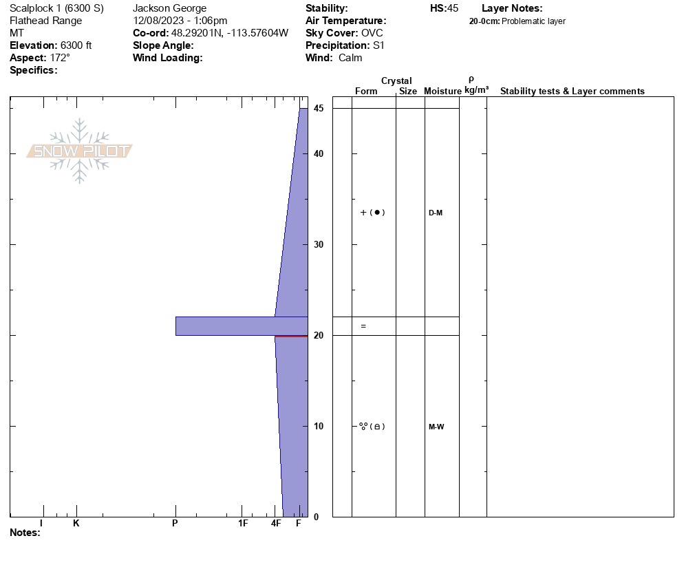
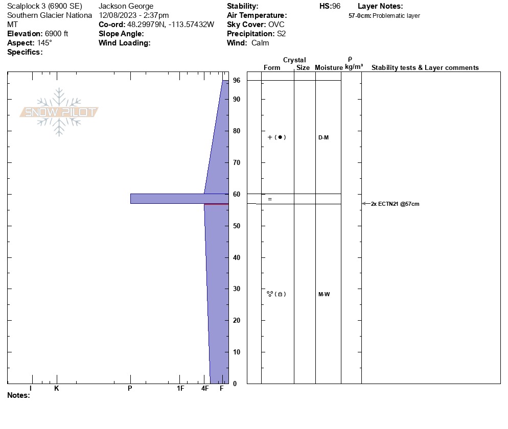
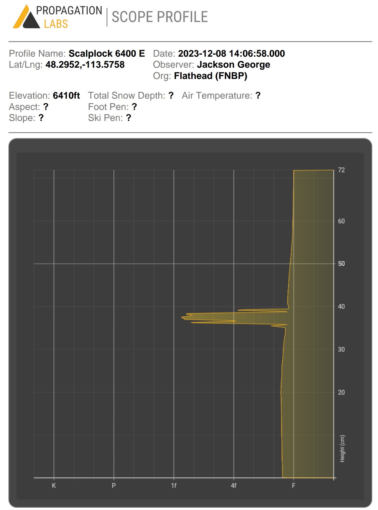
• Below about 6000' the forest understory still dominates the scene. Areas with a thin canopy are starting to develop a shallow pack, but densely timbered areas have a lot of catching up to do. • I dug three pits during the tour today. 1) 6300' South Facing, HS=45cm, HN48=23cm 2) 6400' East Facing, HS=78cm, HN48=30cm 3) 6900' SE Facing, HS=96cm, HN48=36cm • The Dec 5th/6th rain event evidently soaked the snowpack in Southern Glacier Park to the ground. 2-3cm rain crust observed below the more recent snow, and moist snow beneath the crust to the ground. The snow right at the ground is moist/wet (you can wring liquid water out of it if you squeeze hard enough) • The recent snow overlying the Dec 6 crust is somewhat moist and appears to be bonding well to the crust. The crust is rough, grainy, and irregular, which seems to be aiding in the bonding process with the recent snow. It was very resistant to shovel shears in my pits. • The Dec 1 Surface Hoar did not survive at this location. At least not on slopes below 6900' (my high point for the day). It was not discernable to me in any of full pits or hand pits. • All facet crust combinations formed prior to Dec 5 appear to have been erased and transformed into a homogenous slab of slush and moist facets at the bottom of the pack. • Aside from varying new snow totals and overall depths, the structure described above was generally uniform across all aspects that I observed. • In addition to the three profiles that I recorded, I recorded numerous digital hardness profiles on other aspects to confirm this structure and document HS averages. It was also relatively effortless to confirm this structure in several shallow handpits with the lack of snow out there.