
Quick report
- Cracking
- isolated
Visibility and travel conditions were poor and limited observations in more locations.
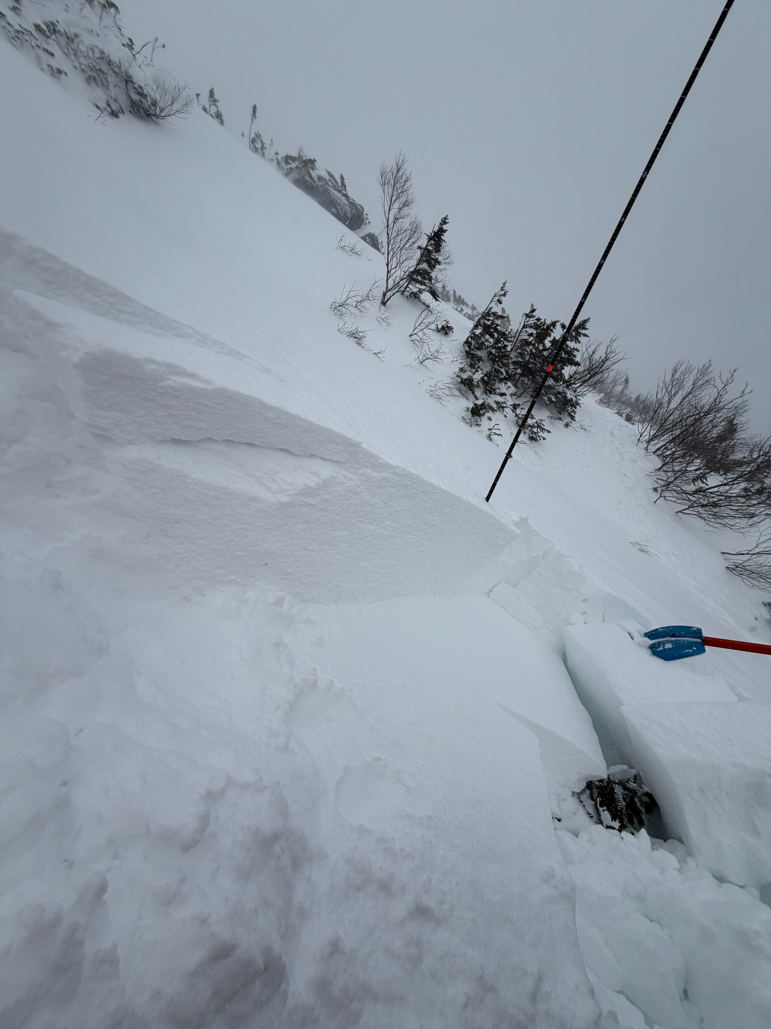
The high traverse on the Summer Lion Head Trail is one of the few places where softer, deeper, more unstable snow was suspected after multiple days of hurricane force winds and little snow accumulation. Sure enough, a protected gully with unstable wind slab was observed on a mid-elevation, east-facing aspect.
While no signs of instability were observed when traveling, isolating a column and remove the support of the snow below it produced reactive results in 2 ECTs and a PST.
It's worth noting the speed and consistency of the wind today at the ridgelines was intense, though it was significantly calmer on this protected slope. It's likely why this reactive snowpack is reletively limited in its distribution and has not been observed in larger, more wind-exposed avalanche terrain or at upper elevations. It's worth taking a look at recent observations from the Gulf of Slides, which observed a similar snowpack structure and also have similar terrain characteristics - low in the gullies at similar elevations where the terrain and trees provide ample protection from the wind.
Though the video is a great example of a mid-slab propagating weak layer, I felt that the conditions I observed here were still aligned with today's LOW avalanche hazard rating given the high spatial variability, prolonged extreme winds, and small potential size of this avalanche problem.
Weather
- Air Temp
- 10
- Cloud Cover
- obscured
- Wind Loading
- previous
- Recent Snowfall
- ~5cm since January 1
- Snow Avail For Transport
- small smounts
Obscured sky conditions due to clouds and intense blowing snow. Cold temperatures around 10 degrees F. Strong winds out of the west.
Snowpack
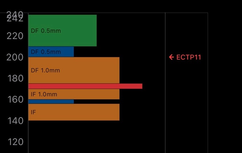
The snowpack on the Summer Lion Head Traverse is about 3 meters deep with a boot penetration off the trail of about 50cm. In general, the snowpack is made up of multiple feet of dense wind slab on top of multiple crusts and decomposing crusts from previous rain and warming events in December. The primary instability that I observed was a mid slab density change where 4-finger-hard snow was sandwiched between 1-finger-hard snow and pencil-hard snow. This weak layer consistently produced propagating results in a test pit (ECTP11, ECTP11, PST 30/100 END).
Old rain crusts deeper in the snowpack are begining to decompose with some faceting occuring around those layers both above and below, likely facilitated by prolonged cold temperatures and the rain crust 'vapor barrier'. No signs of instability were observed at this crust layer. It took significant amounts of force to pull off the remaining windslab from the old rain crust, and when it did fail, it was blocky and non-planar.