
Quick report
It would appear that the storm is either delayed or under producing, but still dramatically improved riding conditions.
Here are the new/old snow interface observations I made. I traveled mostly east facing terrain, venturing into north and south as well.
Below 7,800': Snowpack was not refrozen. In areas that had weak faceted snow, the snow is saturated, but isothermic and if untracked you sink deep below the surface. Trailbreaking and moving in this snow is more difficult than you might expect. When this snow freezes it will likely be good for stability.
Around 8,000-8,500': Here the top of the snowpack is moist and in some places has a breakable melt-freeze crust from cooling during this storm. It is not a thick or uniform crust. Solars have a more stout crust. Snow has bonded pretty well to it. Here there was 10-15cm of new snow by mid afternoon. Skiing was okay. Some wind affect.
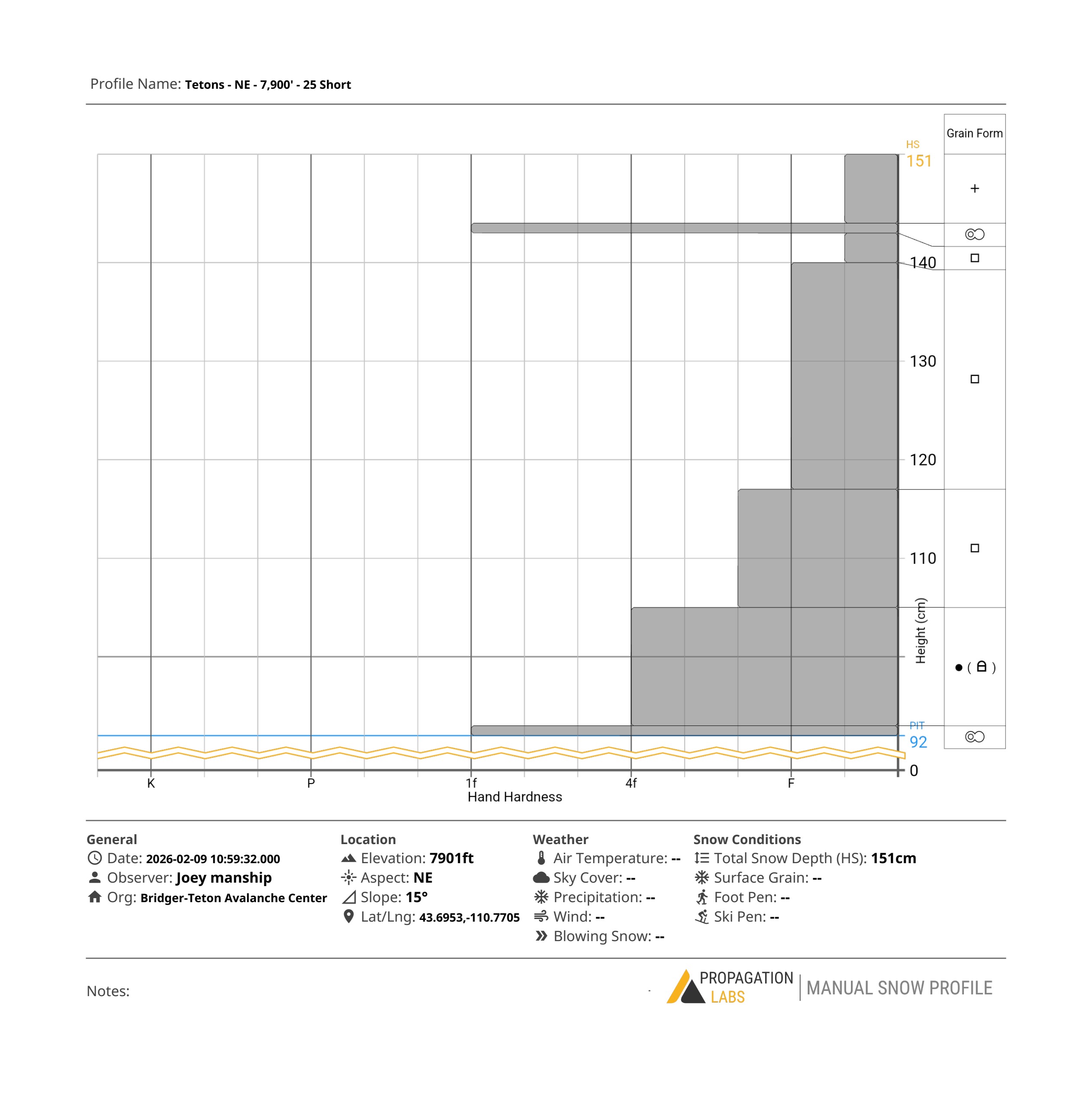
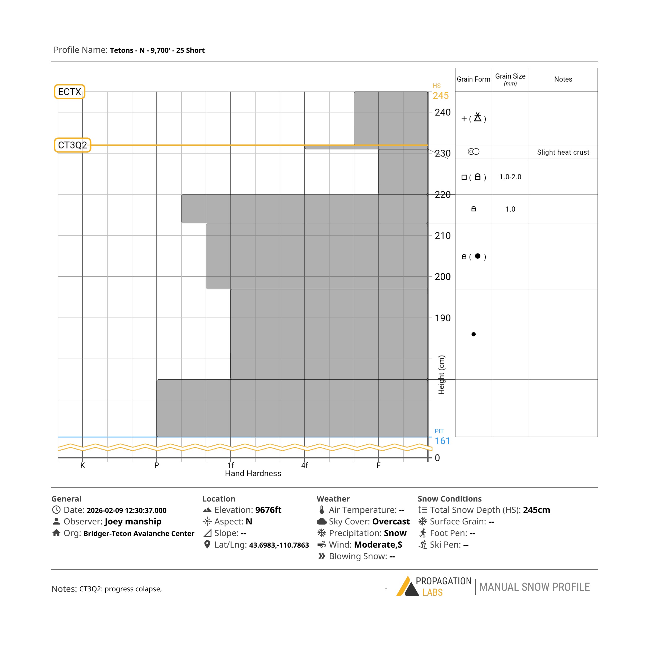
8,500-9,500': Here there is a supportable melt-freeze crust on SE-S and some E facing slopes. On polar (E-NE-N) slopes there is cold snow just below the new snow. New snow is bonding well to this surface. In some places there is the faintest heat crust on top of the cold snow. Looking at this weak snow with the magnification tube showed 1-2mm facets. These facets have signs of rounding and sintering and are not the weakest I have seen. The heat spell may have done some good for stability in certain areas. The being said they are still facets and are still guilty until proven innocent as far as future avalanches go.
Overall new snow is bonding well to old snow, but when more snow comes it could start to overload some of the weak snow now buried just beneath the snow surface. Areas that are heavily wind loaded and mid elevation northerly areas that have very weak snow just below the surface will be most suspect.
Weather
- Air Temp
- 35 at the car, below freezing up high
- Cloud Cover
- overcast
- Wind Loading
- light
- Rain Elevation
- 6700
- Recent Snowfall
- 10-20cm
- Snow Avail For Transport
- moderate amounts
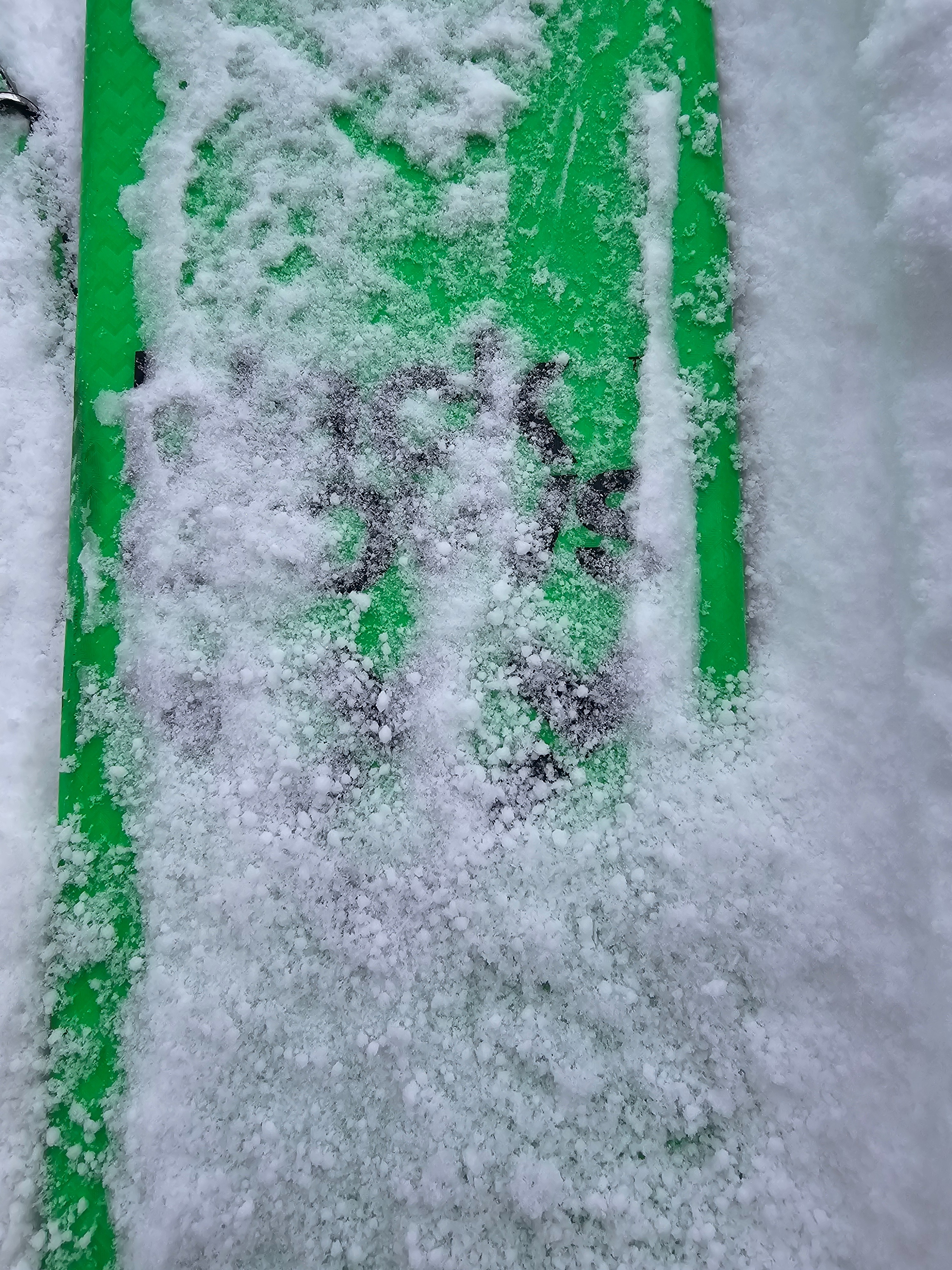
Weather was in and out. Generally >1" per hour snow and graupel with periods of 1" per hour snow. Strong graupel waves. Winds were gusty from the south blowing in the 20s mph. Above freezing temperatures at low elevations.
Snowpack
New snow seems to be bonding well to old snow. There is still lots of weak snow below the new snow, but the interface doesn't seem to be of concern today.