
Quick report
- Aspect
- East
- Elevation
- 2560 m
- Slope Angle
- 30°
A macro of snow crystals collected from just above the sandwich crust; at 45cm from ground.
Reference: 1mm grid on a BCA snow card
A macro of snow crystals collected at the center of the crust, facet, crust sandwich layer; at 40cm from ground.
Reference: 3mm grid on a BCA snow card
Tom's Hill / Weathering Heights area is still VERY thin IMO. The west-facing aspect (north of Powder Park and East of Short Swing) appeared to have much more consistent coverage.
Snowpack
- Instability Comment
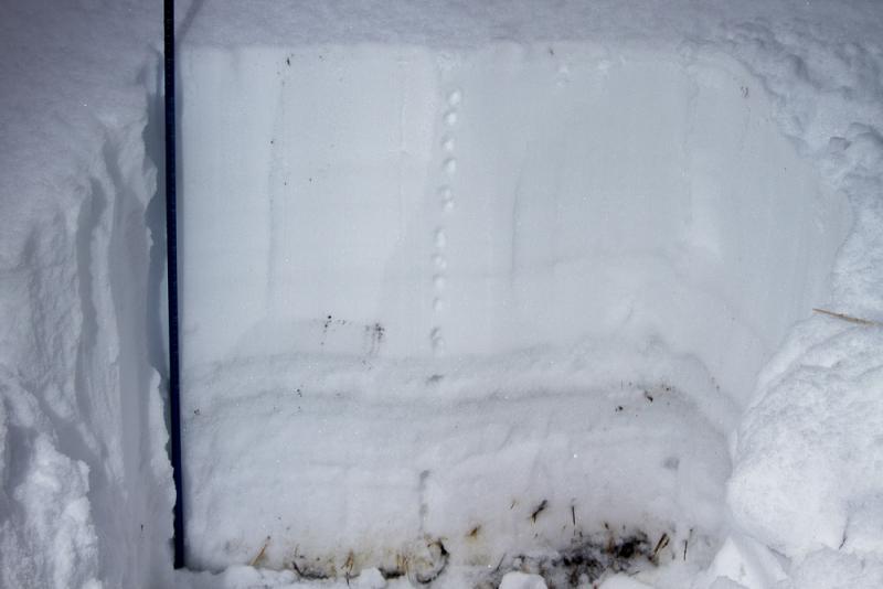
- <p>I observed similar results as those reported by the UAC today: a shallow snowpack with a crust, facet, crust layer near the ground.</p>
90cm was the average depth at this location. Snow appeared well bonded at ground level with a very dense / hard layer that rose to about 35cm where the crust-facet-crust layer began. This C-F-C layer was about 10cm thick with a very loose layer of facets at the center. After 45cm snow consistently decreased in density and felt 'right side up.'
Pit was open to the sky, dug to ground level, and located far from trees.