
Snowpack

Manitoba

Heifetz/Johnston-BloomSummit Lake
View on map
Observation photo 1Observation photo 2Observation photo 3Observation photo 4Observation photo 5Observation photo 6

Quick report

Collapsing
specific

We toured up Manitoba to assess overall snowpack structure and strength at both mid- and higher elevations.

From roughly 1,600 to 2,500 ft, we experienced widespread collapsing whenever we traveled off the established skin track, consistent with numerous observations reported over the past several days. At elevations above approximately 2,500 ft, we no longer observed collapsing despite the continued presence of poor snowpack structure.

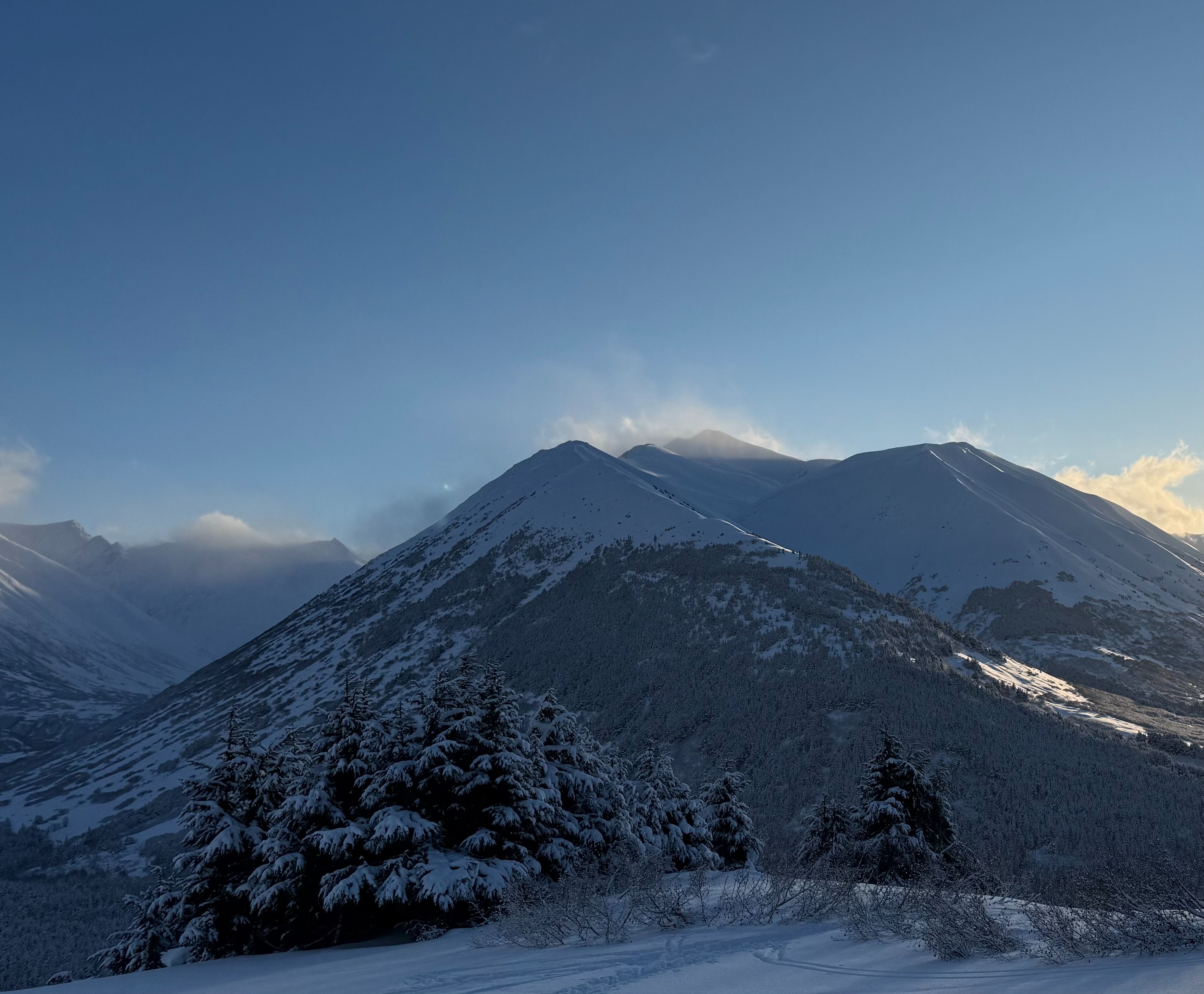
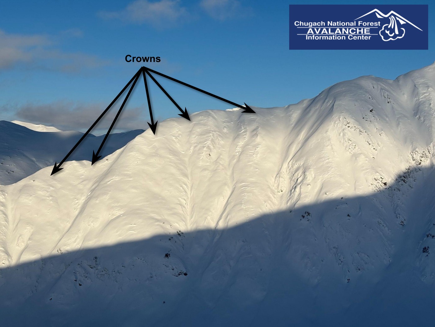
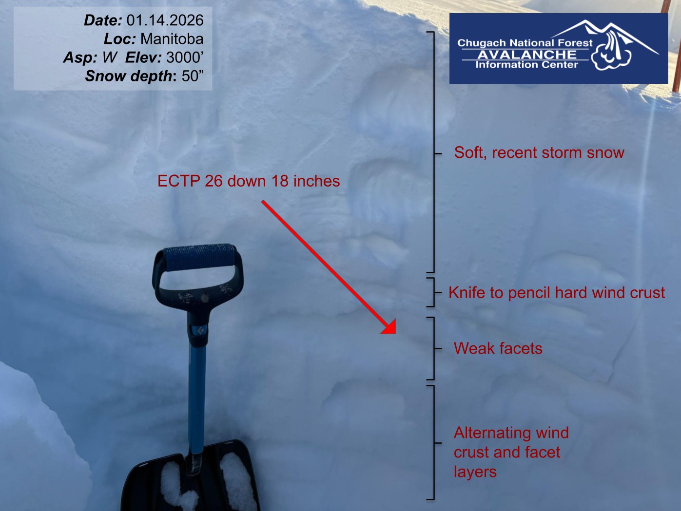
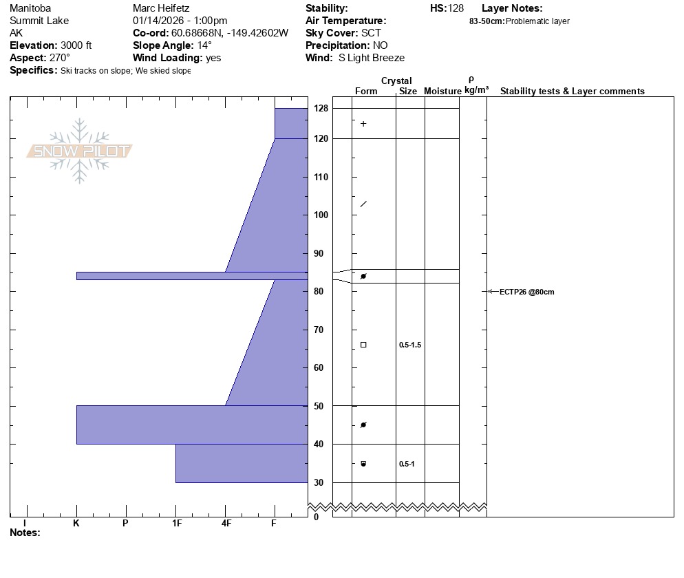
Snowpit tests at our upper-elevation pit at 3,000 ft, just below Manitoba’s northern ridgeline, showed that most of the recent storm snow from the past week was sitting on weak facets and produced unstable results. We also observed the crown of a large natural avalanche on the southwest aspect of the ridge from Silvertip to Wilson South that crossed multiple gully features. We also saw two additional crowns on westerly slopes on Raven’s Ridge, all of which likely occurred sometime within the past week. We did road obs after skiing and didn't see any other avalanche activity. 

The heavy precipitation and strong winds expected over the next couple of days, combined with this weak snowpack structure, will make both natural and human-triggered avalanches likely.

We experienced collapsing (whumpfing) from about 1,600 to 2,500 ft whenever we ventured off the skin track into undisturbed snow.

Weather

Air Temp
16
Cloud Cover
scattered
Wind Loading
moderate
Recent Snowfall
5
Snow Avail For Transport
moderate amounts

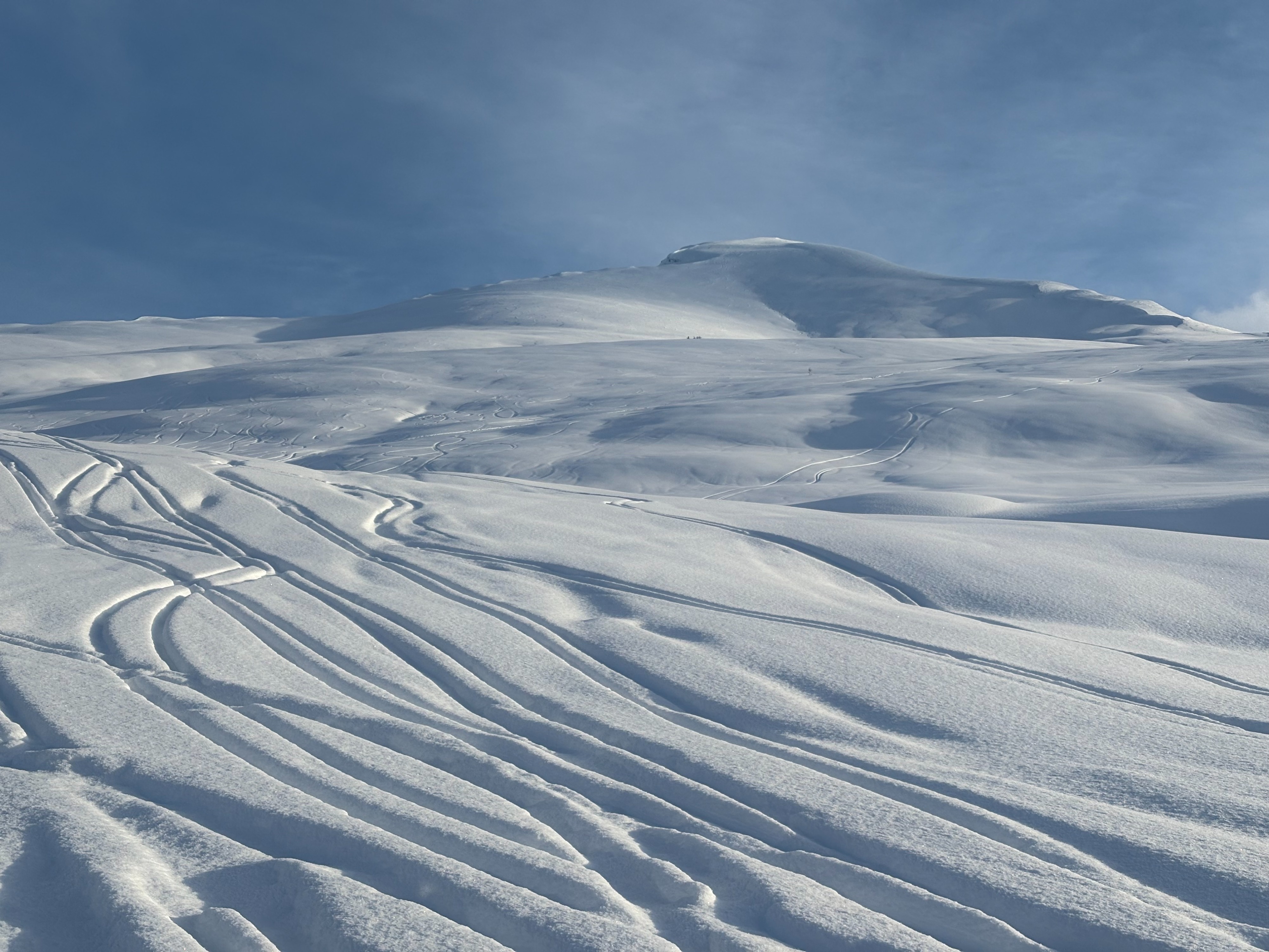
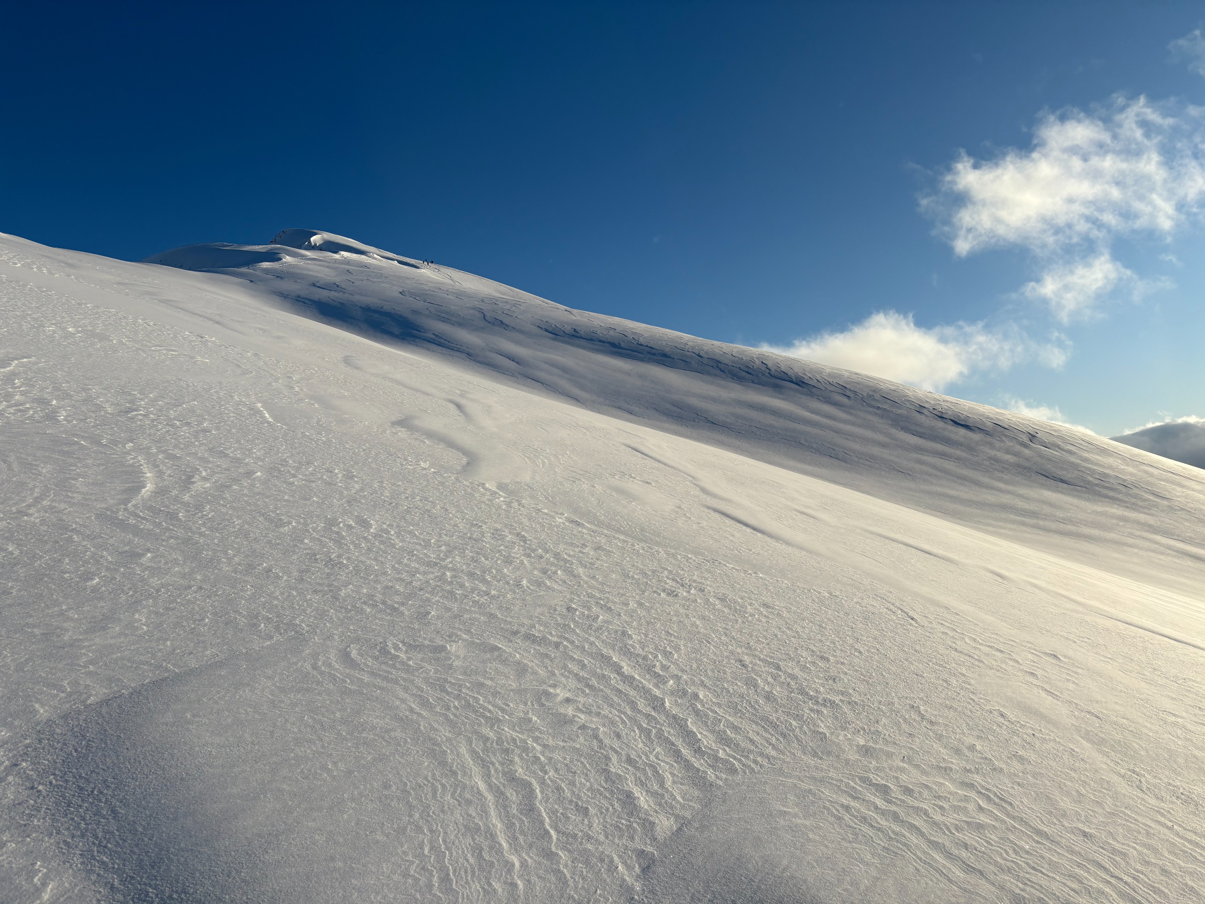
We began the day with fresh snow falling as large flakes under calm wind conditions below treeline. By midday, snowfall tapered off, and skies cleared to scattered clouds. Out of the trees, steady southerly winds were filling in ski tracks, and a new wind skin was forming in the wind-exposed terrain. Active snow transport was observed on many peaks in the area.

Snowpack

We conducted frequent pole probing and quick hand pits throughout the tour to track layer continuity and assess overall snowpack depth.

From approximately 1,600 to 2,600 ft, we found about 1.5 ft of snow overlying the early December melt-freeze crust. This crust is faceted, with 1-2 mm, chained facets on its underside. Total snowpack depth within this elevation band ranged from roughly 30 to 40 inches.

Around 2,600 ft, we continued to find soft surface conditions. The buried rain crust was absent and replaced by a variable wind crust that ranged from breakable to several inches thick and, in places, impossible to penetrate with a pole. Consistent across all elevations were the weak facets below these crust layers.

On a westerly aspect at 3,000 ft, just below Manitoba’s north ridge, we dug two snowpits. Both pits revealed a similar structure, with total snow depths ranging from approximately 50 to 70 inches. An Extended Column Test produced unstable results, failing in the 1 mm facets below a knife hard wind crust (ECTP 26, down 18 inches).

Overall, the snowpack structure was poor at all elevations, with well-developed facets beneath the recent snowfall from the past week.