
Avalanche
- Slab Width
- 30 m
- Weak Layer
- Facets
- Trigger Type
- Snowboarder
- Vertical Fall
- 457 m
- Avalanche Type
- Soft Slab
- Slab Thickness
- 41 cm
- Trigger Detail
- Unintentionally Triggered
- Start Zone Aspect
- Northeast
- Avalanche Problem
- New Snow
- Start Zone Elevation
- 2713 m
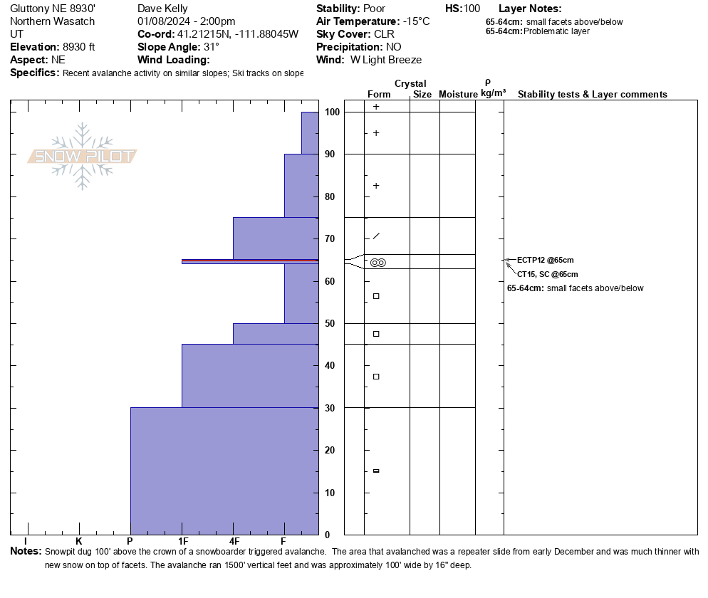
This avalanche was triggered by a solo snowboarder on the afternoon of January 8, 2024 in the Hells Canyon backcountry area outside of the Snowbasin Ski Area boundary. The powder cloud of this avalanche was reported to the Snowbasin Ski Patrol by a local who observed the powder cloud from a distance, however the triggering party did not stick around to talk to the patrollers. When the hasty team arrived on scene they observed one snowboard track in and no tracks out from their very limited vantage point on the ridge. Weber County Search and Rescue was contacted and they worked with the State of Utah DPS and Snowbasin Ski Patrol on this avalanche site. This avalanche, although it was only 16" deep by 100' wide entrained all the new snow and ran 1500' vertical feet to the flats covering over other backcountry tracks in the area. This avalanche ran on weak faceted snow on the ground and although it was a very soft slab the debris set up quite hard and if someone had been buried in the debris they would not have survived. This avalanche was a repeater, which means that this area had slid in early December and had a thinner weaker snowpack. There are many other locations throughout the state with a similar snowpack structure and as we get more snow in the upcoming weeks these areas that are thinner are suspect to be triggered again. This backcountry areas is an avalanche prone piece of terrain that has been the site of a number of fatalities and close calls over the years. Thanks to the Snowbasin Ski Patrol, Weber County Sheriff Search and Rescue, and the State of Utah DPS for responding.
Incident
- Number Caught
- 1
- Number Carried
- 1
- Terrain Summary
- <p>Photo 1 and 2- Crown Face</p> <p>Photo 3- A portion of the debris</p> <p>Photo 4-Partially covered tracks looking upslope where the avalanche ran through the Gluttony slide path</p>