
Quick report
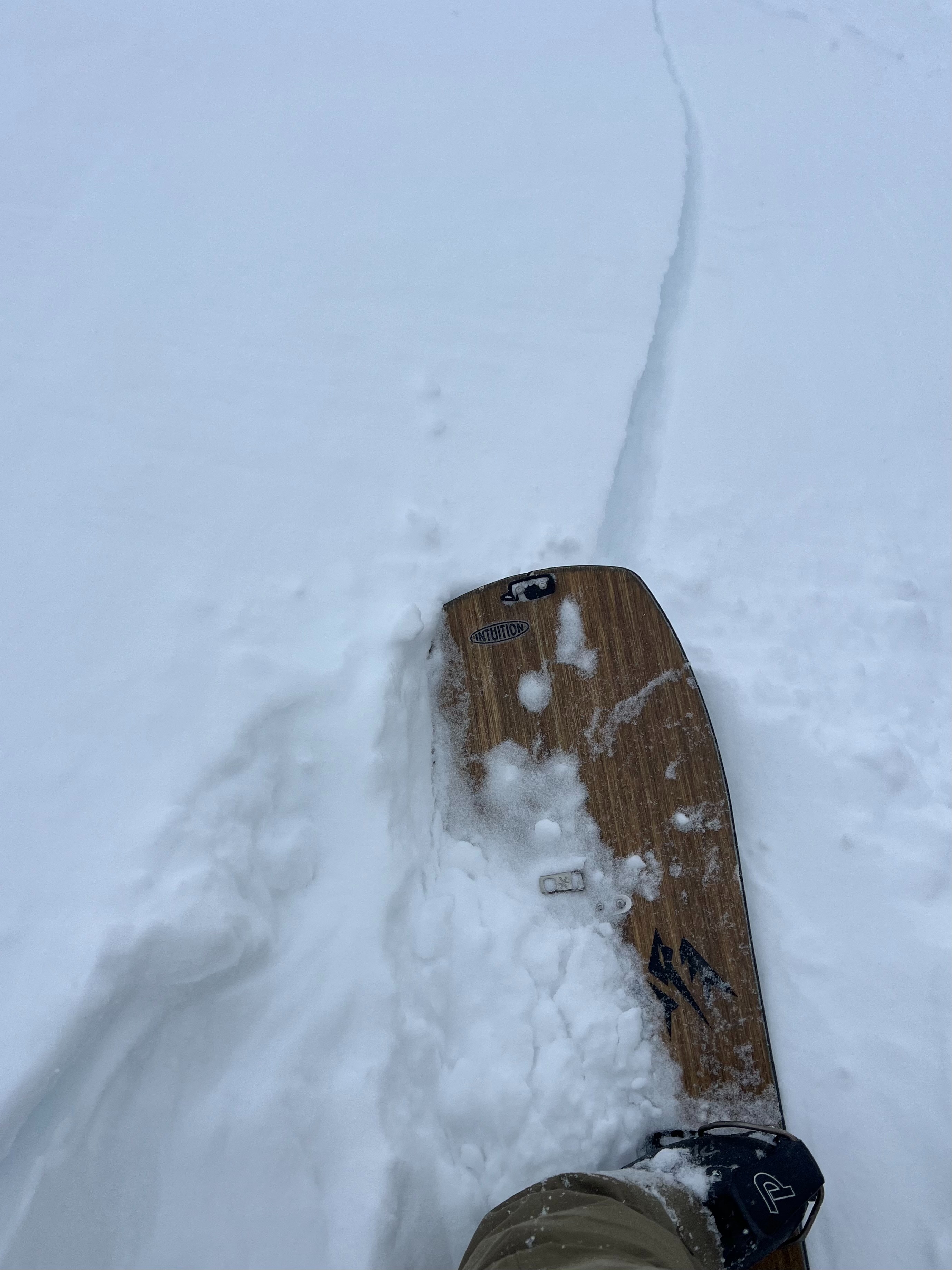
- Cracking
- specific
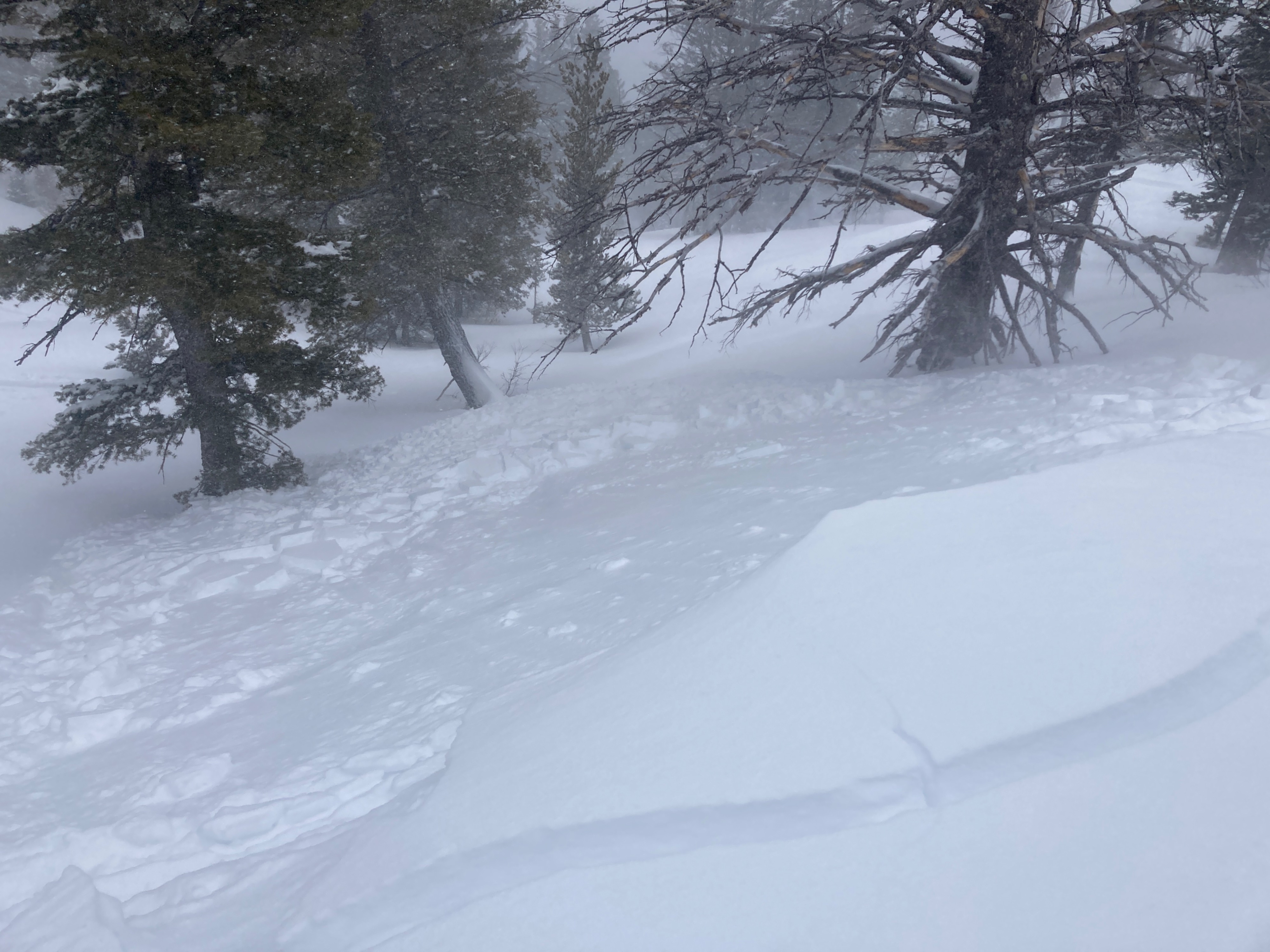
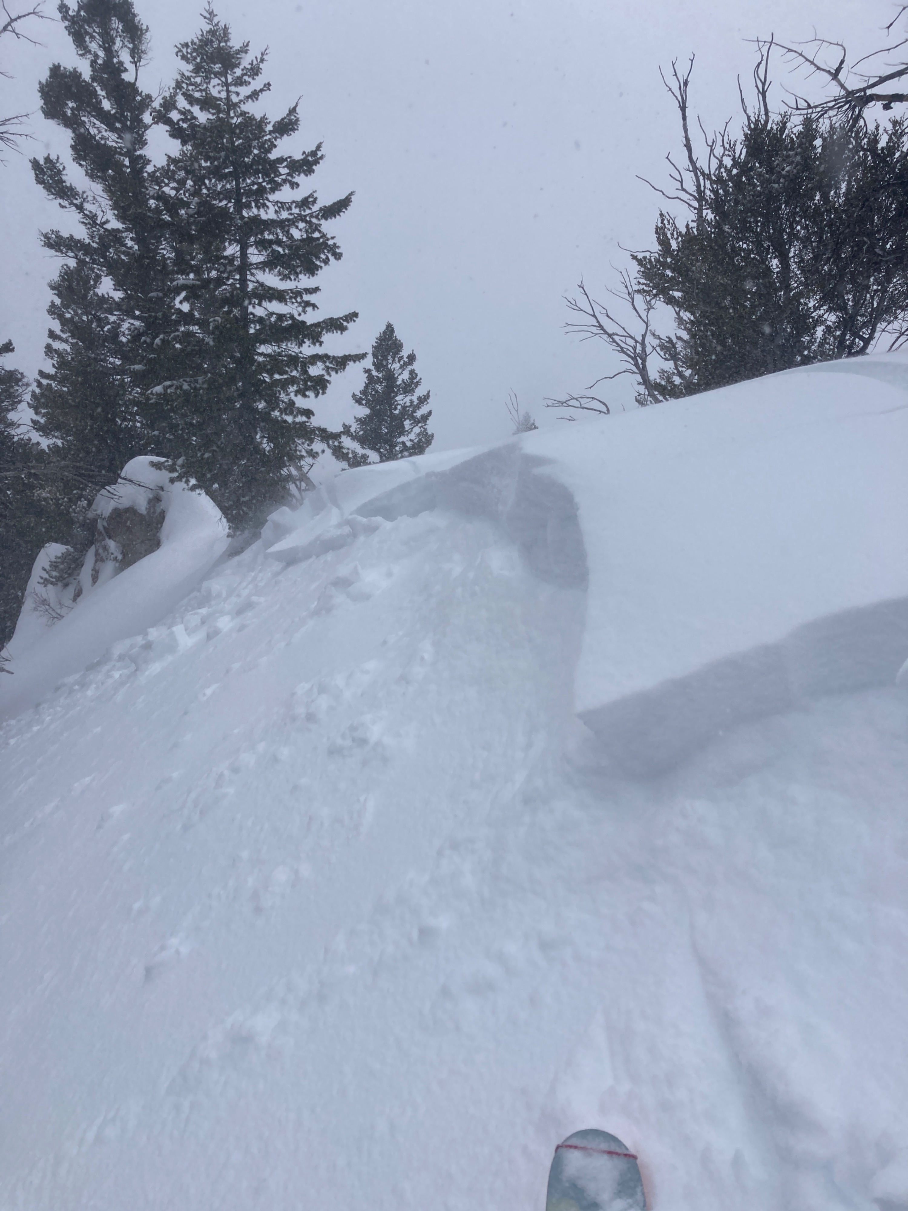
Toured two thirds of the way up Taylor this morning before the meat of the storm hit. 4-6 inches of new snow had accumulated by 10am below 9,000’. We observed touchy and reactive conditions despite the relatively low new snow totals. Wind and storm slabs were widespread and easily triggered in terrain steeper than about 30 degrees. We mostly traveled in south facing terrain where a firm crust from the past several days made for a productive bed surface. Snow wanted to move fast and run a good distance on the crust.
We turned around at 9,700’ due to deteriorating conditions. I’d expect slabs in bigger east facing terrain to be significantly larger than what we observed given the wind-loading and snowfall rates. Heads up avalanche conditions will likely intensify this afternoon into tonight with additional heavy snowfall, increasing wind, and warming temperatures. Dialing back terrain choices and keeping things mellow seems like the best call over the next day or two.
Sensitive, shallow wind and storm slabs in steep terrain where we traveled today. Shooting cracks in wind loaded areas.Weather
- Air Temp
- rising
- Cloud Cover
- overcast
- Wind Loading
- moderate
- Recent Snowfall
- 4-6"
- Snow Avail For Transport
- small smounts
Moderate snowfall rates (~1 inch an hour). Moderate wind speeds with strong gusts out of the SW above 8,000’. Blowing snow in exposed terrain. Temperatures rising throughout the morning. Valley snow turned to rain around 1:30 pm.
Avalanche
- Size
- D1.5 R2
- Type
- SS
- Aspect
- SE
- Trigger
- AS
- Elevation
- 9000 ft
Many small (D1) wind and storm slabs triggered in terrain steeper than about 30 degrees. One larger slide that was triggered by a previous party below the football field.