
Quick report
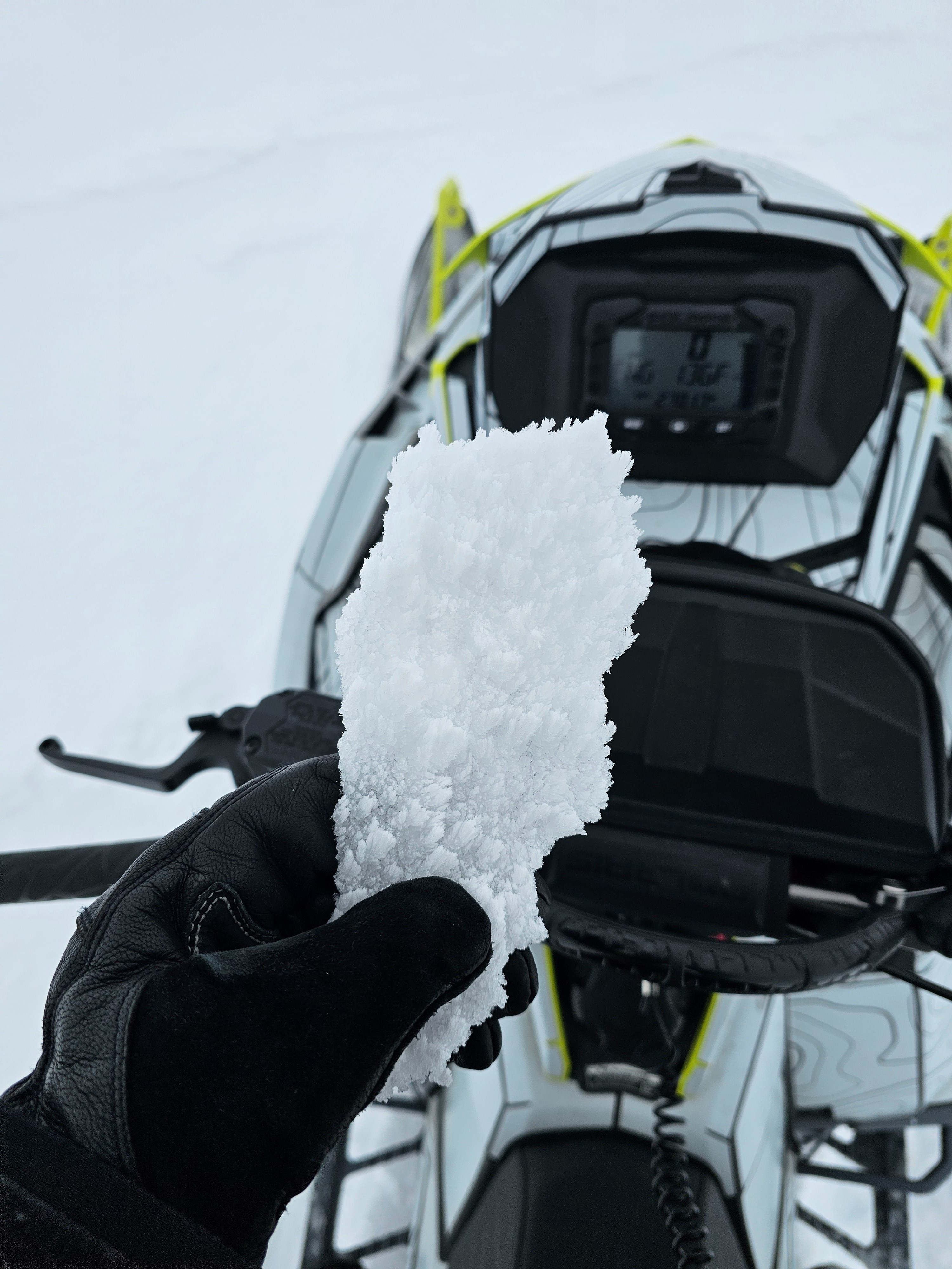
Unfortunately, the rain from yesterday (3/7) made it all the way up to the alpine and affected all aspects that we traveled on. It is a half centimeter thick and knife hard. Above 10,000' there is a rime crust on top of it.Snowmobile riding quality was okay, it would be bad on skis.
Despite sustained moderate winds up high there was minimal snow being transported due to the rain crust. There was sign off wind effect from the previous day.
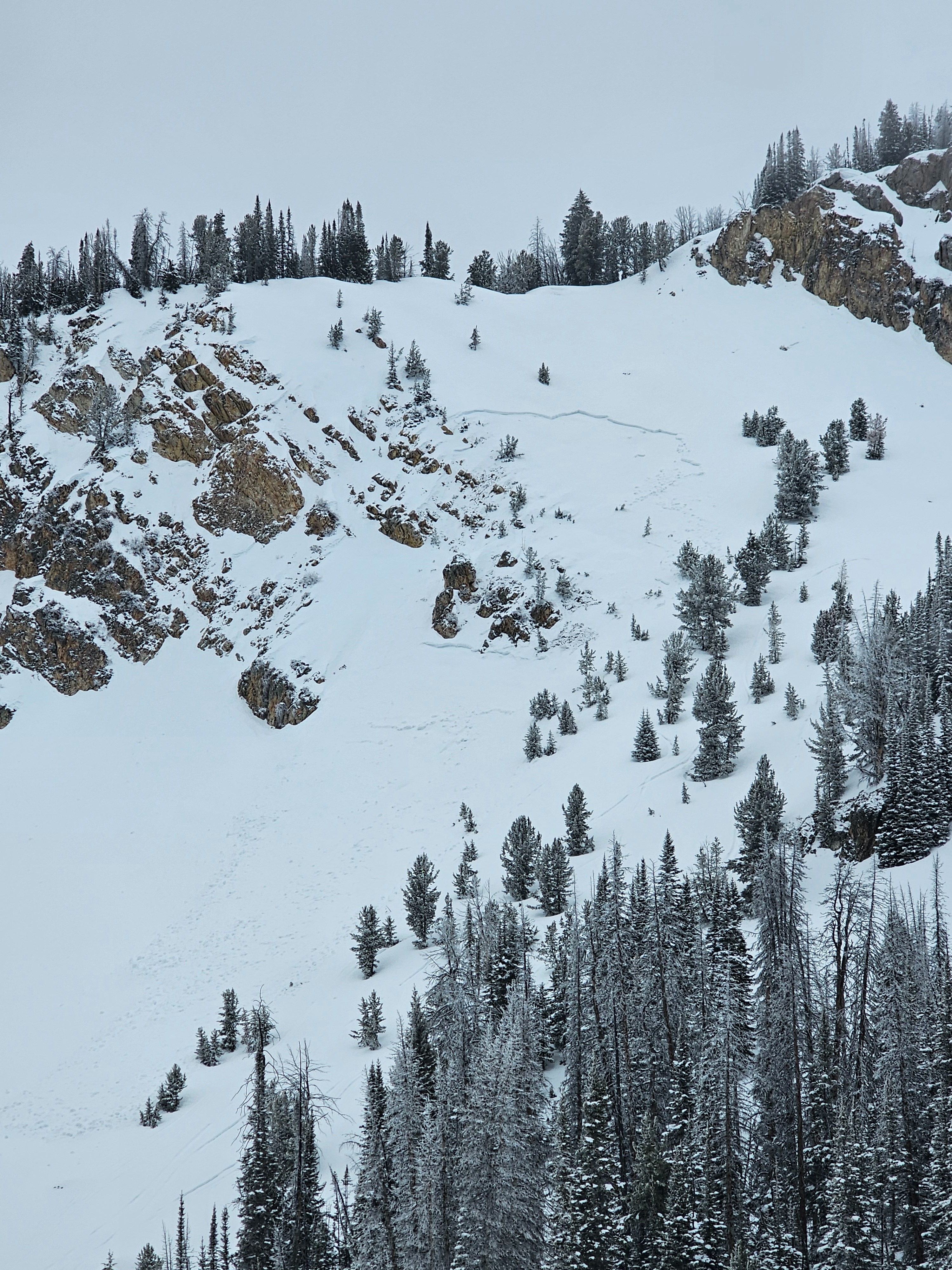
We did not see any signs of instability, but we did see an avalanche on an East aspect that looks to have been remotely triggered last week sometime. The JDL (January Drought Layer) is growing stronger and becoming more difficult to trigger in areas where it sits below a very stiff slab. However, poor structure still exists and it would just take finding a thin spot in the snow to trigger a dangerous avalanche.
Weather
- Air Temp
- 33 at the car
- Cloud Cover
- overcast
- Wind Loading
- none
- Rain Elevation
- Above 10,200'
- Snow Avail For Transport
- none
Overcast skies, cloud line was around 10,000'. Winds were moderate but not blowing much snow. Rime and rain crust on all aspects and up to our high point above 10,000'.
Snowpack
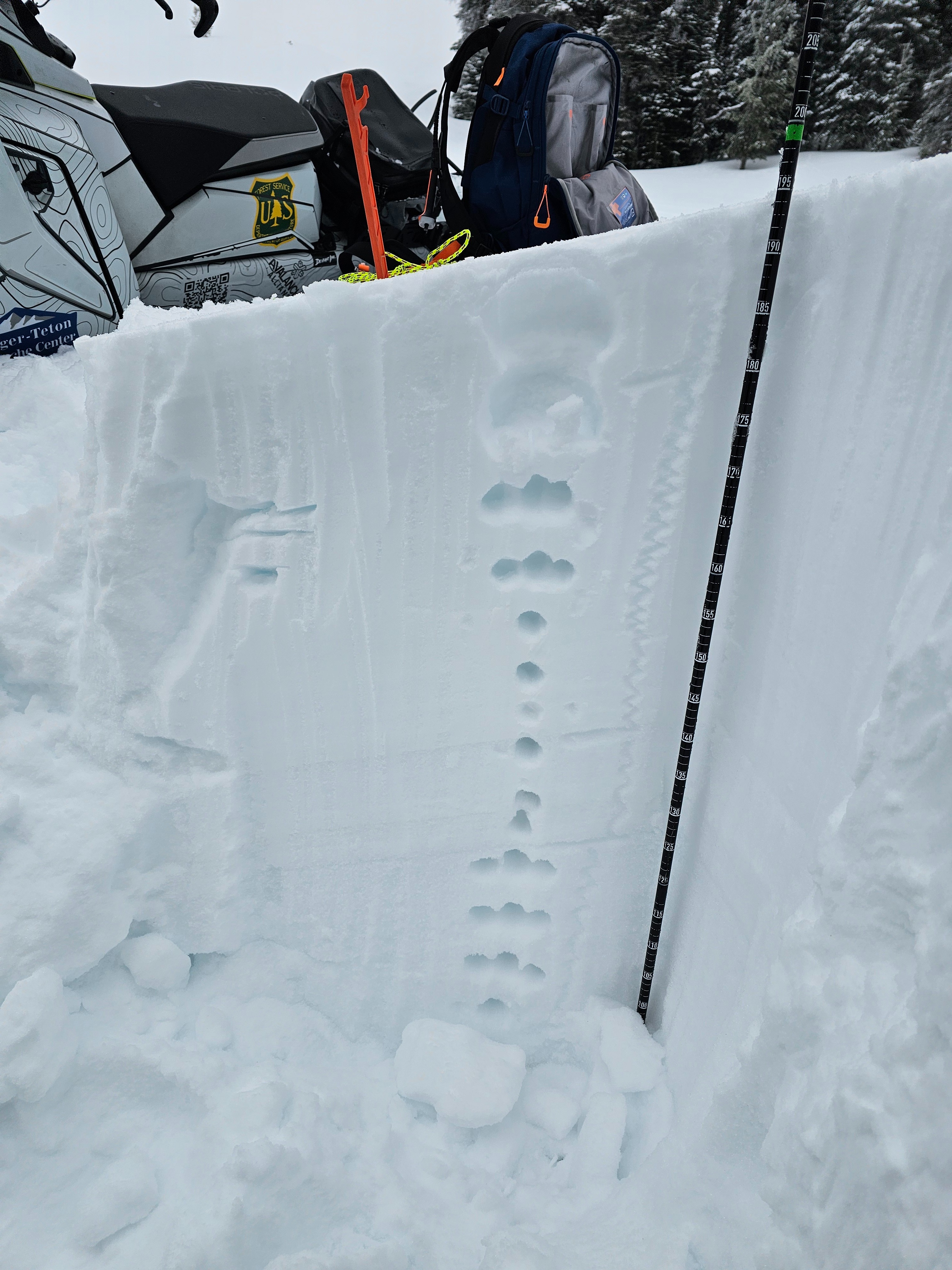
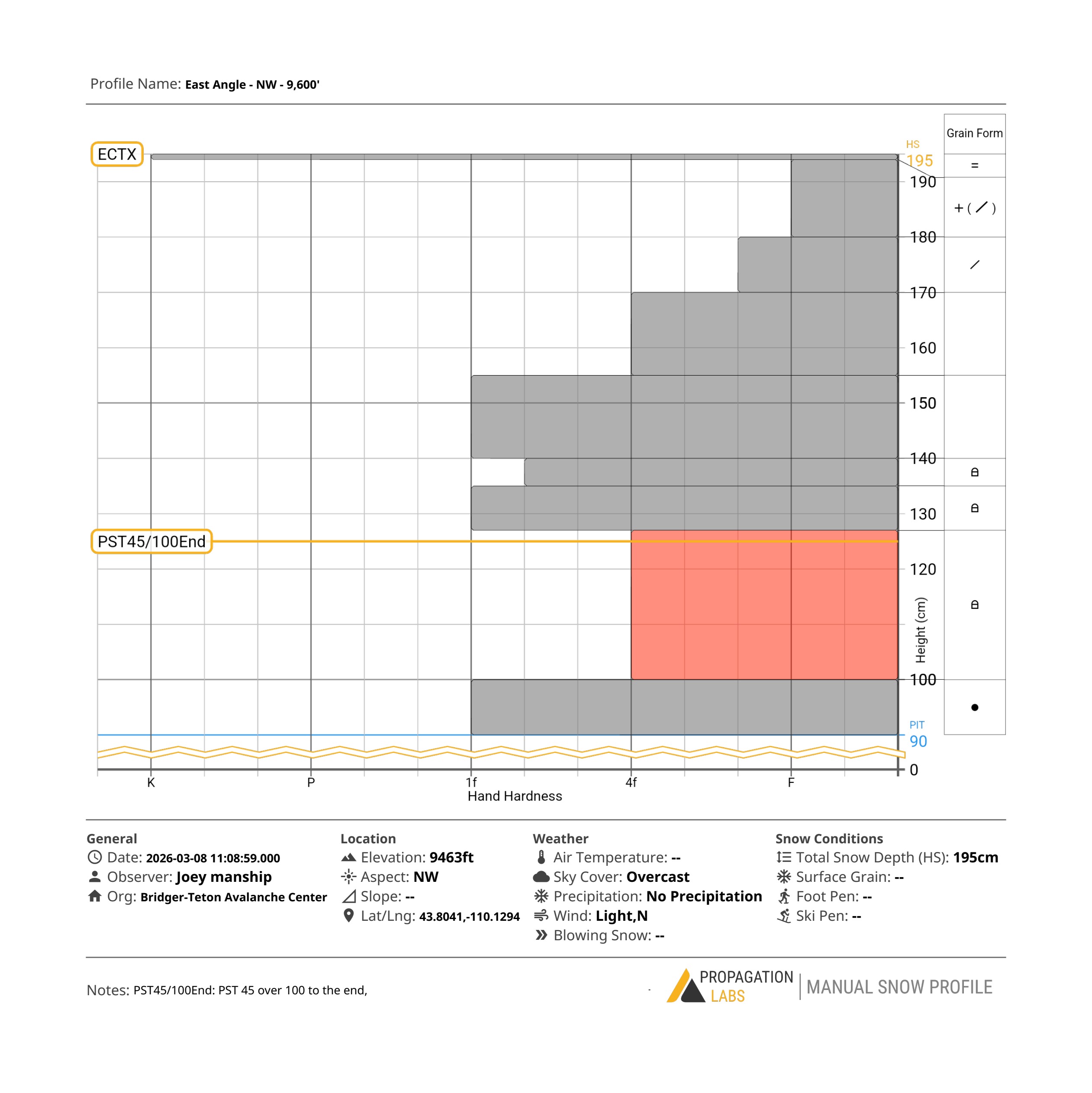
We dug on a NW aspect around 9,500'. In this location the height of snow as over 6 feet (195cm). The January Drought Layer was buried 2.5' (70cm) down below a stiff 1F hard slab. No propagation in an ECT and a PST 45/100 To End.
In this location the snopack is rather deep and relatively strong. Other locations where the slab is thinner this layer is still of concern. From where we dug, you could see an avalanche triggered within the last week that likely failed on this layer.
Avalanche
- Size
- D2 R1
- Type
- HS
- Aspect
- E
- Trigger
- AM
- Elevation
- 9800 ft
Avalanche looks to have been a week old. Remotely triggered from tracks near by. It started as a dry slab and looks to have picked up wet debris as it moved down.