
Weather
View on mapAnderson Mountain
Cam Mackenzie
Quick report
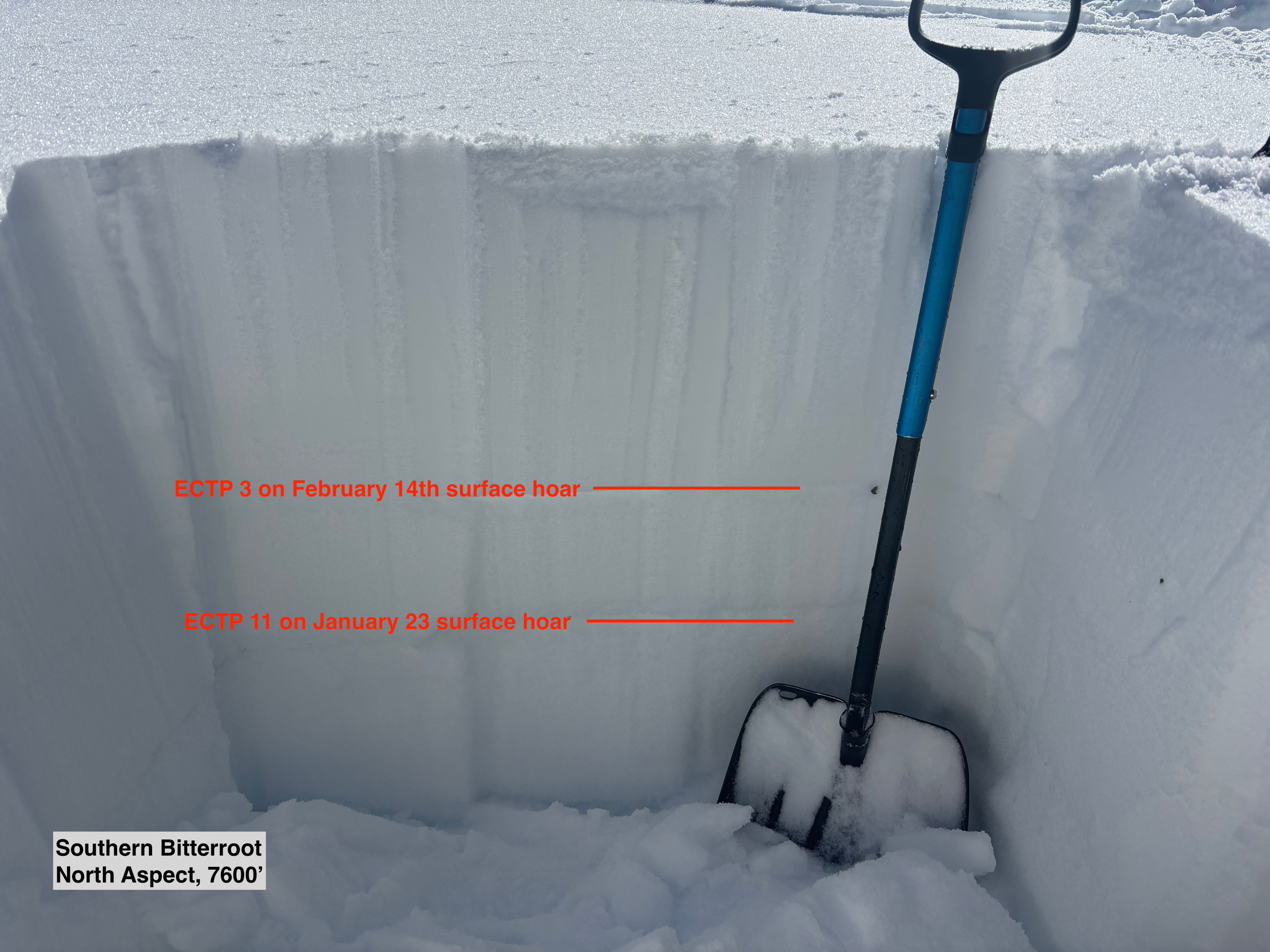
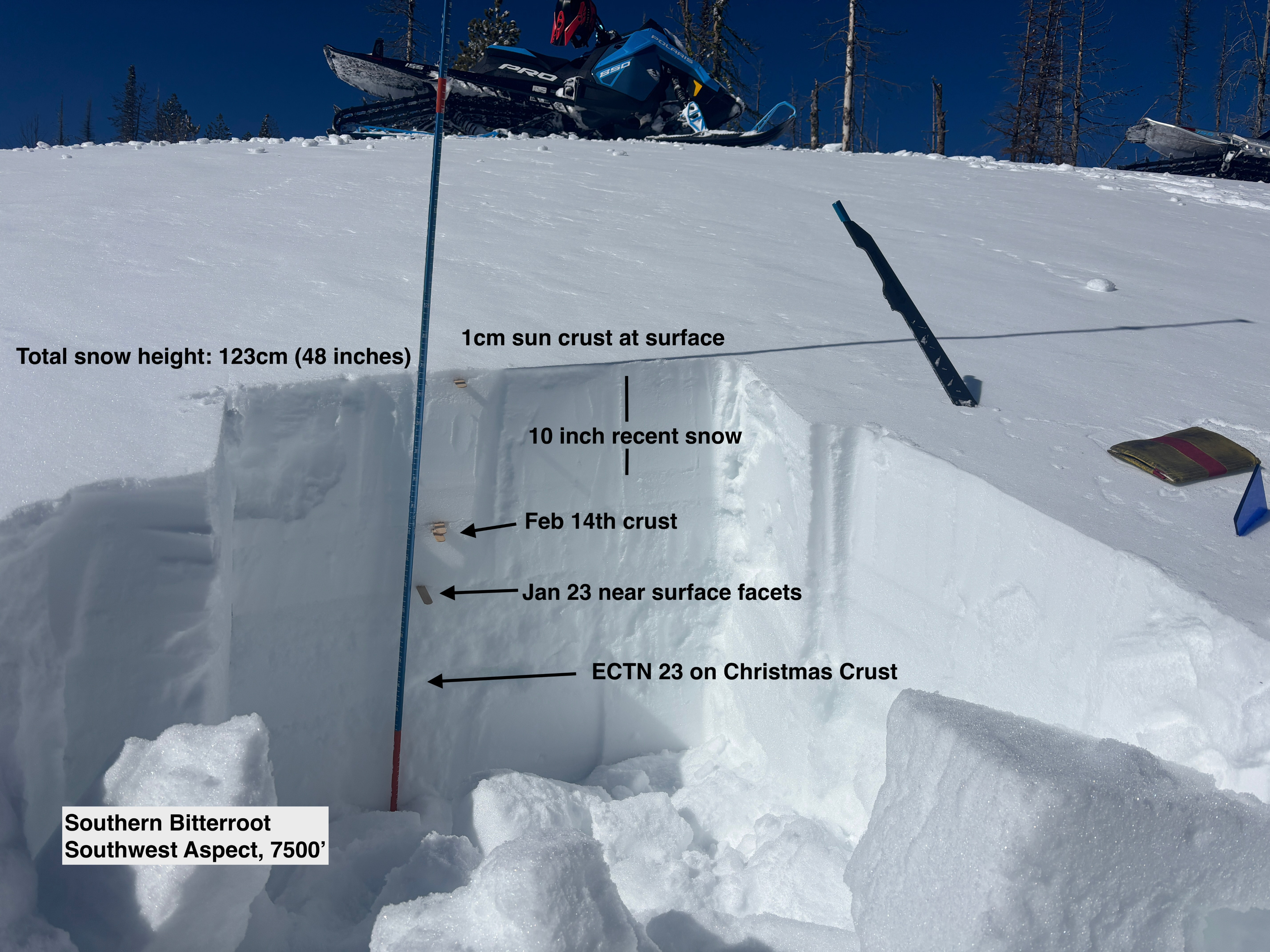
Today our target was persistent weak layers at mid elevation and into the lower portion of upper elevation bands. We found generally unreactive conditions except for on true north aspects with buried surface hoar. Some key takeaways from today...
- This area has a thinner snowpack than the rest of the Bitterroot, and at only 123cm (48 inches), we were still able to get non propagating snowpit test failures on December layers.
- All terrain shows signs of strong wind yesterday, but with a fresh sun crust at the surface, most wind transport has already occured and even steady wind isn't able to transport any snow that is now capped with a crust.
- Buried surface hoar is not everywhere, even at the same elevation/aspect but where you do find it, it pops out easily in snowpit tests and is alarmingly reactive.
- We could not get snowpit test results on buried crust/facet combinations on south aspects, but poor snowpack structure remains with facets surrounding crusts from Feb 14th and Jan 23rd.
- We are transitioning to a snowpack where you are unlikely to see cracking/collapsing/whumfing before triggering an avalanche.
On the drive out, we saw natural wet loose avalanches along road cuts. Tomorrow (Friday) I expect solar slopes to have a more stout crust at the surface that will take more time to break down before we see another wet loose cycle.
No signs of instability aside from reactive snowpit tests.Weather
- Air Temp
- Warm, low 30s but with strong sun felt closer to 40
- Cloud Cover
- few
- Wind Loading
- light
- Recent Snowfall
- 10 inches from last storm
- Snow Avail For Transport
- small smounts
Warm day with strong sun. Steady moderate winds out of the west.