
Quick report
- Cracking
- specific
Widespread storm snow avalanching in the new snow during periods of high precip rate. By 1400, the new snow had settled into a storm slab and was beginning to act more of a slab and less dry loose.
Weather
- Air Temp
- 20
- Cloud Cover
- obscured
- Wind Loading
- moderate
- Rain Elevation
- n/app
- Recent Snowfall
- 30-50cm
- Snow Avail For Transport
- large amounts
Today felt like skiing through a snowglobe. Precipitation rates peaked in the morning with a sustained 3+ inches per hour for 2 hours (9 inches in 2.5 hours). Winds were primarily isolated to exposed terrain at upper elevations but there were short periods of wind effect at mid elevation.
Snowpack
I would estimate new snow to be 18 inches in most areas at upper elevation and 12 inches at mid-elevation.
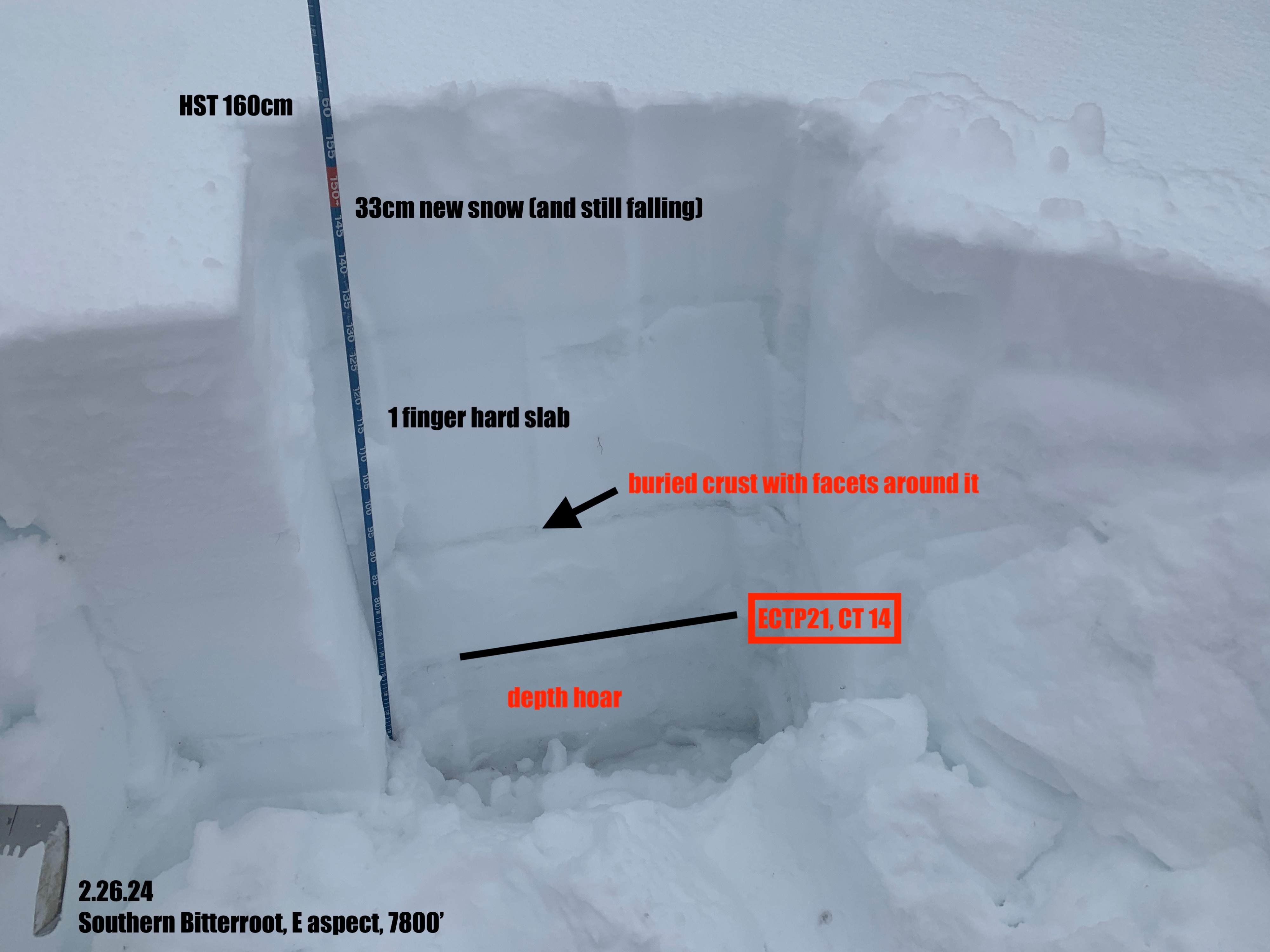
I dug one full depth pit in sheltered terrain on an east aspect at 7800' to assess conditions in areas without wind loading. I was surprised by how weak the snow near the ground is, with stability tests failing on depth hoar near the ground. The mid snowpack melt-freeze crust was present with facets above and below as well.
The rapid loading of the high precip rates definitely stressed the persistent weak layers and made them reactive in snowpit tests. Visibility was poor so I did not get good eyes into larger avalanche terrain, but I suspect a more widespread natural slab cycle occurred today, especially in wind loaded areas.