
Quick report
- Cracking
- isolated
- Collapsing
- isolated
We toured various aspects of Mail Cabin to check out some upper snowpack interfaces and storm snow (and all the wind). The weakest interface I observed was around 40cm deep, an interface buried 3/19 during a brief day of low-density snowfall followed by clear skies. This created a crust/facet combo on southerlies and a near-surface facet/buried stellar interface above 8,500'. This layer propagated yesterday for me (ECTP12) on an upper-elevation NE aspect ~9500' and was around 1.5 feet deep. This was the layer of concern where we traveled today, as well as mid-storm crystal changes. Deeper crusts and NSF layers (buried 3/13) appeared unreactive, but there are likely spots where this layer remains more deeply buried and reactive. I would be more concerned about deeper instabilities if we had traveled into more exposed terrain.
Spring is a transitional and spatially disparate time; widespread instabilities and natural avalanches oftentimes don't present themselves in an easy-to-read pattern as a backcountry traveler. Spring storms can also be quite rapid and transition to warm temperatures and clear skies quickly, and temperature fluxes can change surface slab properties to be more or less reactive quickly. What I found today matched a storm slab pattern in that even sheltered terrain was starting to become slabby by the end of the day. What IS a storm slab, you ask? Well:
•Slab layers (denser) = small crystals, needles and columns, rimed crystals (but not graupel)
•Weak layers (low density and graupel) = larger crystals, stellars, dendrites and plates with little to no riming, and graupel
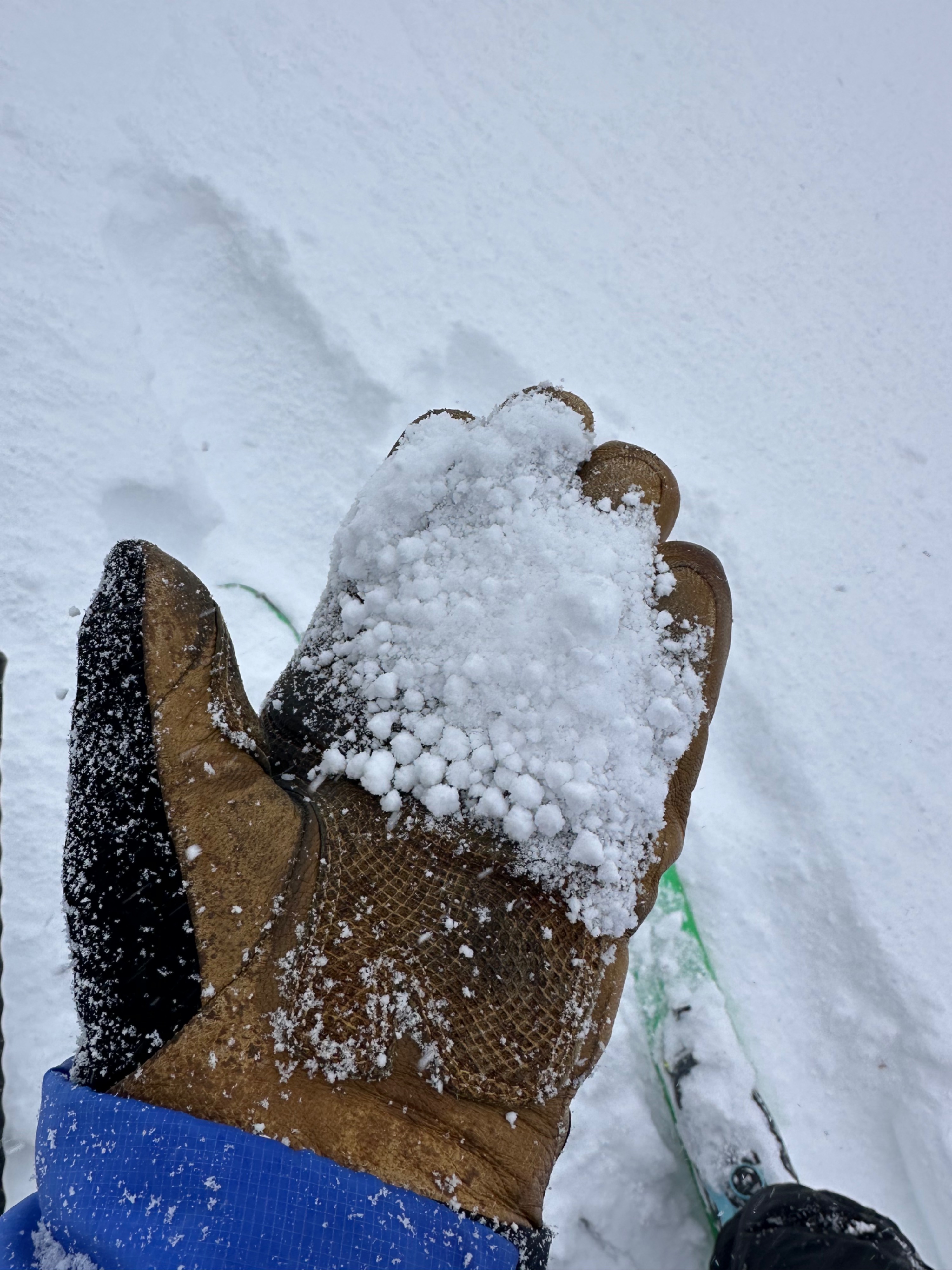
This storm terminated in some awesome large graupel (see attached), but most of the slab is composed of rimed crystals atop larger crystals with less riming. The type of snowfall depends on cloud temps—not surface air temps. High-density snow can fall at low temperatures, and low-density snow can fall at high temperatures. Overall, the amount of riming (i.e., high humidity conditions when snow crystal shapes become obscured by additional moisture clinging and freezing to the original crystal, usually accompanied by high winds) adds complexity, making for a solid slab if falling on weaker crystals, and especially with the addition of wind compaction with intense winds. Overall things to watch moving forward: wind-loaded slopes with new snow and most low, mid, and upper-elevation slopes with the warm-up arriving later this week.
Weather
- Air Temp
- 25
- Cloud Cover
- broken
- Wind Loading
- intense
- Recent Snowfall
- 10-15
- Snow Avail For Transport
- small smounts