
Quick report
- Cracking
- isolated
- Collapsing
- isolated
Despite healthy storm totals of two feet in the alpine, the snowpack appeared to behave reasonably well, even on northerly aspects with old snow coverage. Natural avalanche activity, signs of instability, and snowpit results weren't too spooky, but enough to warrant caution on some alpine slopes. It's still combat skiing through thin coverage BTL with no avy concerns.
Isolated cracking near ridgeline in obvious wind drifts about a foot deep involving just yesterday's low-density drifted snow. A few localized collapses on NE facing slopes NTL, seemingly at the storm interface, that didn't radiate far.Weather
- Cloud Cover
- few
- Wind Loading
- previous
- Recent Snowfall
- 50
- Snow Avail For Transport
- moderate amounts
Snowpack
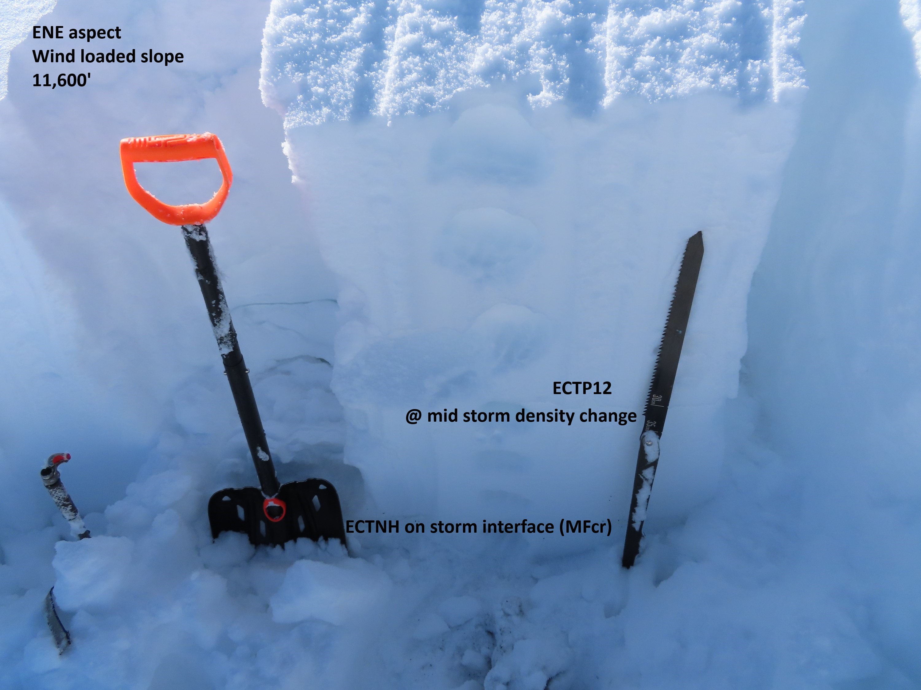
Settled storm totals were about 18" in windsheltered terrain at 11k, and increased towards 2' in the alpine with significant wind redistribution. A few quick tests above 11.5k targeting the storm interface produced non-propagating results (both where the layer was a melt-freeze crust (ENE) and facets (N)). We probed at some impressively thick drifts up to 5 feet deep guarding the entrance to north-facing terrain, but didn't feel comfortable testing or ski cutting them. Those types of features are what I'm most cautious of.
Avalanche
- Size
- D1 R1
- Type
- SS
- Count
- 3
- Aspect
- E
- Trigger
- N
- Elevation
- 11400 ft
Good visibility of a lot of terrain. Some evidence of small slides early in the storm, but I didn't see any distinct crowns at the storm interface like we saw earlier on Whetstone. The most recent avalanche activity was all thin wind slabs that ran during the westerly wind event yesterday and overnight, all D1s on easterly aspects N/ATL. Stability tests continued highlighting this failure layer (ECTP), up to 45 cm deep.