
Quick report
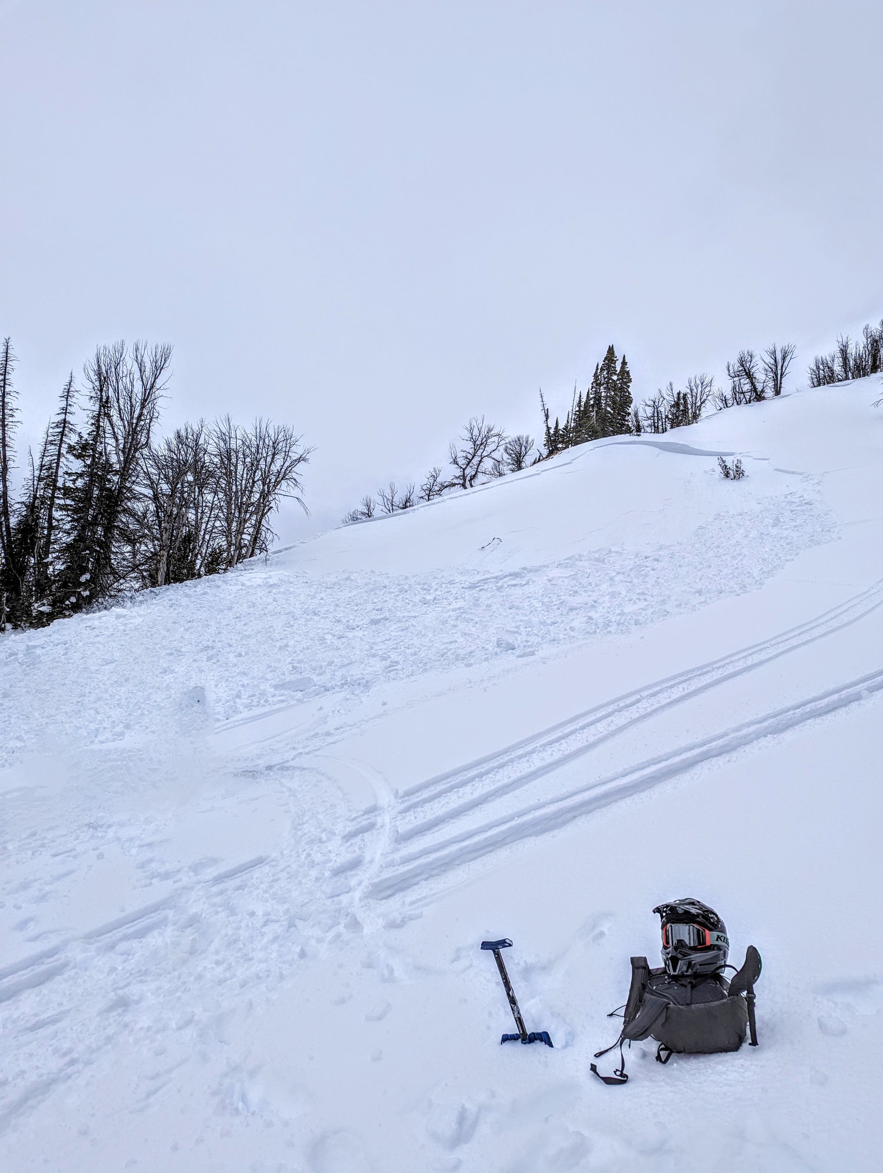
We snowmachined back to Grouse Mountain for some weather station maintenance and skied up the northeast ridge to access the station. Along the ride in we observed multiple avalanches that most likely slid over a week ago during the loading event and associated high winds. Many of these avalanches were small D1 located in steep wind-affected terrain at upper elevations and on multiple aspects.
Of note, on the skin up the northeast ridge, there were multiple avalanches including a very large D3 on the north side of Grouse that connected several smaller gullies and ran full track. It appeared to include almost all available avalanche terrain (R4) and we saw several sizeable trees in the debris pile at the bottom. This most likely failed in wind-affected terrain but included snow down to deep weak layers at the bottom of the snowpack. On the southwest aspect of the same ridge, several D1-D2 avalanches were observed in simlar steep wind-loaded terrain. The ridge itself had a double cornice, indicating multiple wind directions. This confirms the persistent slab and wind slab spatial distribution on multiple aspects due to shifting winds.
While the snowpack is slowly adjusting to the load from early in the month, it remains possible to find this problem and with a refresh of snow on the way, more patience is warranted while we give this weak structure on Togwotee more time.
Weather
- Cloud Cover
- overcast
Avalanche
- Size
- D3 R4
- Type
- HS
- Count
- 3
- Aspect
- N
- Trigger
- N
- Elevation
- 10300 ft
A very large avalanche on the north face of Grouse Mountain. The avalanche failed on faceted snow near the ground. The average crown thickness was 3.5-4 feet. The avalanche ran 2700' horizontally and 900' vertically to the bottom of the path. Nearly all of the terrain that could have slid did (R4). Many broken trees were visible in the debris pile. Average slope angle in the start zone was 38-40 degrees.