
Quick report
- Collapsing
- widespread
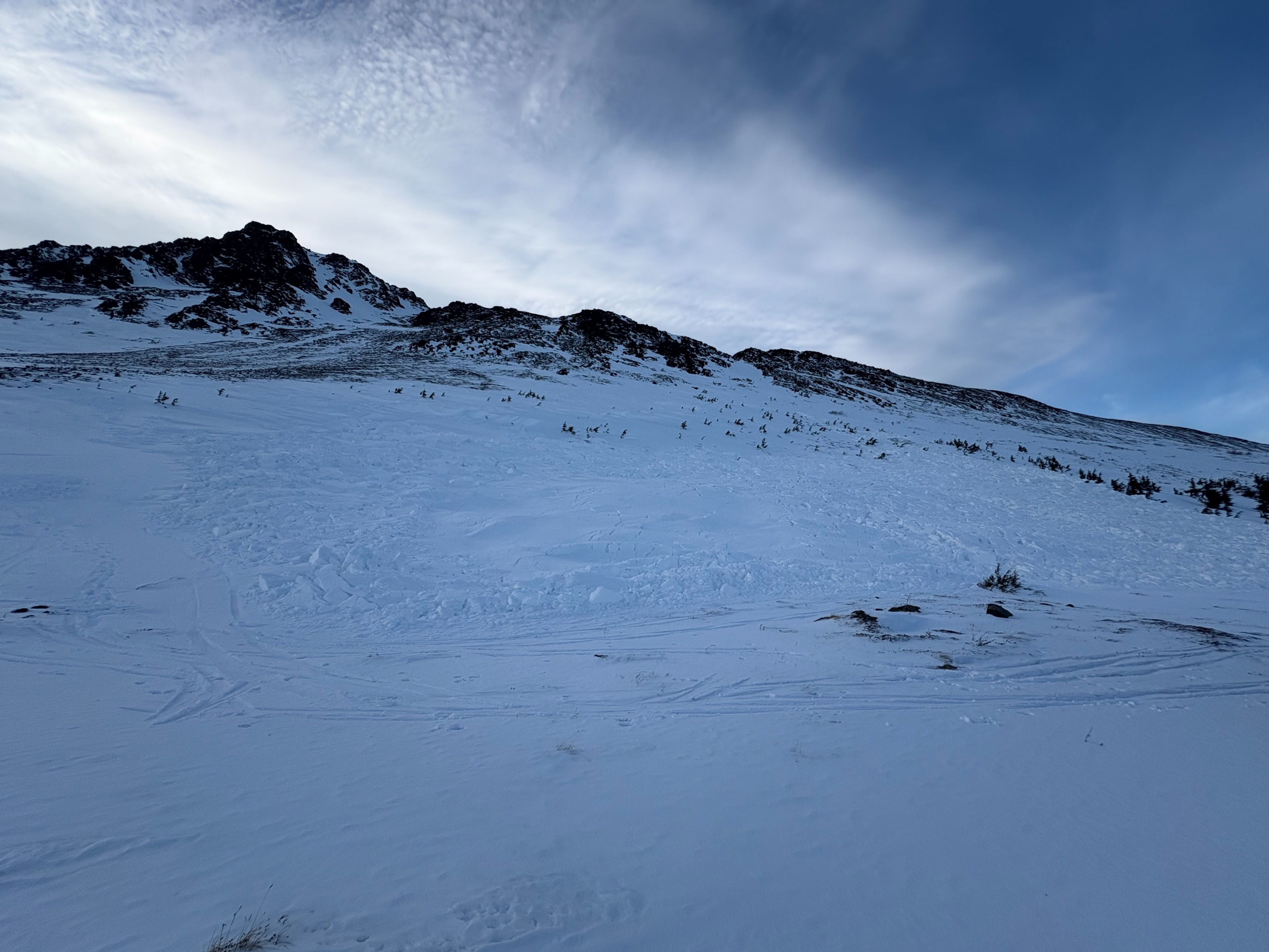
Our objective for the day was to assess the recent remote-triggered avalanche from 1/17 (see attached avalanche) and continue along the Powerline Trail to look for evidence of additional recent avalanche activity. We determined that this avalanche failed on facets below the late-November melt-freeze crust. Portions of the crown were partially filled in by wind-deposited snow; however, we estimated crown depths ranging from 2–4 ft.
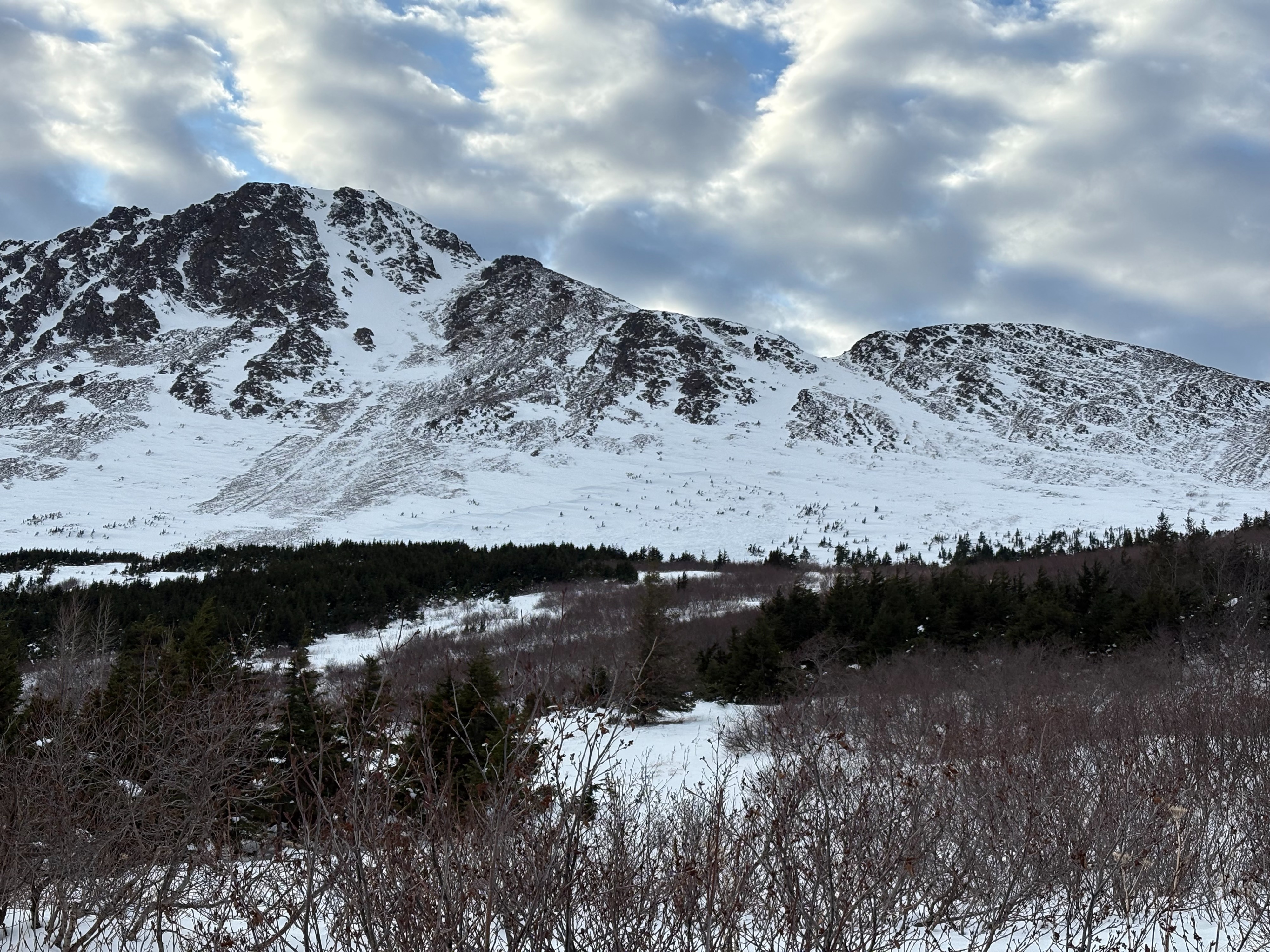
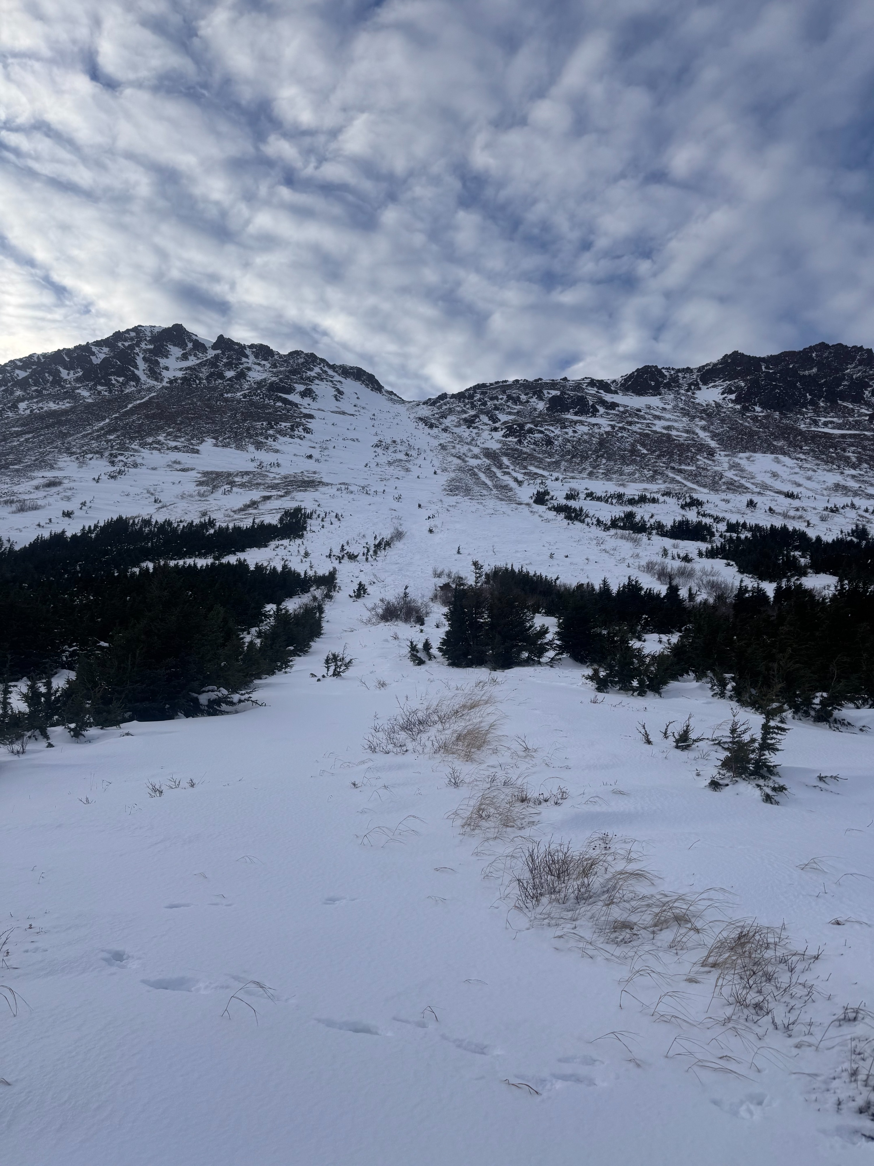
After skinning down through the alders to the Powerline Trail, we continued back into the valley and observed avalanche debris in a north-facing chute off Peak 2. The debris was covered by wind-deposited snow and the crown was not visible. This avalanche likely occurred naturally last weekend or early this week.
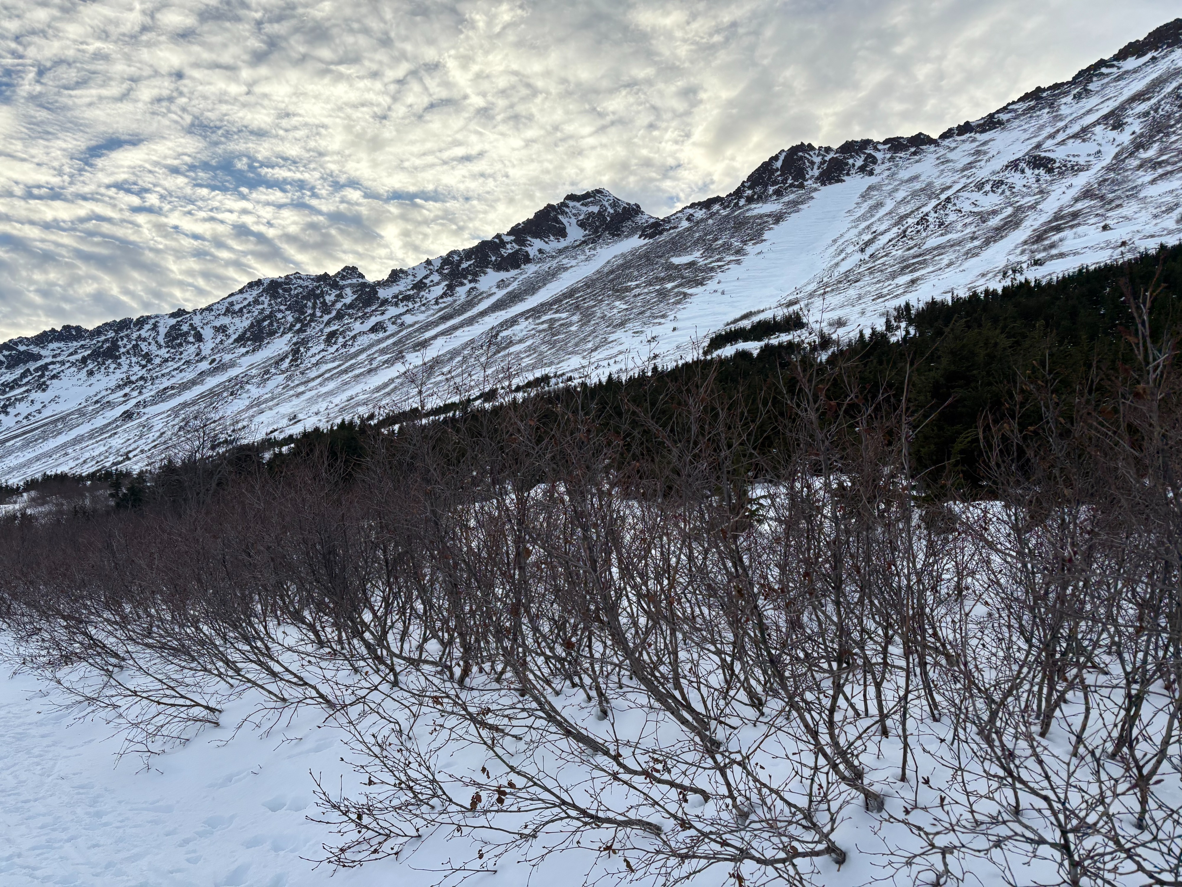
Despite appearance of thin snow in the Chugach State Park, most of the snow has been blown into specific areas and those specific wind-loaded areas can still produce large avalanches, like the ones we observed today.
We expereinced whumpfs, whenever we travelled off the established skin track.Weather
- Air Temp
- 28
- Cloud Cover
- scattered
- Wind Loading
- previous
- Rain Elevation
- not observed
- Snow Avail For Transport
- small smounts
Calm winds and scattered clouds provided excellent visibility with expansive views of the Alaska Range and beyond.
Snowpack
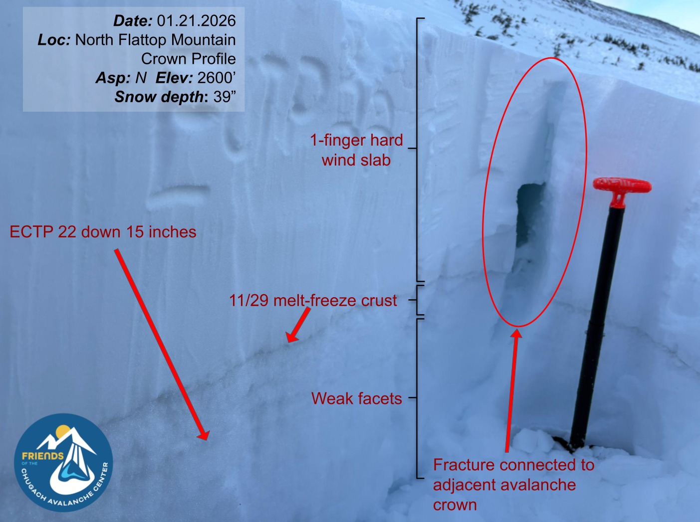
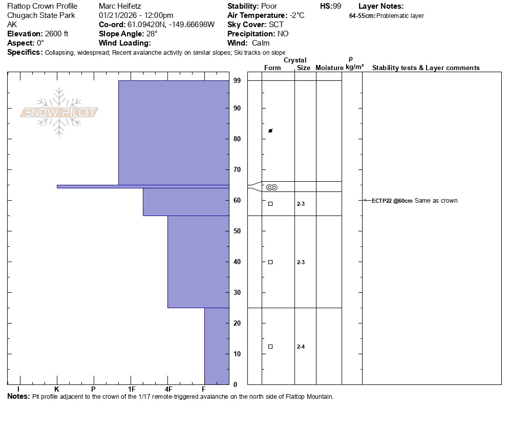
We completed a crown profile at the site of the remote-triggered avalanche reported on 1/17 and determined the failure occurred on facets below the 11/29 melt-freeze crust. In the portion of the crown we could safely access, the failure was approximately 15 inches deep. In more heavily wind-loaded sections of the crown, the failure depth was observed to be as deep as 4 ft.
Adjacent to the crown, at 2600 ft, we completed an Extended Column Test and observed unstable results on this same layer the avalanche occured on (ECTP22 down 15 inches). Our snowpit was located on the shallower side of the crown, where total snow depth measured 39 inches. In other nearby areas, total snow depth was significantly greater, likely explaining the wide variation in observed crown depths.
The weak faceted layer responsible for this avalanche can be found anywhere from just a few inches below the surface to several feet deep in areas that receive more wind-deposited snow. Although the Chugach State Park appears to have a thin snowpack, the wind has funneled the snow into gullies and high alpine bowl and areas that have lots of wind deposited snow can produce very large avalanches.
Avalanche
- Size
- D2.5 R3
- Type
- HS
- Aspect
- NE
- Trigger
- AS
- Elevation
- 2700 ft
Report from 1/17 indicates this was remotely triggered from the flats 100m away; see that observation for details and photos just after the avalanche occurred. Estimated width of 300' and vertical fall of 200', with a crown depth ranging from 2-4' (deeper than we anticipated!).