
Quick report
- Aspect
- Northeast
- Red Flags
- Poor Snowpack Structure
- Elevation
- 3231 m
- Slope Angle
- 28°
- Red Flags Comment
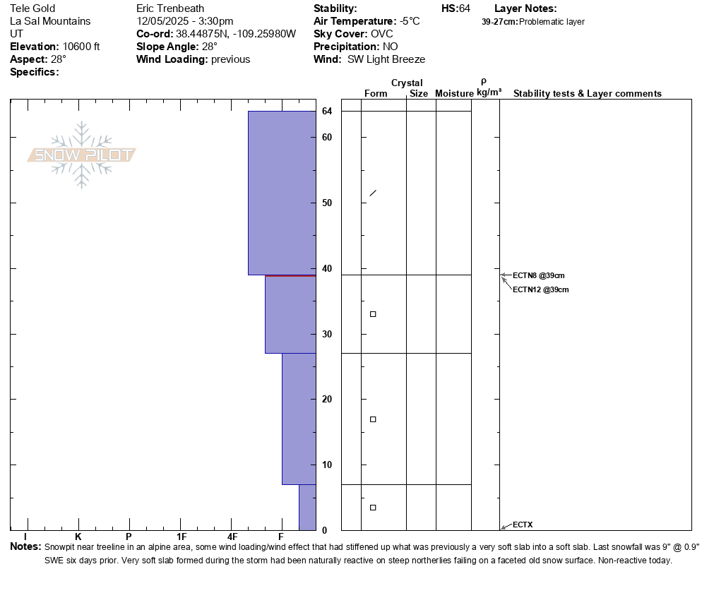
- <p>The snowpack structure isn't great but not particularly alarming at the moment. Mid November snow is faceting and the 9" of snow we received on November 30 has formed a slightly denser, albeit very soft slab on top. This slab was initially reactive during the height of the storm with many shallow avalanches failing primarily at the old faceted surface, but with at least one R2 D2 avalanche failing at the ground. In my travels today I observed other shallow avalanches that had failed during the storm as well. I dug a pit near tree line in a wind exposed area and found a slightly stiffer slab. Extended column tests produced scores of ECTN8 and ECTN12 at the old faceted surface as well as an ECTX. It's my feeling that any problem to be found at this point will be primarily on northerly aspects above tree line where wind slabs exist over top of faceted snow. It's worth noting that weak snow currently exists on most aspects and the trend looks like it will become weaker before we get more snow. </p>
It's still thin out there. Depths range from 18"-24" with favored areas holding up to 30".
Snowpack
- Instability Comment
- <p>As outlined above, the underlying snowpack is faceted and weak with a slightly denser slab on top. This did produce avalanches during the height of the storm last weekend but instability seems to have run it's course. With the upcoming weather forecast, the overriding slab is more likely to become weaker, not denser, and the avalanche danger will continue to decrease until our next storm. </p>
9" of storm snow from last Sunday still holding up pretty well. Powder remains abundant but low snow conditions prohibit unbridled enjoyment.