
Quick report
- Aspect
- South
- Red Flags
- Recent Avalanches, Heavy Snowfall, Wind Loading, Collapsing
- Elevation
- 3170 m
- Slope Angle
- 31°
- Red Flags Comment
- <p>Triggered an avalanche on Northeast facing at 10500ft in upper Cardiff Fork of BCC. (see avalanche list). A dozen or so collapses experienced in low angle north facing terrain. Wind was blowing hard enough to transport snow and it was snowing hard enough at times to increase the avalanche hazard.</p>
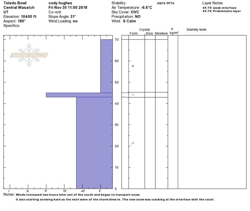
I wanted to see how south was looking and to confirm why I believed it was safe to ski. There was some cracking where the new snow was slowly bonding to the sun crust. With new snow and winds overnight this could be a bit more sensitive tomorrow.
Snowpack
- Instability Comment
- <p>The avalanche we triggered was in a thin rocky area and failed on facets at the ground. With continued wind and snow overnight the faceted layers on the ground will continue to be stressed and extra sensitive to the weight of a skier or rider.</p> <p>I was experiencing cracking on south facing slopes within the top foot of the new snow we have received since Nov. 28th. With NW winds forecasted and more snowfall overnight I expect the interface between the new/old snow to be sensitive. Wind slabs will be on high alert tomorrow with the potential shift in wind.</p>
Powder snow on all aspects.