
Quick report
New snow instabilities are present in the upper snowpack from the storm earlier this week. In this location with 1 to 2 feet of new snow, the storm snow is consolidating and will likely gain strength with mild spring weather.
Weather
- Cloud Cover
- broken
- Wind Loading
- previous
- Snow Avail For Transport
- moderate amounts
Intermittent cloud cover with sun in between. Ridgetop winds were moderate from the west.
Snowpack
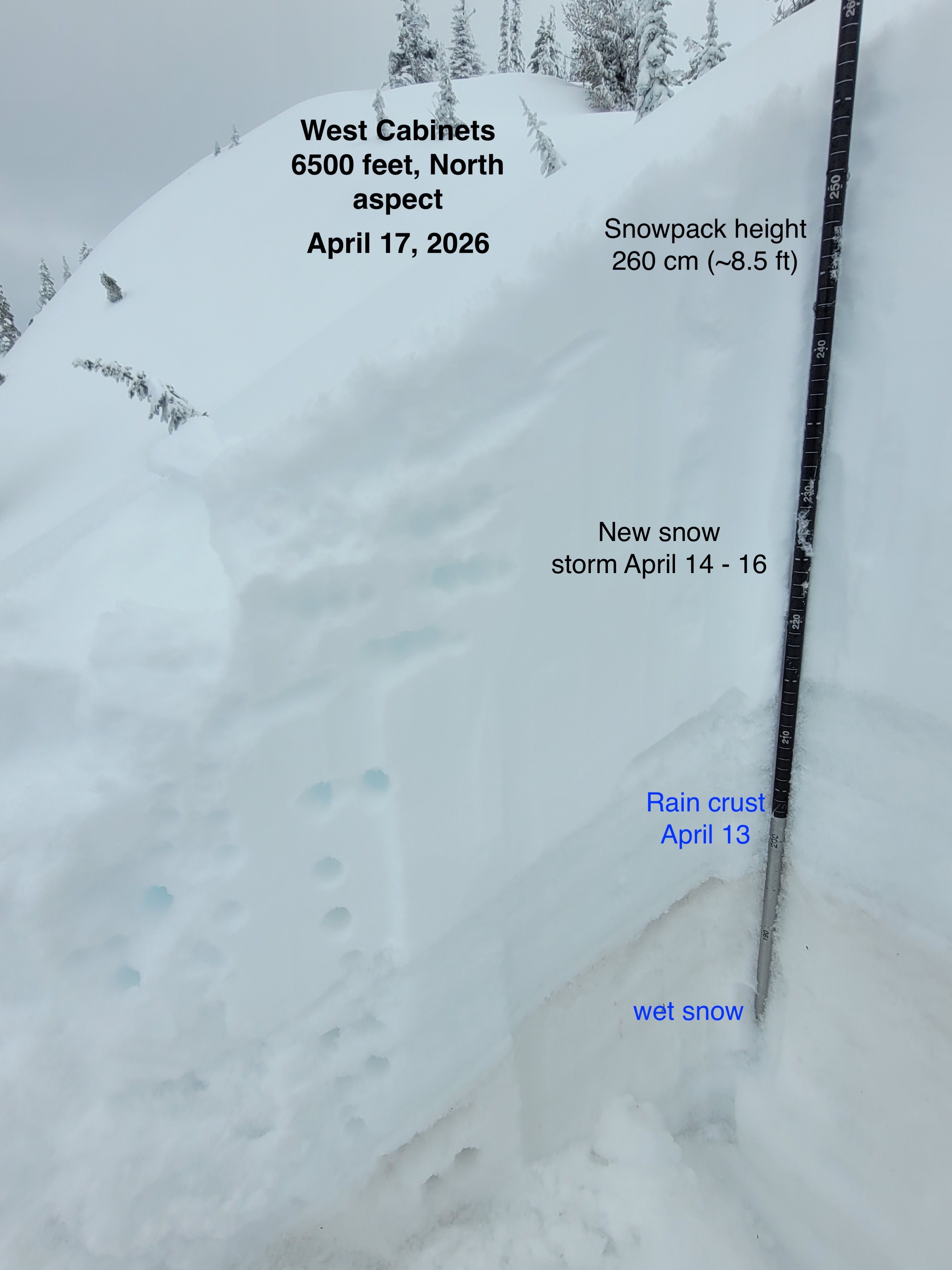
Intermittent sun throughout the day warmed and moistened snow surfaces on southerly facing slopes but not enough to cause wet loose concerns today. At the camera plot site near 6000 feet there was 24 cm of consolidated storm snow on top of a rain crust. Traveling up to 6500 feet, snowpack height was 260 cm on a North aspect. In the upper snowpack, the top 5 cm surface snow was slightly inverted hardness, but the overall storm snow was 4F to 1F hard and right side-up hardness. Test results showed easy force CT PC and ECTN results down 10cm from the surface. A mid-storm and beginning of storm interface, down 25 and 49 cm respectively (1cm above crust), showed moderate to hard force CT RP results. The 50 cm of recent snow is on top of a Pencil hard,15 cm thick, rain crust. Below this crust is 1F- wet unconsolidated melt forms.
Avalanche
none observed