
Quick report
- Aspect
- Southwest
- Red Flags
- Heavy Snowfall, Wind Loading, Poor Snowpack Structure
- Elevation
- 2743 m
We started our tour from Spruces under cloudy (OVC) skies, temperatures in the mid-20s, light westerly winds, and snow. Snowfall rates were generally between 0.5" to 1" (1-2.5 cm) an hour (S2) throughout the day. The weather remained consistent throughout our tour, with the occasional light easterly wind. There was some wind transport occurring along exposed ridgelines; however, winds were relatively light compared with previous storms.
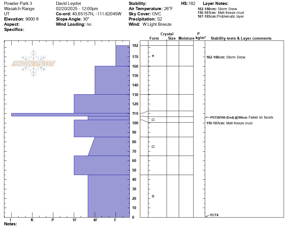
Hand shear tests on southwest, west, and northwest aspects at mid-elevations had moderate or hard results (Hand-Moderate/Hard). This indicates that the new snow is setting up well. We dug a couple of test pits - one on a south aspect and another on a west-southwest aspect (the snow profile for the WSW pit is included in this observation). The height of snow (HS) was 182 cm. There were weak, faceted, layers present at approximately 107-103 cm, 85-65 cm, and 45-0 cm. Our extended column tests yielded no result (ECTX), however our propagation saw test indicated instability (PST 30/100, END) in the facets below the melt freeze crust at approximately 106 cm.
Our observations are in line with the UAC's forecast. We found three of the four weak layers listed from today's forecast - the November/December facets, late January facets, and the "Facet/crust combos on solar slopes, now extending into low- and mid-elevation SE-facing terrain." The facet/crust combo was the most problematic layer in our pits.
The new snow provided great skiing in this zone! Enjoy!