
Quick report
- Cracking
- isolated
We toured above the summit to check out the snowpack on slopes on both the south and north halves of the compass.
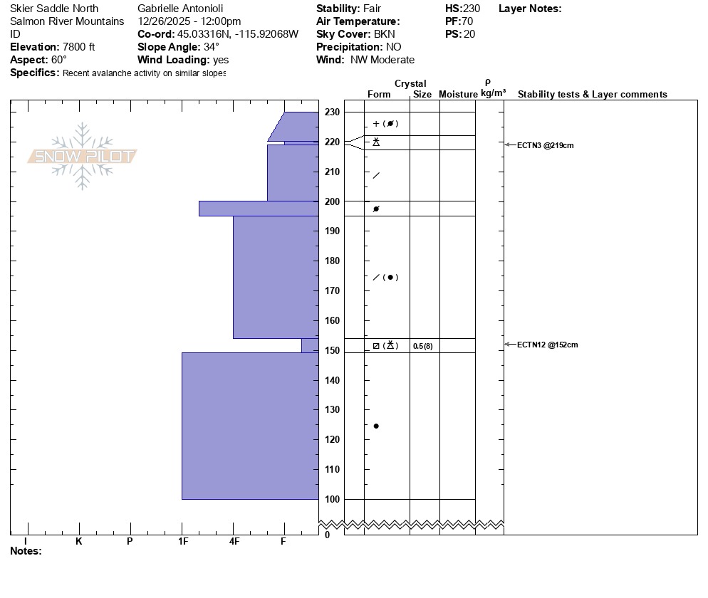
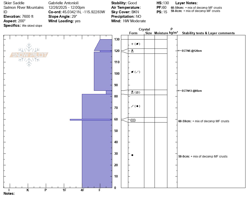
I found an average snowpack depth of around 130 cm (over 4 feet) on W/SW aspects above 7,000 feet, and a snowpack depth of around 230 cm (nearly double that, 7.5 feet deep) on E/NE aspects. Why does this matter, you ask? It matters from two perspectives:
- A) You're most likely to encounter areas of unstable new snow where that new snow is stacked deepest and transported by the wind (on upper-elevation E aspects, ranging NE-E-SE) and
- B) Any deeper, preserved weak snow layers buried deeper in the snowpack are most likely where the snowpack is deepest—above any previous rain lines, where old snow has hung out the longest, and where a more layered and less consolidated snowpack exists (NE-N-NW).
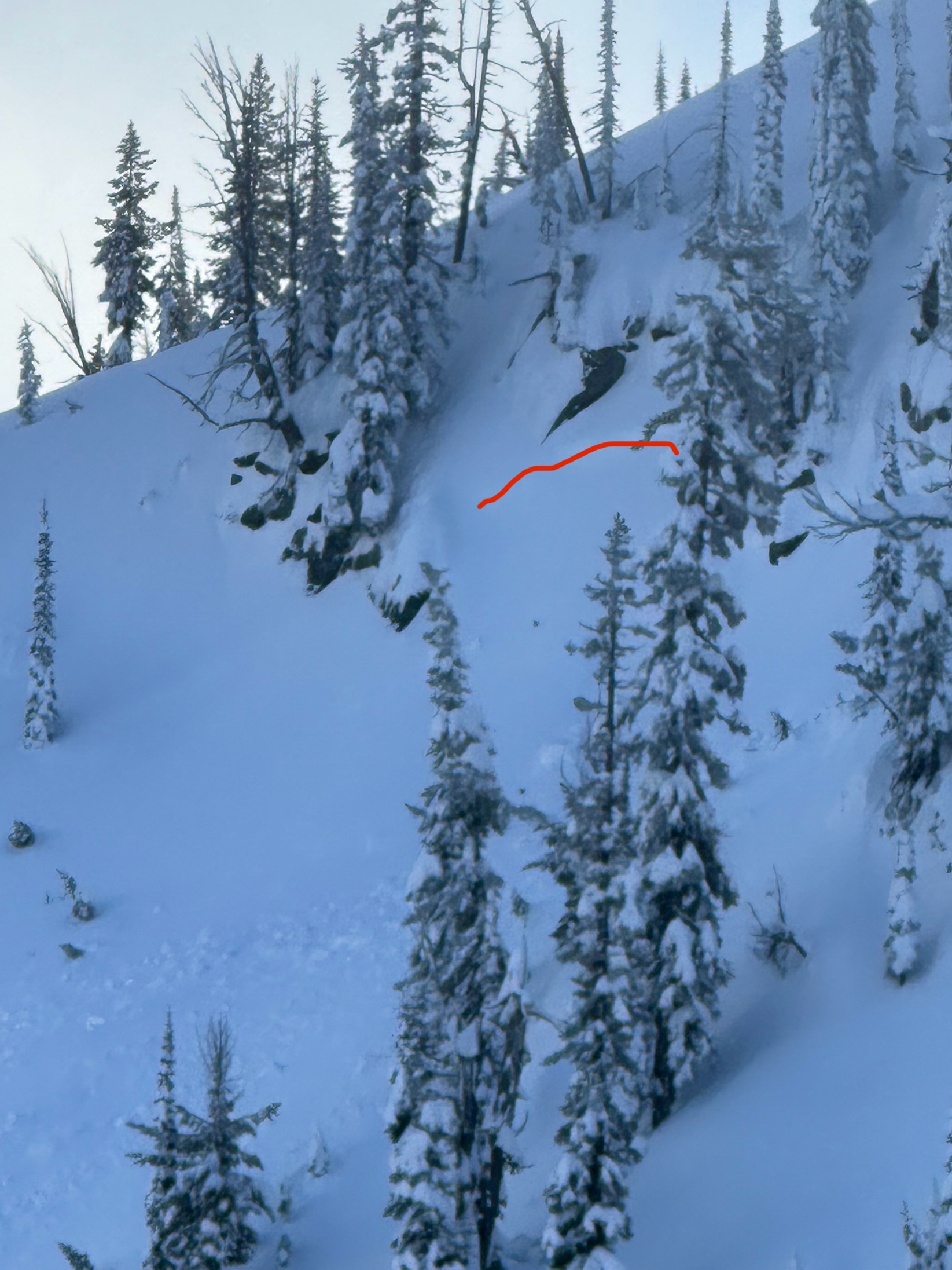
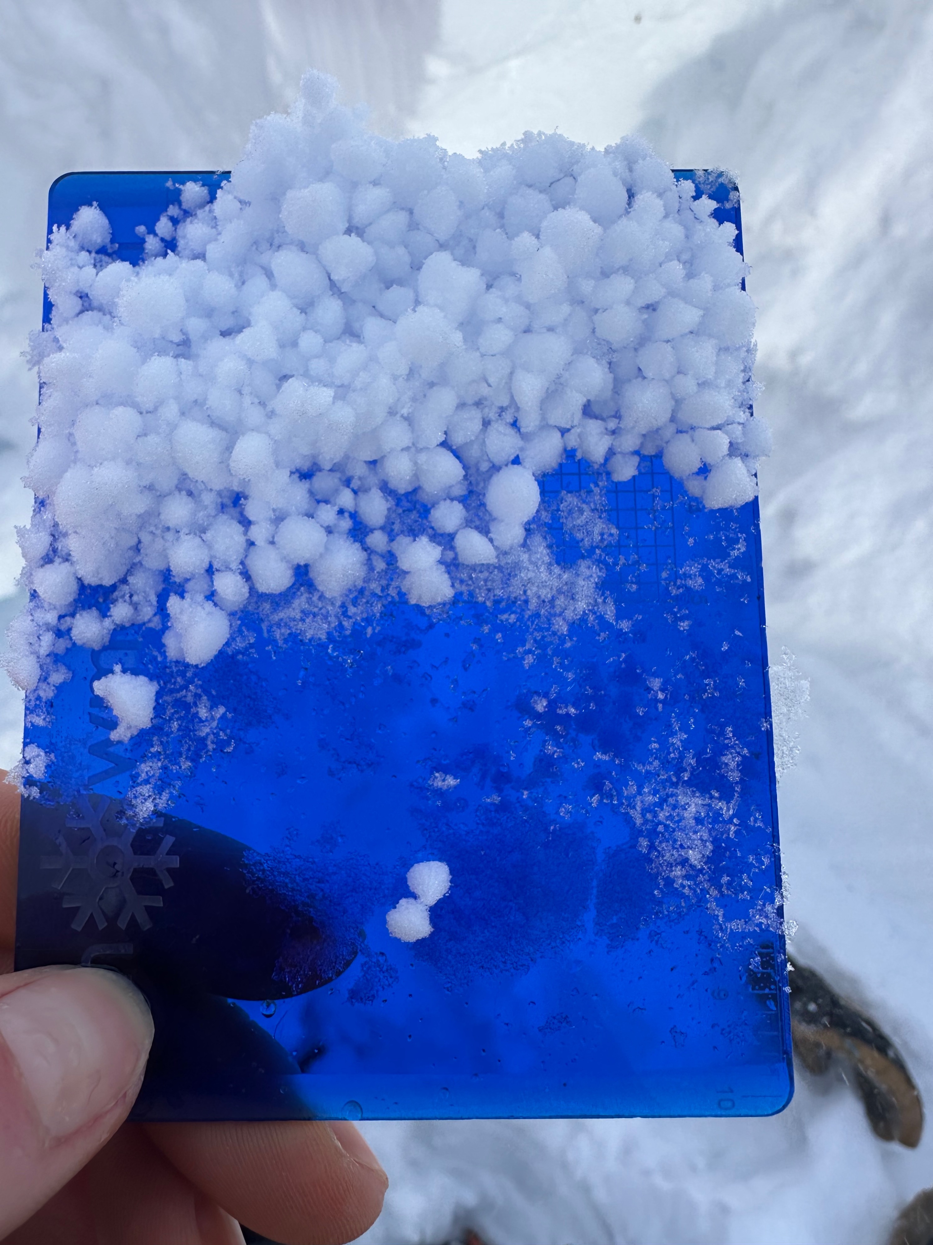
We paused on our approach, where I could feel weak snow beneath wind-compacted fresher snow with a pole. This weak snow is a layer of large graupel mixed with near-surface facets, around 2-3 cm thick and buried around 1-1.5 feet deep. A first extended column test at 7,600 feet on the W/SW yielded no propagating results (ECTN13 down 1.5 feet), but I'd watch for this layer where you travel, especially if traveling above 7,500 feet. We found this same graupel/nsf layer about 1.5 feet deep, also producing a non-propagating result. A second layer of concern is present on N aspects around 2.5 feet deep, consisting of a thicker layer of 0.5mm buried NSFs. Though the layer did not propagate fully, it had an ECTN7 score that fractured nearly across the entire column, which, to me, speaks to its potential to produce avalanches. This also appeared to be the depth of noted recent, but small, avalanche activity (see wind slab below).
This is the first season I've ever witnessed in a snowpack without a discernible or widespread persistent weak layer problem. This does not mean that faceted snow is absent from the snowpack, nor does it mean that facets won't start to form around buried rain/sun crusts [they like to form within any snowpack that has barriers for vapor flow, like crusts]. It does, however, mean that a large avalanche cycle has yet to be observed, and that warm temperatures and high rain lines have gradually consolidated much of the layered snowpack in our area. When traveling in the mountains, this lack of apparent pattern can be challenging. We still need to be on our toes in steep terrain above 7,500 feet, and anywhere new snow is piling up—especially atop layered snowpacks on N aspects above 7,500/8,000 feet. Low-elevation travel remains difficult, and it remains tough to make the juice worth the squeeze.
Weather
- Cloud Cover
- broken
- Wind Loading
- moderate
- Snow Avail For Transport
- moderate amounts
Skies clearing upon departure around 4 PM, but increasing W/NW winds.
Avalanche
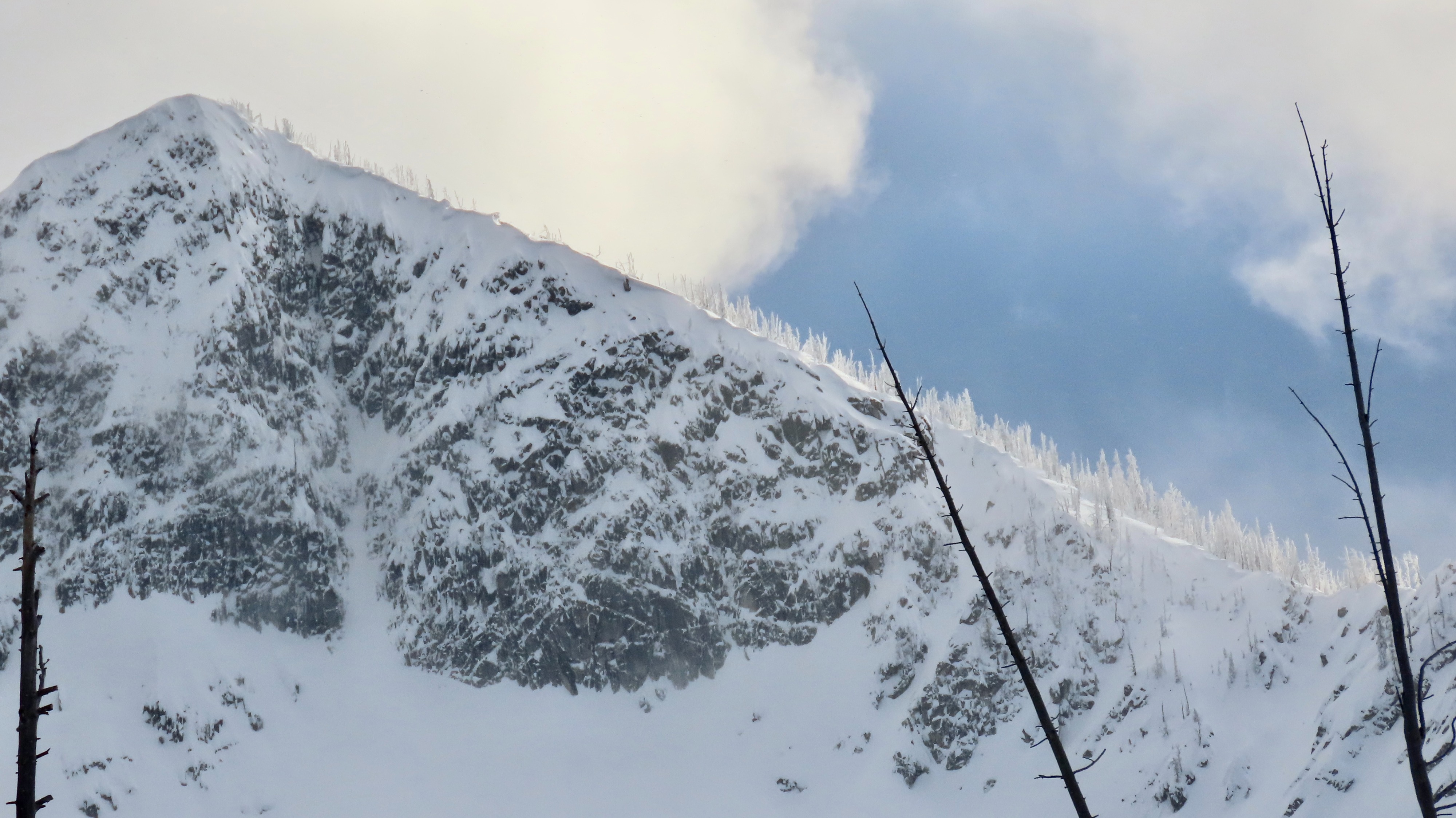
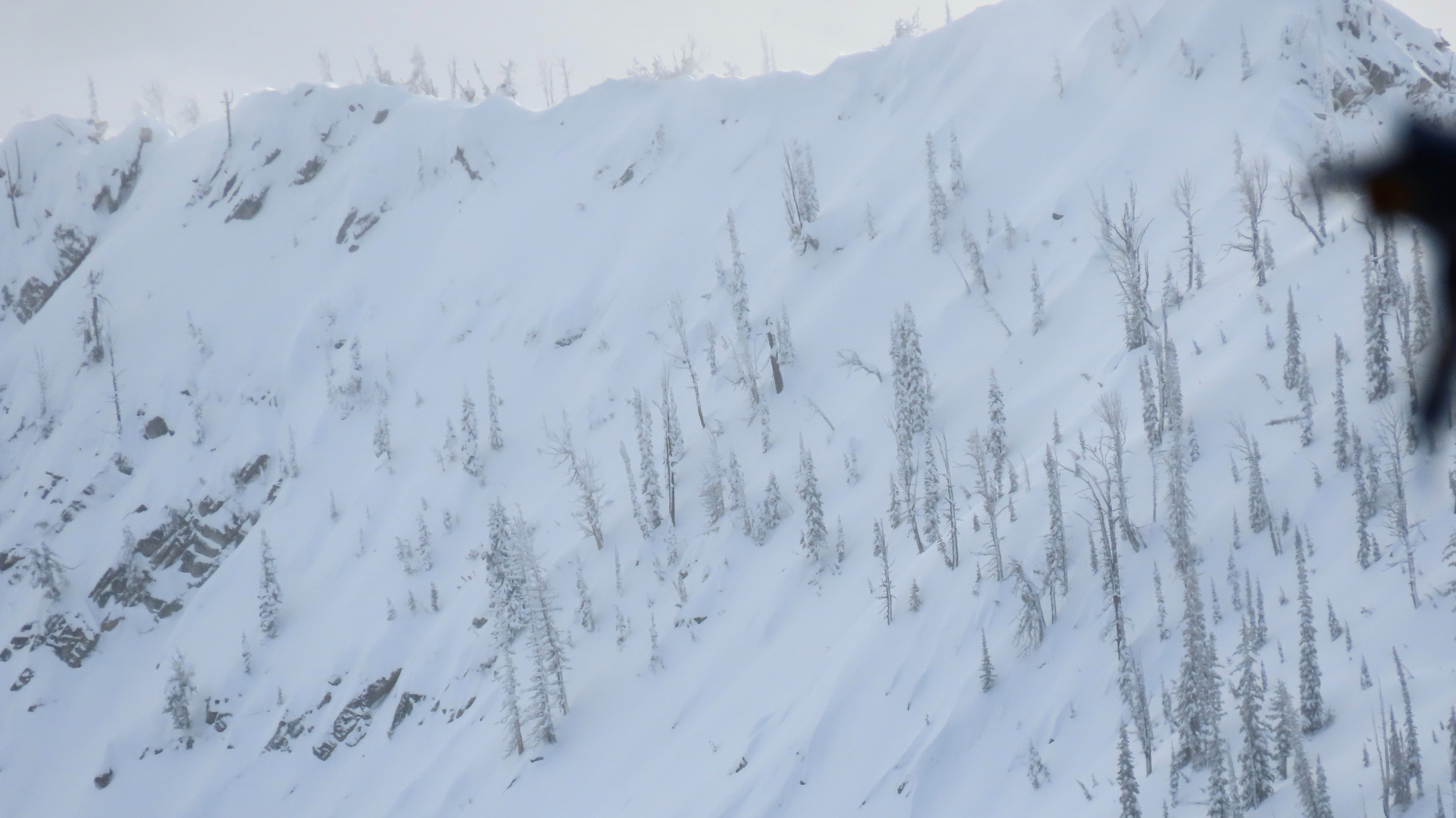
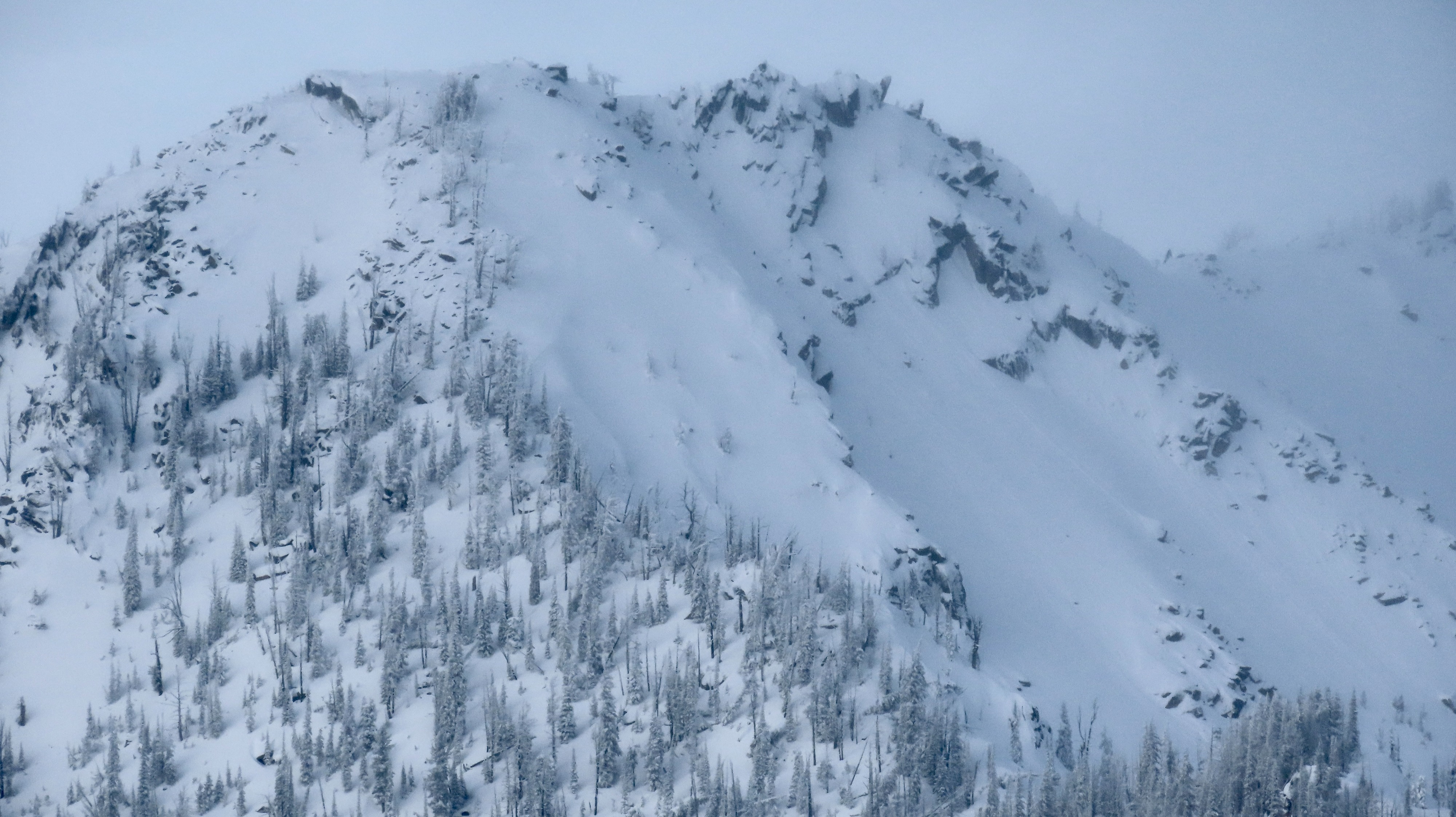
Noted a handful of point-releases and small wind slab avalanches