A Look at the Current Snowpack
Whistler/Pemberton Backcountry Brandywine
Andrew Councell , Sunday 20th November, 2022 10:00AM
Recent observations from the South Coast region from BTL/TL elevations into some glaciated ALP elevations (see pics for a snapshot). Outflow winds have really worked the snow surface anywhere above TL, with some hard-to-find faceted & dappled texture in the most sheltered areas which provided some quite good skiing. But the greater amount of wind-hammered, sun-baked and temp-affected snow makes it not worth the trouble!
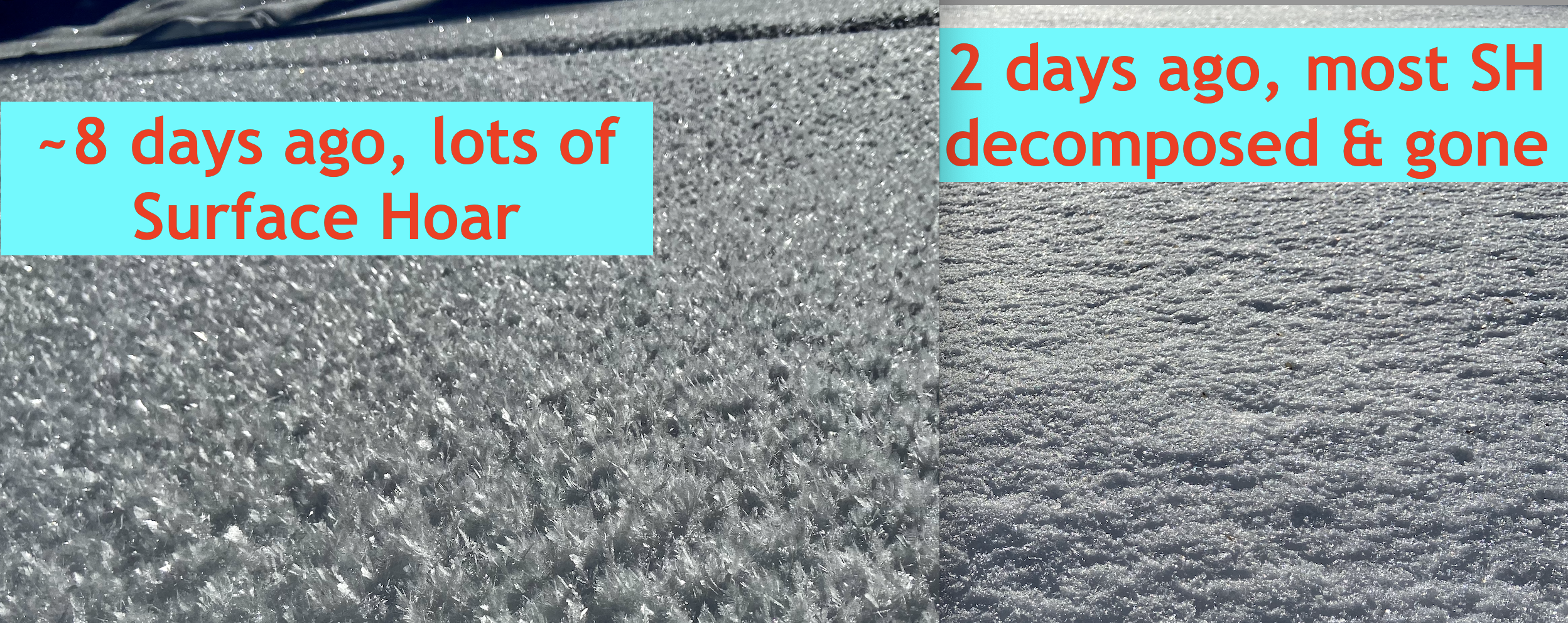
A week ago HS around TL elevations was 80-100cm but there has been at least 20cm of settlement since then, bringing the average HS to around 60cm. Where there was once sz. 10-15 surface hoar throughout TL meadows there is now only decomposed fragments at best due to it all being baked, blown or melted away. Deep, permanently shaded creases in the mountainsides are the only places holding snow in the trees.
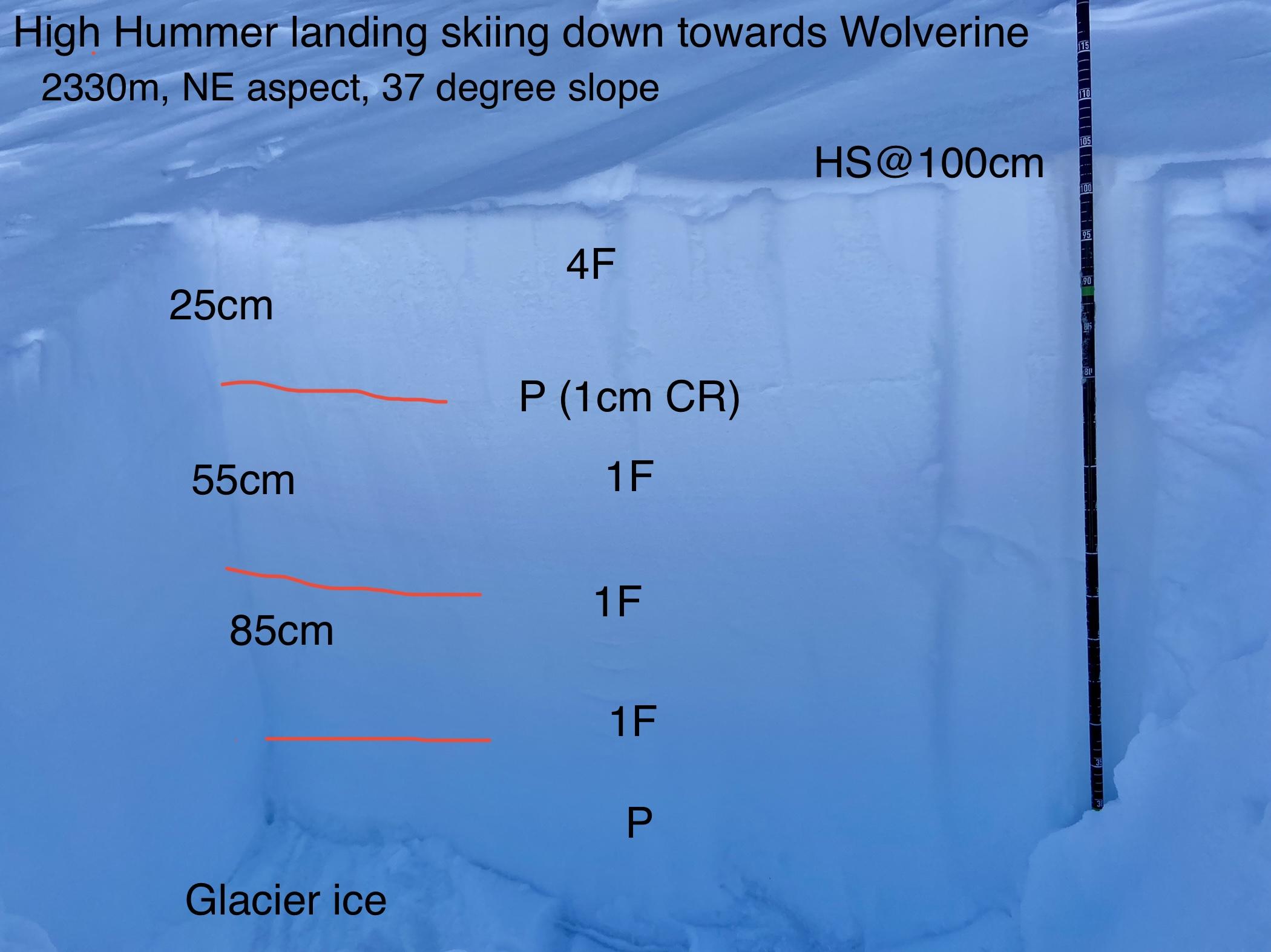
I had a quick dig at ~2350m on a NE aspect where there was exactly 100cm of snow over the glacier ice. Initially I was only going to do my standard two columns but a failure on basal facets on the ice prompted me to do another couple of tests. From the top there was ~15cm of 4F trending to 1F with a distinct ~1cm crust 25cm down; from there, despite other interfaces in the snowpack, the density remained mostly 1F until a small 10-15cm band of P density near the ice. Unlike our typical Coastal snowpack, our current version shows faceted (rotten) snow of varying degrees throughout...not surprising given the cold/clear overnight conditions we've been having during this unusual drought.
Test results revealed CT21 (SC) planar shears down 25cm on all four columns. In two cases, when isolating all the way to the ice, the entire column failed on 2mm facets on the ice at ~CT23-24. On the final column I didn't isolate the back to the ice and the column did not fail on those basal facets. Interesting but not too surprising. Despite some layering in the current snowpack, it all "feels" generally too weak to facilitate much propagation. A sz. 1.5 cornice (very few cornices around currently) that broke off naturally did not trigger any slab on impact or on its way into lower terrain, confirming my above sentiment.
In general, what we'd like to have happen now is a real wallop of warm, wet weather to squash and smash around our rotten snowpack. Without a real strong series of storms on the horizon this may not happen anytime soon which may set us up for an uncommon snowpack going into the ski season this year. Garibaldi Lake is not frozen. :)
Source: Mountain Conditions