
Quick report
- Aspect
- Northeast
- Red Flags
- Poor Snowpack Structure
- Elevation
- 2926 m
- Slope Angle
- 25°
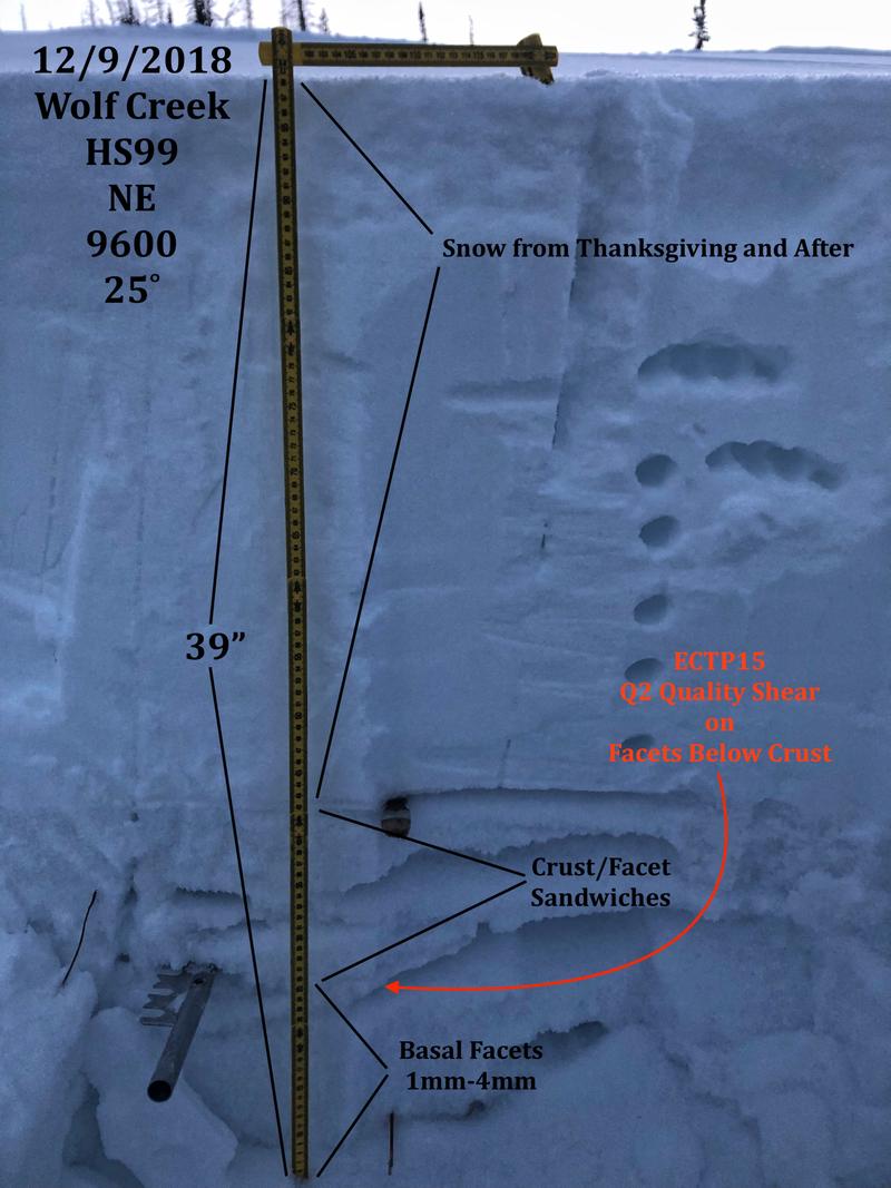
First time out on snow for the season. Snow depths were about 18-40 inches (45-100 cms) depending on aspect, at elevations between 9400 and 10K. On northerly aspects there were about 16" (42cm) of 1mm-4mm facets sitting on the ground with the top half of the facets made up of layers of crusts with facets sandwiched in between. Snow pit results reflected the weakest interface was on facets below the deepest crust. Failure was with moderate effort and propagated across the colum. Boot penetration was boot top high. The Thanksgiving snow has consolidated into a 1 finger hard, 2 foot slab. Steep slopes facing the north half of the compass are suspect. The dense slab on top of the facets could easily give someone a false sense of security if they haven't done their homework. I did not do a temperature profile in my pits so I'm not sure what's going on with the temperature gradient.
Photo below: rimed surface hoar.
Snowpack
- Instability Comment
- <p>The faceted snow at the bottom of the pack was the biggest concern where we traveled. Pit tests reflected moderate effort to fail and a propensity to shear across the column within the basal facets. Rising danger with added water weight to the pack. </p>
Solar aspects were damp in places but I was surprised to find soft snow on those aspects as well, even with the mild day time temps and clear skies. Noticed what looked like rimed surface hoar on on southerly aspects. On slopes facing the north half of the compass the snow surface was slightly faceted but not that well developed.