
Quick report
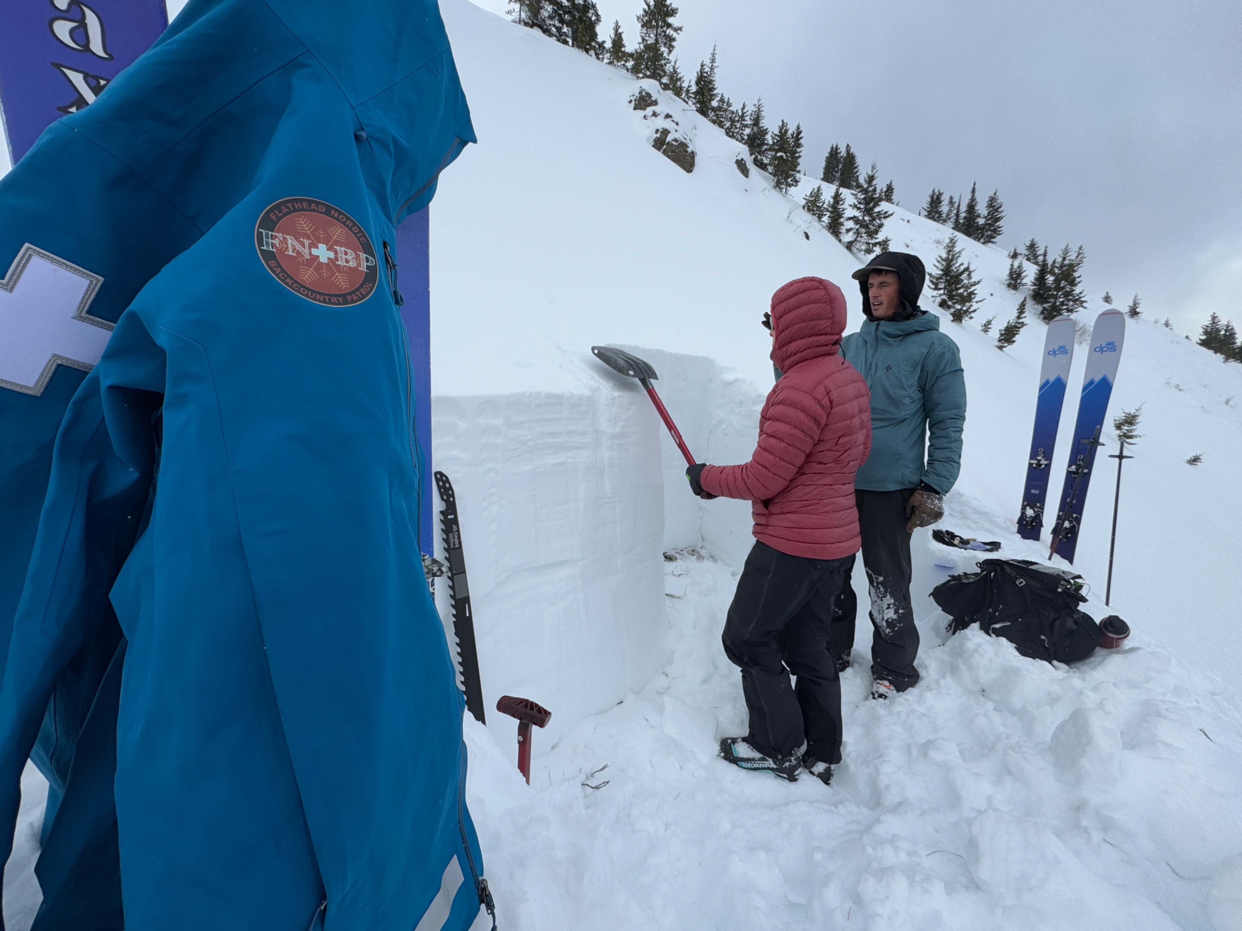
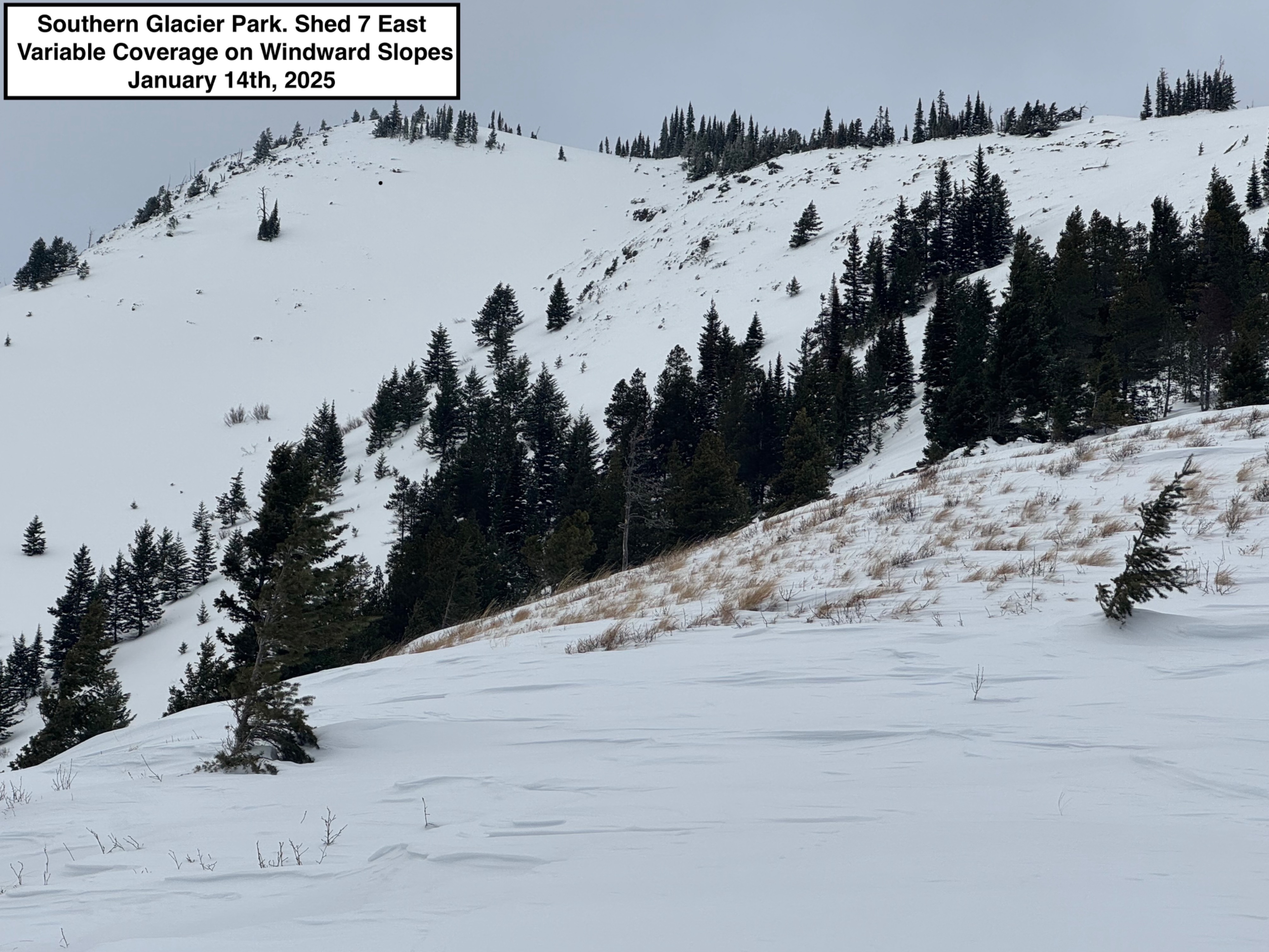
Traveled with some amazing volunteers from the Flathead Nordic Backcountry Patrol to the eastern part of the advisory area. Thanks for all the help and good company today! • Objectives were to document snowpack structure within the BNSF Avalanche Safety program area and to look for recent avalanche activity. • Relatively good stability enabled us to safely peek into the Shed 5 start zone to get some specific data about the present snow structure there. • East facing slopes at mid/upper elevations had been previously loaded recently and were actively experiencing light loading this morning-afternoon as wind speeds exceeded the threshold for drifting snow. We did not experience any cracking within the old or new slabs. Winds seemed to be tapering off when we began our descent around 1:30pm. • Despite our findings that verified generally stable conditions, we advise backcountry users to still exercise caution while traveling on windward slopes that harbor the most variability in coverage and snowpack structure. • We would like to note that our pit site was representative of wind loaded terrain proximal to a ridgeline with relatively uniform coverage, and that many of the mid/upper elevation start zones in JFS canyon presently hold a highly variable and relatively shallow snowpack compared to other areas west of the divide. • The good news is that conveniently stable snow and quality riding can generally be found in the same place at the moment. Sheltered slopes with deep and uniform coverage, especially on east and north facing slopes. • A persistent cloud deck hovered around 6500', but otherwise visibility was pretty good below that elevation. We did not observe any recent natural avalanche activity in the "Avalanche Alley" neighborhood. No signs of instability
Weather
- Air Temp
- 21
- Cloud Cover
- overcast
- Wind Loading
- moderate
- Recent Snowfall
- 1
- Snow Avail For Transport
- small smounts
Stubborn cloud deck lingered at about 6500' all morning/afternoon. We could see distant blue skies and sunshine greeting the prairies along the Rocky Mountain Front. Very light snowfall amounted to 1cm or less during the day. Temps remained below freezing. And winds were blowing lightly out of the west with moderate gusts. We observed some drifting snow above 5500'. Many of the west facing slopes along ridgelines have already been heavily scoured by recent winds, leaving only a small amount of snow available for additional transport in these locations.
Snowpack
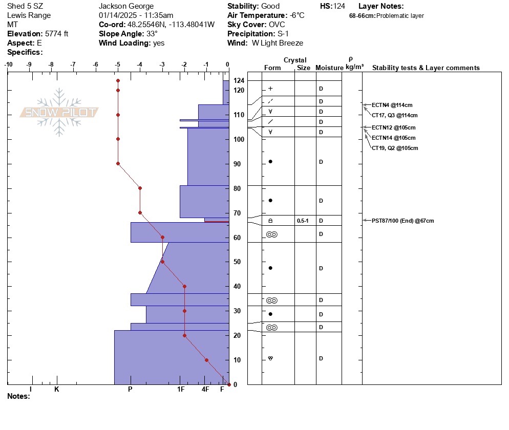
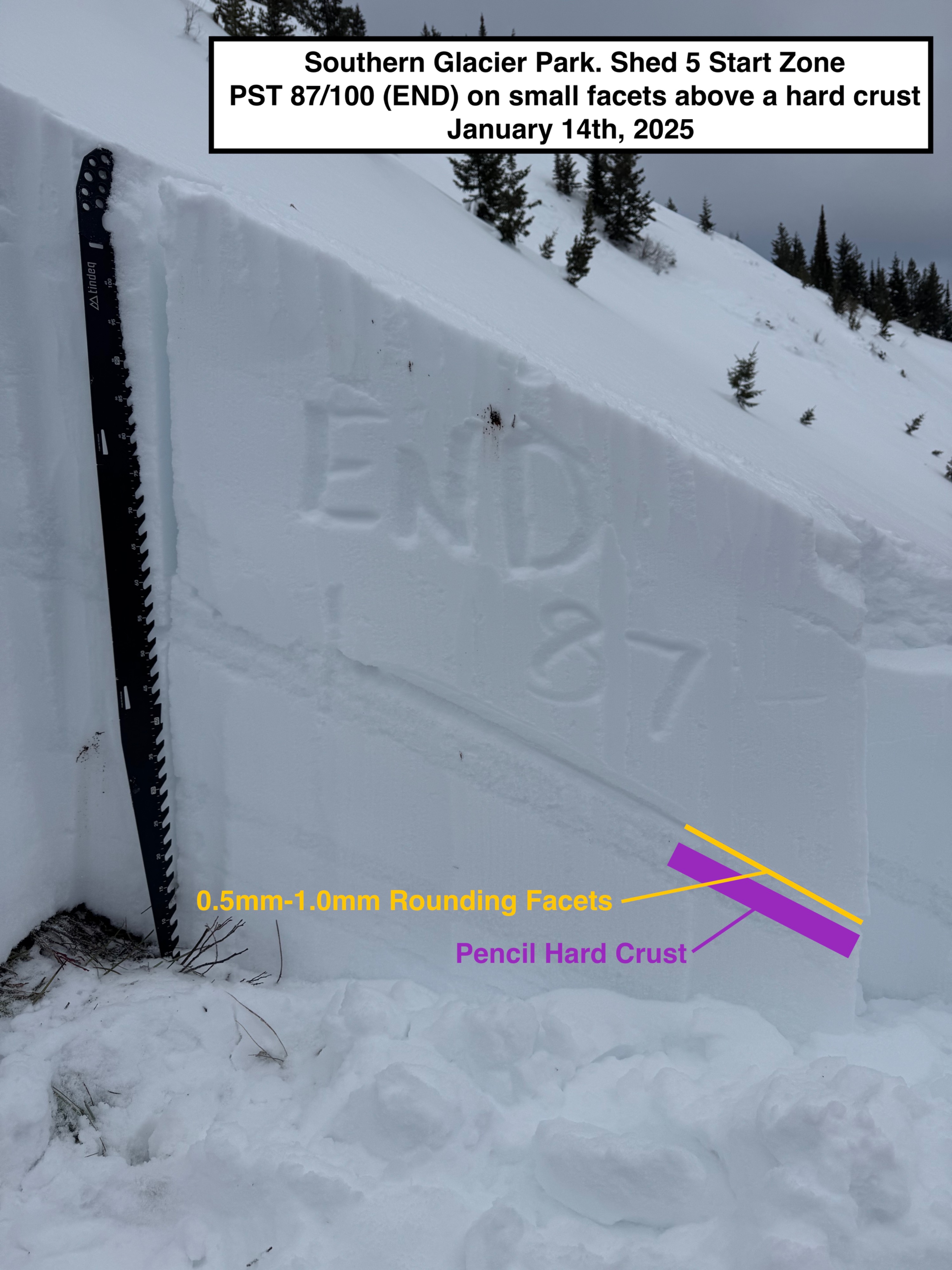
Snowpack data collected from the west flank of the Shed 5 start zone. • 5774' East Facing Slope. 33 degrees • HS 124. HN24: trace • Our primary layer of concern today was a thin layer of small rounding facets that overlies a hard crust 58cm (~2ft) beneath the surface. However, this layer was unreactive in all of our stability test. (PST 87/100 (END). • Our stability tests and the snowpack structure verify the FAC forecast of generally good stability today. • More details can be found within the attached Snow Pilot profile.