
Quick report
- Aspect
- Northeast
- Red Flags
- Poor Snowpack Structure
- Elevation
- 2591 m
Photos:
#1: Surfaces were anything from wind-buffed to wind-crusted at the upper entrance to Hells
#2: The newest snow from last week was failing with easy to moderate force on a layer of graupel that fell ahead of the most recent pulse.
#3: Graupel described above.
#4: In sheltered, high elevation northerly terrain, we were still able to produce loose, dry sluffing of facets easily.
#5: A huge thank you to our partners at Snowbasin Snow Safety.
Snowpack
- Instability Comment
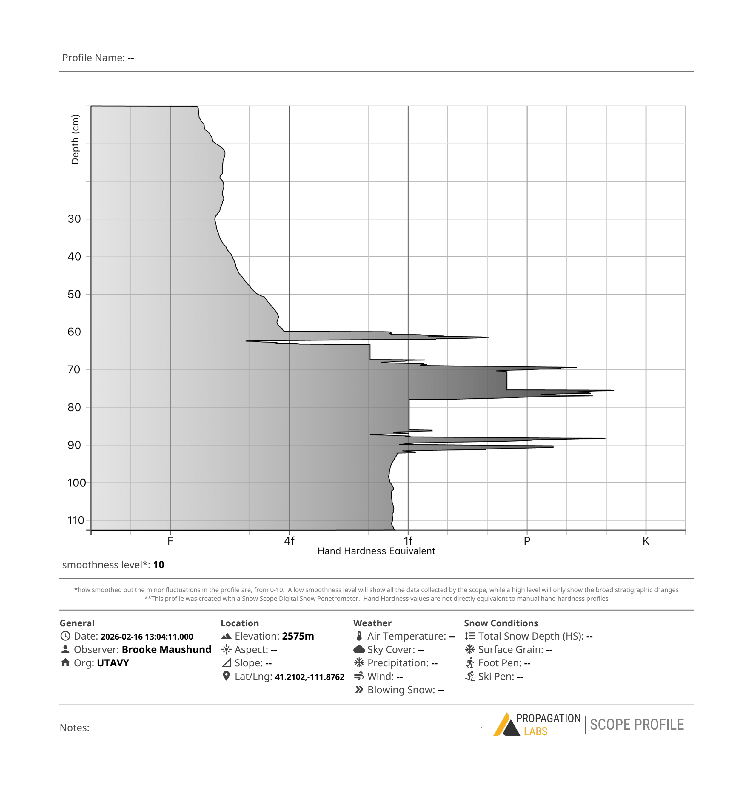
- <p>Where coverage currently exists, the snowpack setup is primed to produce avalanches once the incoming storms build a slab of new snow atop our current structure.</p> <p>Traveling from the top of No Name towards the top of the starting zone of Hells Canyon, we then made our way across several different starting zones facing N-NE between 8900-7830'. Digging three pits across elevations, we found a similar setup: 3-5" of newest snow from the most recent storm pulse, sitting on top of a graupel layer from earlier last week, sitting on top of a snowpack of mostly faceted, very weak snow. While the New Year's and Christmas crusts still exist, it's mostly the weak snow that faceted during the dry spell in January atop the New Year's crust where we're most likely to see large avalanches.</p> <p>The largest difference between the elevation bands was HS (110cm at 8900' vs. closer to 65cm at 7830'), and slightly more moist facets at 7830'.</p> <p><em>A huge thank you to Snowbasin Ski Patrol, Snow Safety, and Corey Kruse for having us.</em></p>