
Quick report
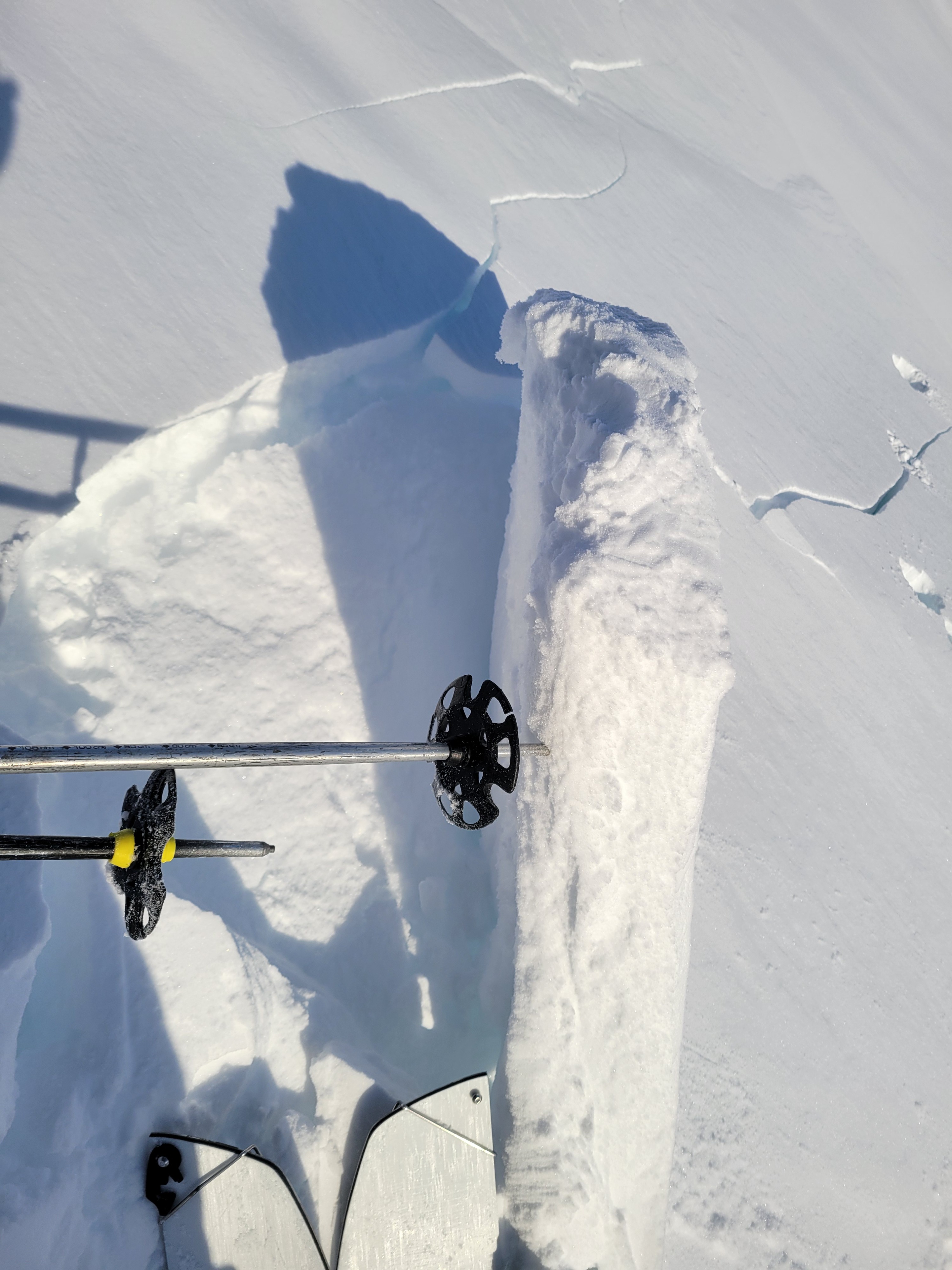
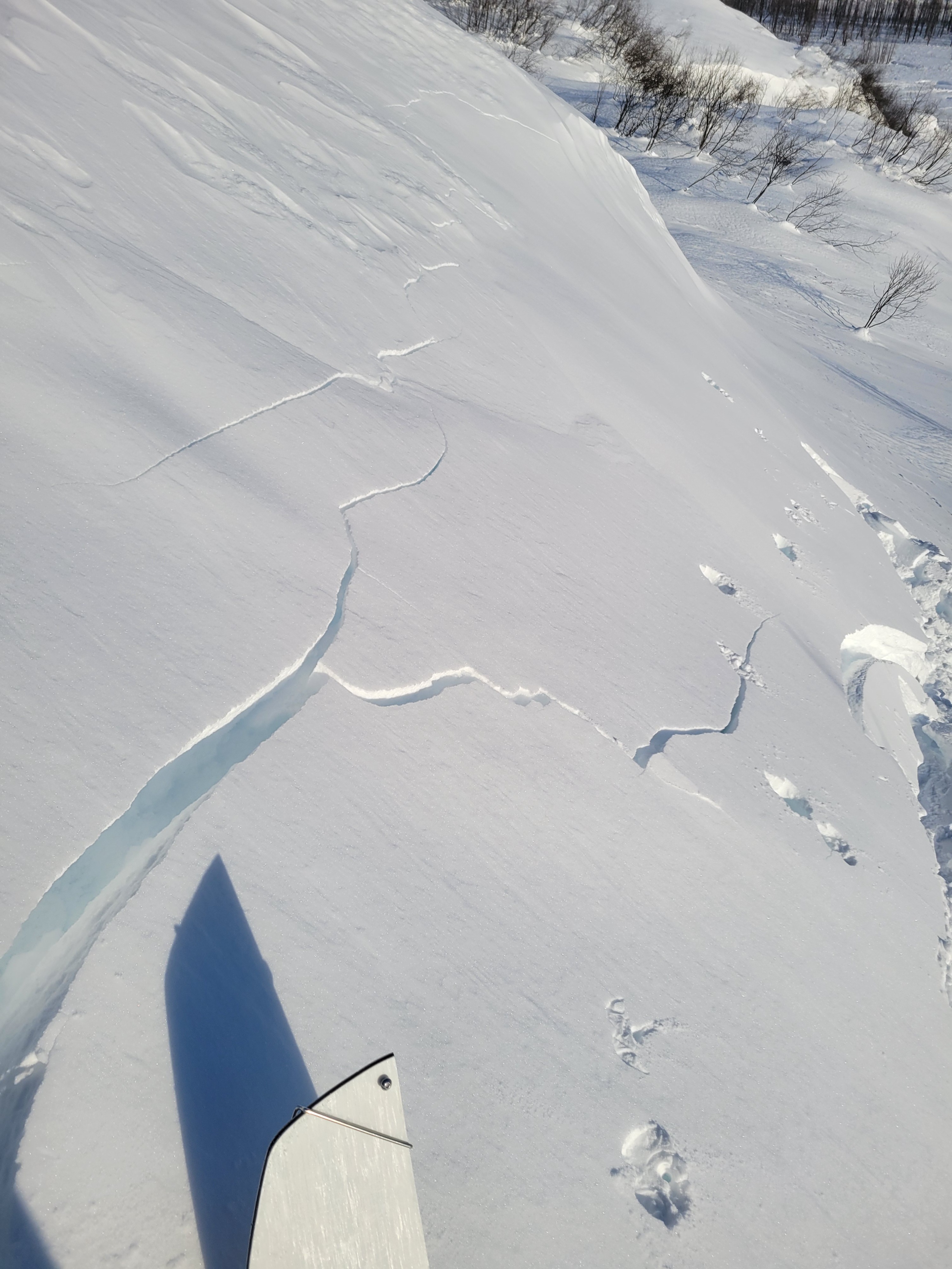
- Cracking
- isolated
- Collapsing
- isolated
Overall avalanche hazard was observed to be moderate at elevations to 1600feet. The main concern is small isolated pockets of windslab that lie on top of a degrading rain crust with dry unconsolidated snow underneath. It is unlikely to buried by one of these slabs but they could take you for a ride over a cliff, into a creek bed or into other undesirable terrain. For now slabs area easy to spot appearing much smoother than surrounding areas. After new snow falls tonight and tomorrow slabs will be harder to identify and could surpise a user. Deeper instabilites were unobserved. Observations of slab activity apply to areas where windslab overlies rain crust.
Shooting cracks to 20 feet and collapsing observed. Hard slabs 2-8 inches thick on top of crumbly rain crust were reactive on small test slopes around 33 degrees. Slopes did not avalanche.Weather
- Air Temp
- 0F
- Cloud Cover
- clear
- Wind Loading
- none
- Rain Elevation
- Crust above 1500ft
- Recent Snowfall
- None
- Snow Avail For Transport
- none
Snowpack
Last weeks storm snow had settled quite a bit with 20cm ski penetration in areas without slab. The rain crust that formed at the end of the last snow event is begining to break down in the cold temperatures. This rain crust on top of dry uncohesive snow is providing a weak layer underneath small areas of hard and soft slab. Reactive windslabs were found on small isolated slopes and were easy to identify by their smooth appearance. Harder windslabs were more reactive than soft.