
Quick report
- Aspect
- North
- Elevation
- 3018 m
- Slope Angle
- 34°
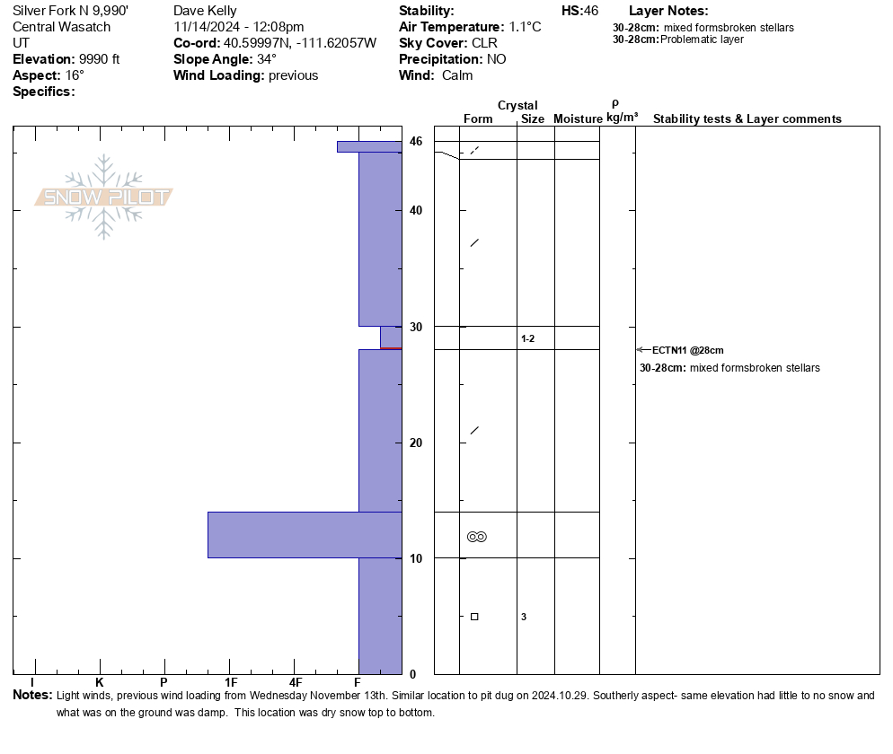
Snow pit was dug in a similar location to this one from October 29, 2024. Snow at the same elevation on the southerly aspects was damp to non-existent (see below photos). The snow in this pit was primarily dry and the rain layer from October was in the same place about 4" from the ground. Card marks weakness and brown dust layer marks rain crust. Total depth was 18".
Below snow pit was on a west facing slope at 9790'. Total depth was 12" and this was variable depending on how much southerly aspect each slope had.
The below photos show snow cover.
Photo 1- Looking west down Little Cottonwood Canyon- Superior in the back
Photo 2- Wind sculpting from strong winds on Wednesday November 14th. These areas of wind-drifted snow were hollow and punchy
Photo 3- South facing Davenport Hill opposite the north facing snowpit (9,990' elevation)
Photo 4- South facing Grizzly Cup area
Photo 1- South facing mid Big Cottonwood Canyon with Silver Fork on the lookers left
Photo 2- Upper Grizzly Gulch with Patsy and Wolverine in the far distance
Photo 3- Looking down canyon- Pfeifferhorn/Hogum in the far distance
Photo 4- West Bowl in the foreground, Upper Days Ridgeline, Superior, and Cardiac (back ridge)
Snowpack
Overall it was a thin snow pack with lots of variability and a "skins on from door to door" kind of ski tour. There are locations in the high elevation sheltered northerly facing terrain where you could find soft turns. I am still wary of what is just under the surface. Snow depths ranged from 0" and wildflowers on southerly facing slopes to 18" on shaded northerly slopes. Average was more 8"-12" above 9,000' in elevation. Some locations had deeper stiffer wind drifts, but they were isolated.