
Quick report
- Collapsing
- Observed
Even with the 6" of new (very low density) snow from 2 days ago recorded at Angle, the snowpack is still relatively thin on Togwotee. The interval board at the weather station had 9.5 inches of snow with 1.1 inches of snow water equivalent yielding about 11.5% density which included some older snow from before this last storm. The 6" of storm snow from 2 days ago had 0.45 inches of SWE which is about 7.5% density snow - very light and fluffy!
The SW aspect that we skied, even with strong solar input today, remained mostly cold and dry. On the aspects that we travelled today (SW-W-NW), we found preserved near surface facets and surface hoar under the latest storm snow.
Snow heights from 9000' to 10,000' ranged from about 14 to 36 inches respectively.
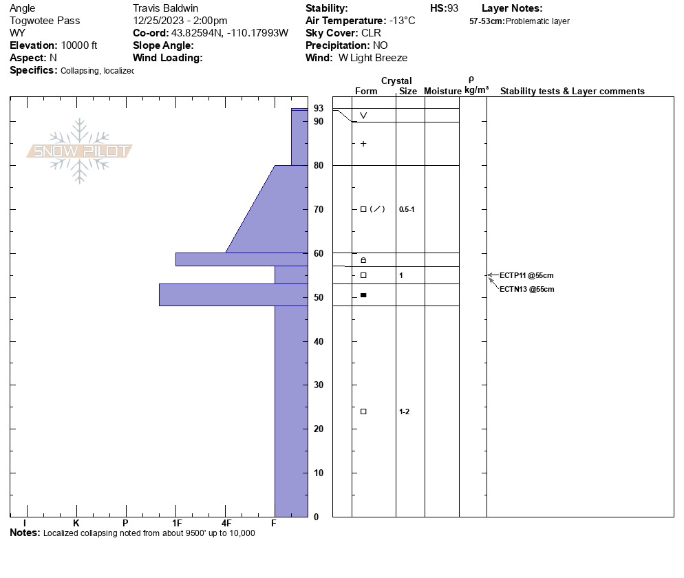
We dug at 10,000' on a N aspect where the snow height was 36 inches. We did 2 ECT's and got an ECTP11 and ECTN 13, both at the same December snow/November drought interface, up 22 inches from the ground.
From 9500' up to 10,000' there was localized collapsing. Not enough cohesion in the new snow to see cracking but you could see collapses settle the new powder. Didn't seem to extend more than 10m at a time.Weather
- Cloud Cover
- clear
- Wind Loading
- none
- Recent Snowfall
- 15
- Snow Avail For Transport
- moderate amounts
Cold, clear and mostly calm on Togwotee today. Light W/NW wind at 10k. No snow transport noted.