
Quick report
- Cracking
- specific
- Collapsing
- widespread
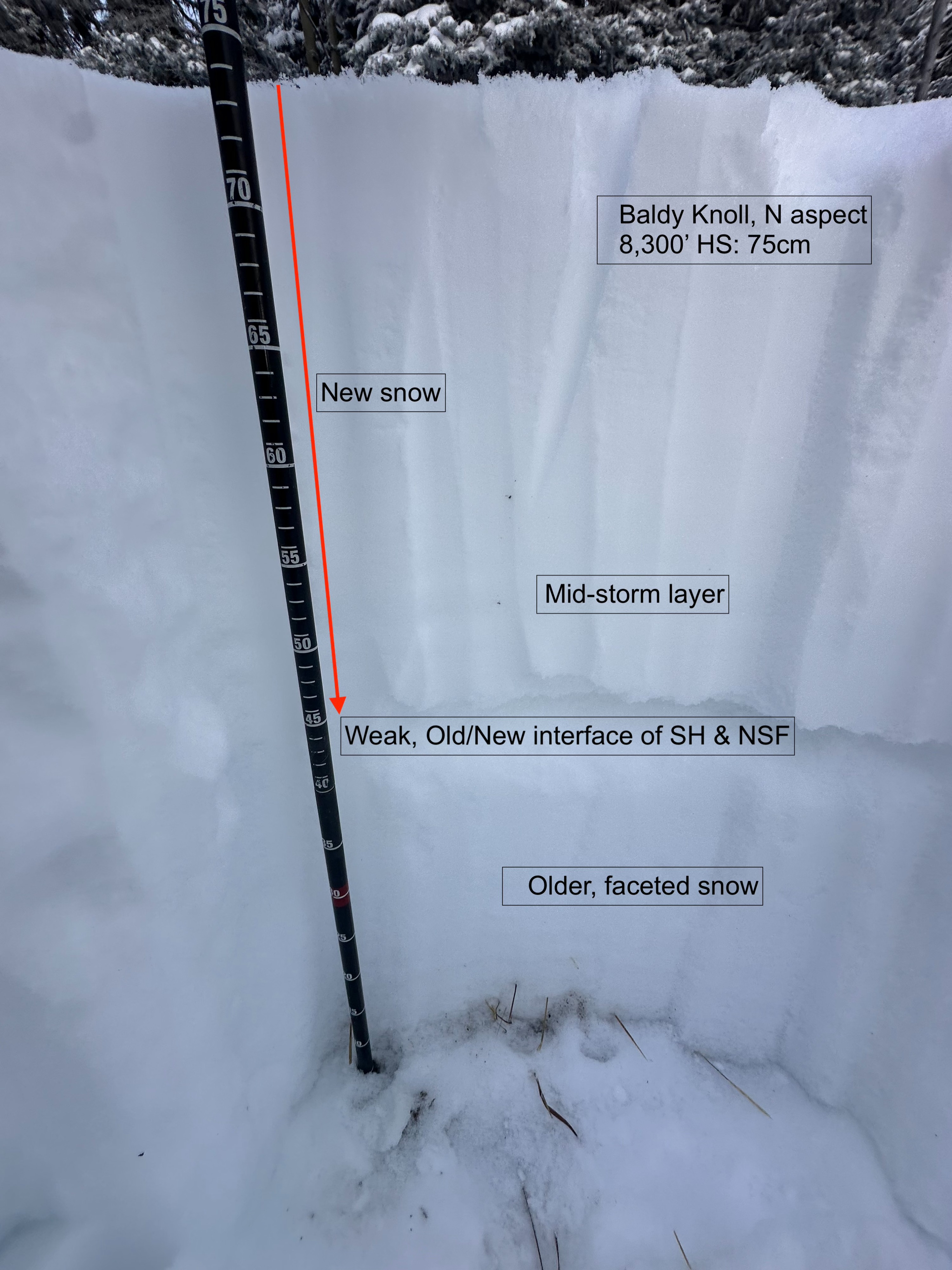
Toured up to Baldy; average HS above 7,500' around 50-80cm. (1.5-2.5 feet), 30cm (1+ feet) of which was new snow. I found continuous old weak snow on all aspects I observed (W-NW-N as well as SE), and experienced collapsing in all of these areas as well. Small pockets of wind-affected produced shooting cracks, but I could see snow moving at upper elevations and would suspect this problem would be widespread here. Pits on multiple aspects 8,000'-8,300' held a similar ratio of snow (half weak and old, half new), with the weakest interface being the old/new interface. Some areas had buried NSF/SH, while others just held buried NSF. Of note is also a mid-storm interface (not a PWL, just a different crystal type) that may remain sensitive in addition to the old/new (O/N) interface and weaker snow beneath that. A few ECTs didn't yield interesting results, but the slab of storm snow was too soft for me to produce what I would see as an accurate result relative to actual avalanche conditions.
The facet layer beneath the O/N interface is thick. This problem is currently harder to predict because the distribution of old snow before this storm was spotty. There are slopes with little to no snow prior to this storm that are perfectly safe. However, turn a corner to a different aspect that held old snow and encounter a very different story with a touchy avalanche problem that may catch folks off guard, particularly on sheltered, treed slopes.
As this new snow settles into more of a slab (and with more wind and snow on the way), the potential for triggering this problem in unsuspecting places will remain likely. This is a good time to enjoy the new snow, but keep your slopes angle tight and check slope angles in the field.
Widespread collapsing on all aspects I observed (W-NW-N as well as SE)Weather
- Air Temp
- 19
- Cloud Cover
- overcast
- Wind Loading
- moderate
- Recent Snowfall
- 30
- Snow Avail For Transport
- large amounts
Increasing W winds throughout the afternoon; matched forecasted increase, estimated ~20-30 mph hitting middle and upper elevations. Snowfall tapering throughout the course of the day