
Quick report
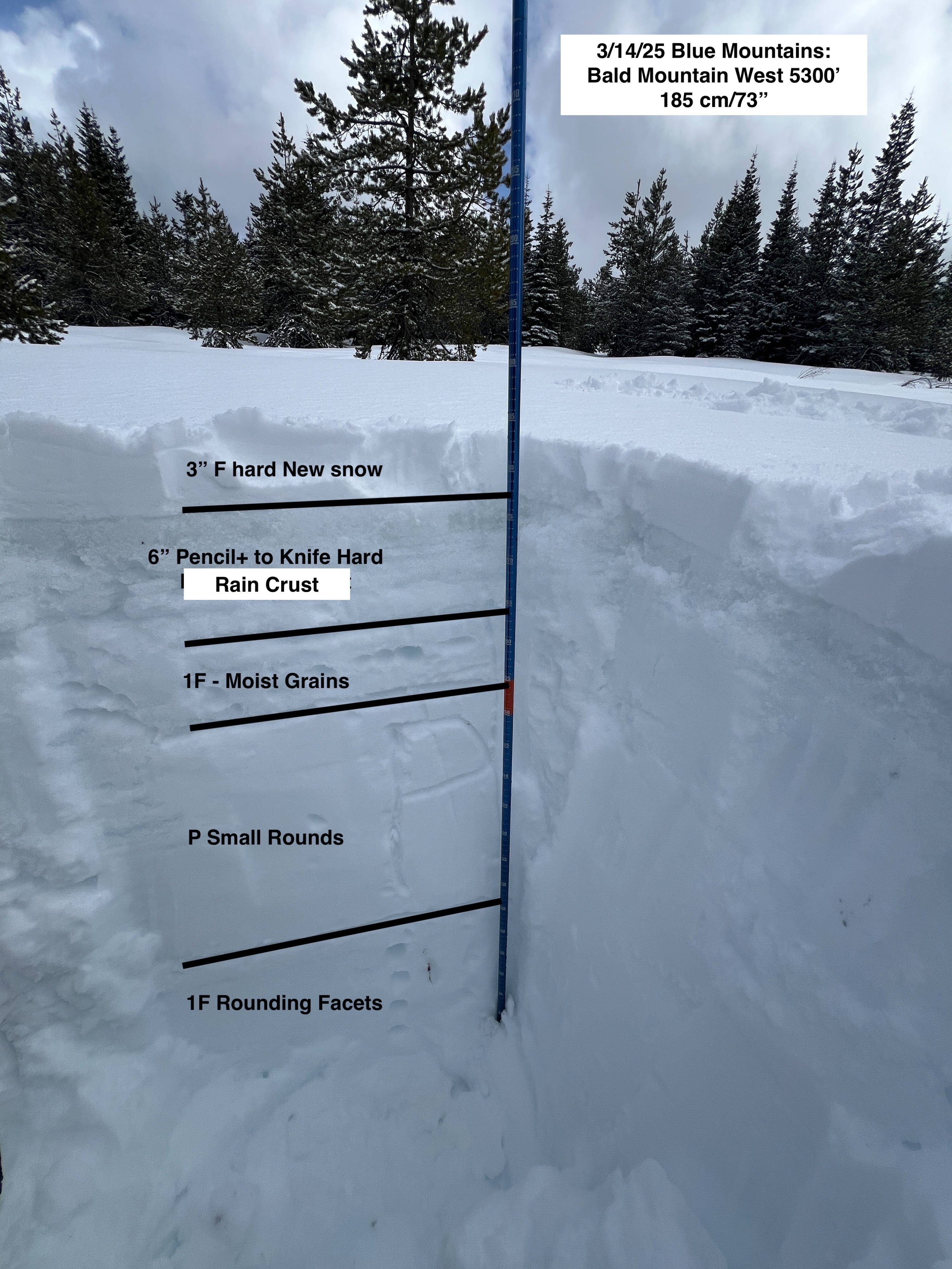
We headed up to Tollgate to see if we could find the snowline from Wednesday and to see if there was any recent wind loaded snow. It was evident that there was a rain on snow event to at least 6,000'. The saturation of the snowpack that took place has locked up well with recent colder temperatures. Several inches of new snow fell overnight which made the riding quality slightly more inviting than what it must have been yesterday. A stout 6" Rain Crust existed below the new snow in all areas traveled today. It was supportive under the weight of our machines. We did not observe any significant wind loading. I would rate the danger at Low today given the freezing temperatures and lack of significant new snow and/or wind loading.
Weather
- Air Temp
- 28
- Cloud Cover
- broken
- Wind Loading
- light
- Recent Snowfall
- 6
- Snow Avail For Transport
- small smounts
Temperatures in the upper 20's to low 30's. Mostly Cloudy Skies. 2-4" of snow overnight. No new snow during the day. Light SW winds.
Snowpack
2-3" of new snow sat above a 6" hard Pencil to Knife hard Rain crust. Below the crust is 3" of moist grains that had been wetted by Wednesday's rain event. A stout Pencil hard slab is below those grains, but sits above the January (rounding) Facets that were 1 Finger hard.