
Quick report
- Cracking
- isolated
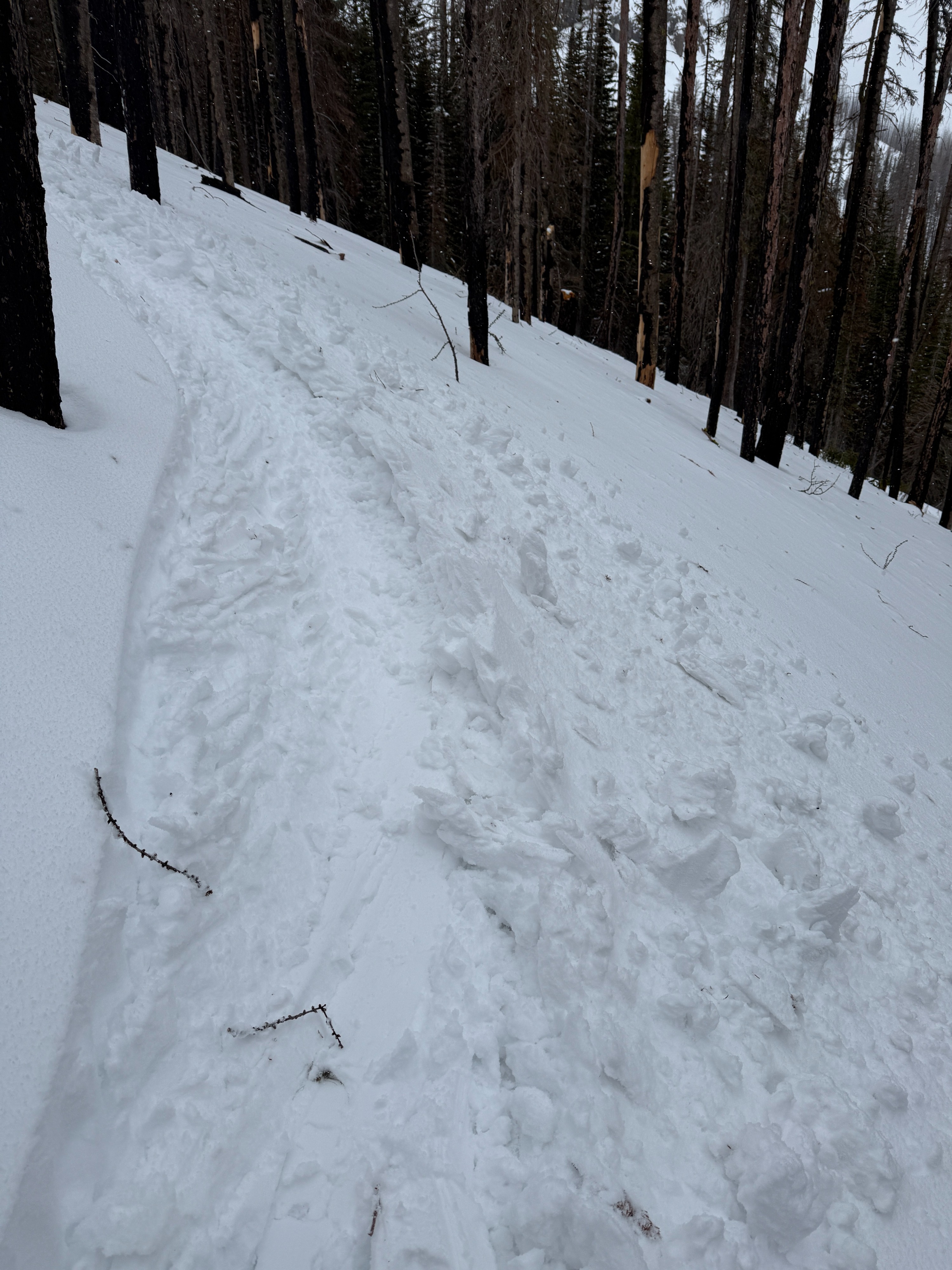
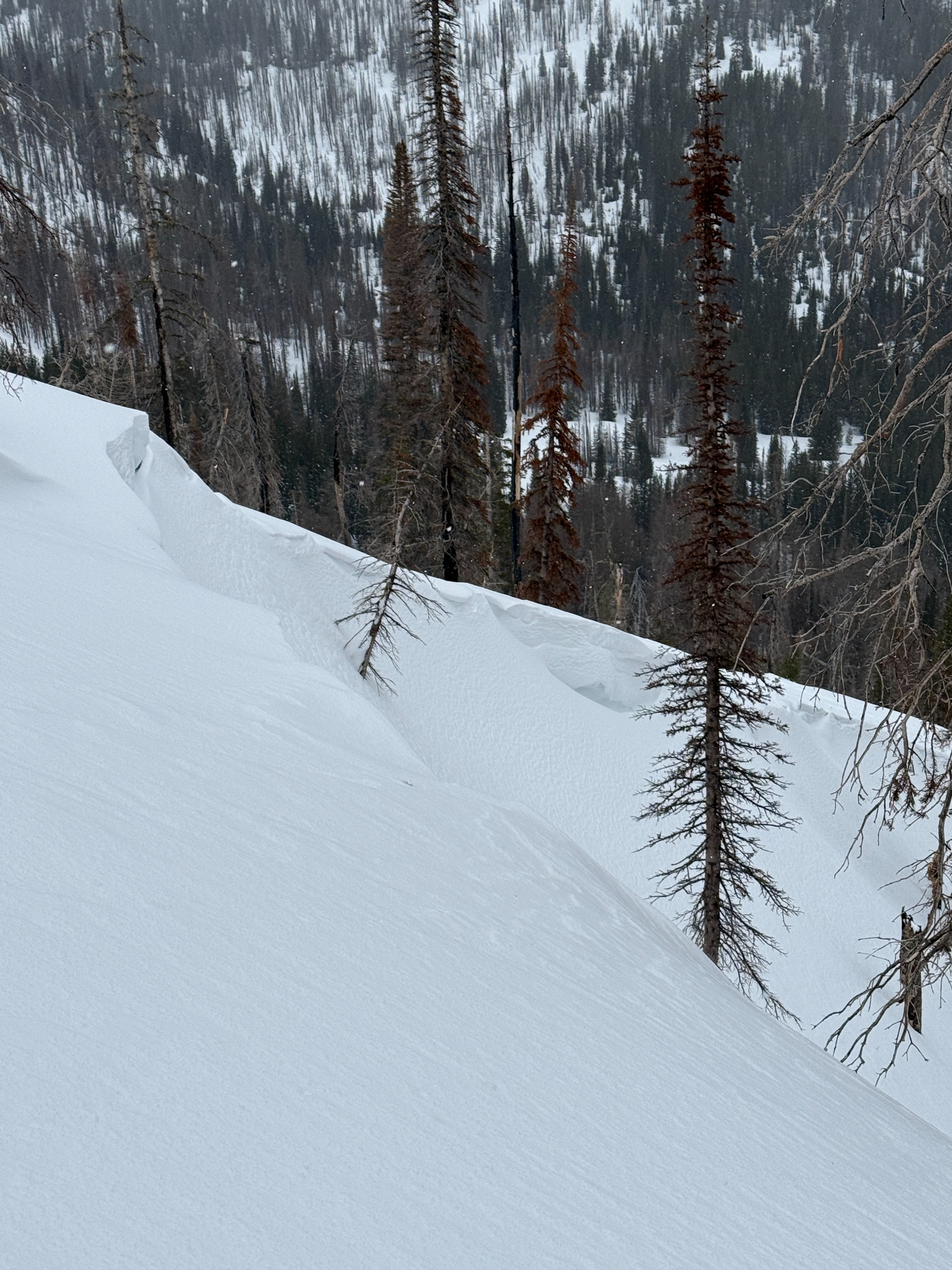
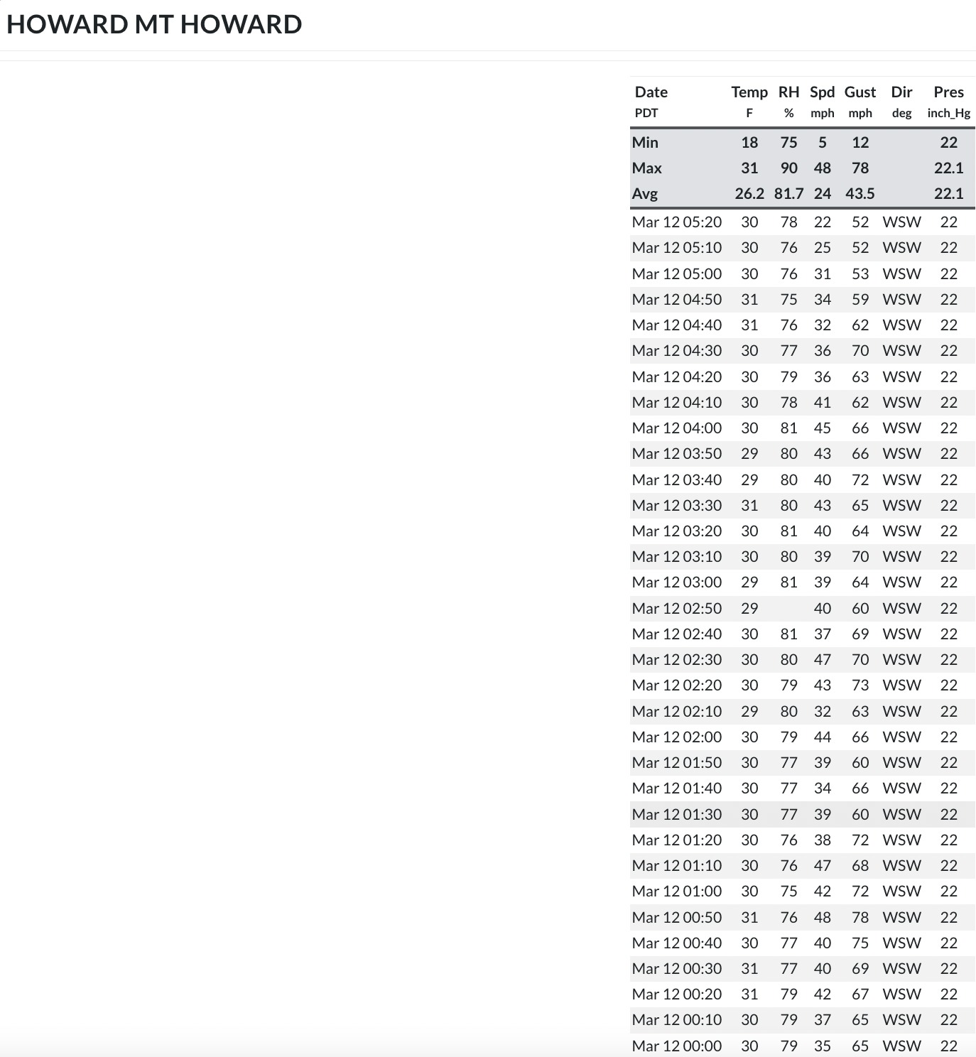
I travelled to Big Sheep drainage today and found the snowline to be at around 5500'. There was a couple inches of snow at Salt Creek Summit at around 9:00, but temperatures were on the rise. At the Tenderfoot Trailhead, there was 7" of new storm snow since Tuesday. There was a major wind event on Wednesday night, check out the screenshot of the Mt. Howard wind speeds and gusts. They were sustained in the 40 mph range and gusted into the upper 70's! There was evidence of the wind hammering down with sculpted creek banks and dunes covering old skin tracks. The new snow was dense- at times it cracked around my skis. I travelled up to about 7500' and looked at some wind-loaded features to see if they had released naturally. They had not, but they looked quite wind-loaded- A rippled snow surface below a cornice.
I did not travel to upper elevation ridgelines; I would imagine the WSW winds had loaded much of the leeward exposed terrain.
It was warm- and below 7500', you could find rollerballs on steeper terrain and from ski tracks.
"upside-down" storm snow plus wind transported snow created cracking around skis while skinning. Slabs of snow could be easily cut loose with hand shears and kicking out skintrack corners.Weather
- Air Temp
- 37
- Cloud Cover
- overcast
- Wind Loading
- previous
- Rain Elevation
- 5500
- Recent Snowfall
- 18
- Snow Avail For Transport
- moderate amounts
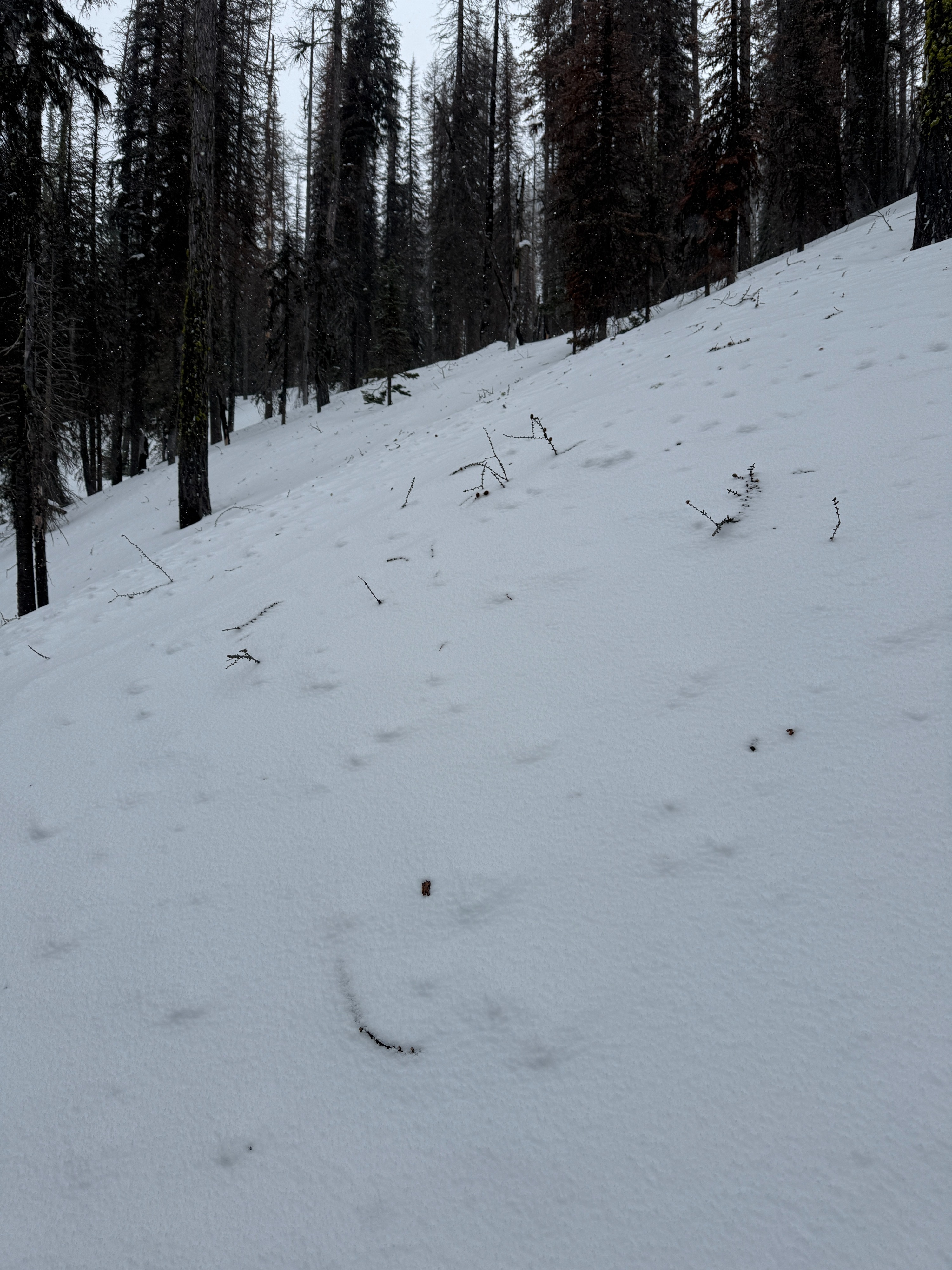
There was 2.5" of snow at Salt Creek Summit at 0900. It was snowing lightly. By the time I turned up the 100 road, it was raining lightly (5500'). There was 7" of new snow on a thin crust at the Tenderfoot Trailhead (6500'). There was plenty of evidence of previous wind- with sculpted features in the drainage bottom and no new snow on trees. The wind was light and variable during my travel. I did not see any wind plumes off the higher terrain. Light snow persisted throughout the day, and was almost rain by the time I got back to SCS (6100').
Snowpack
Average height of snow (HS) : 170-200 cm / 5.5 feet
Storm snow since 3/10: 18cm/7 inches. Today's snow was more dense and slabby than the lighter snow from yesterday. The storm snow was "upside-down".
The new storm snow lies above 2 thin melt freeze crusts.
The Valentine's Day interface did not have buried surface hoar where I dug, and was hard to identify. The January Facets were 80cm/31 inches from the surface. I got mixed results in snowpack tests.