
Quick report
- Cracking
- specific
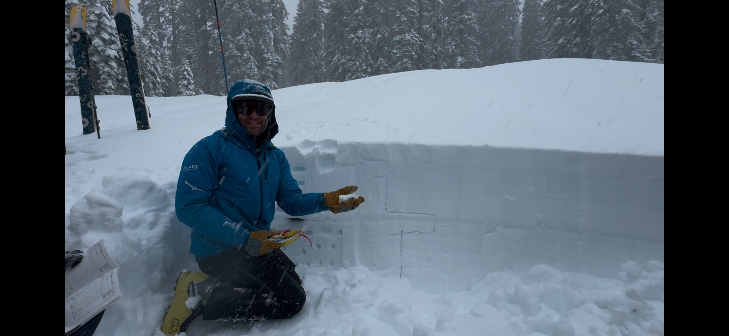
Another day of working with what we've got in this La Niña year. We were relieved to see heavy rain turn to snow on I80 on the way to Castle Peak Snopark. While this observation is relatively limited due to the short nature of our tour (just bopped up past Hole in the Ground and stayed below/near tree line on Andesite), we did make some observations of the recent and welcomed snowfall.
Observed some cracking in areas of active wind drifting right at 7,900' E facing on Andesite Ridge.Weather
- Air Temp
- 33
- Cloud Cover
- overcast
- Wind Loading
- intense
- Rain Elevation
- 7000'
- Recent Snowfall
- 10cm/4"
- Snow Avail For Transport
- small smounts
Rain line at 0745 appeared to be between Billie Mack Meadows and directly south of Summit Lake Meadows (7,000'). We were relieved to see this change to wintery mix and snow as we gained in elevation after getting absolutely soaked to the bone on our AIARE Level 1 yesterday. By 0745, it was snowing heavily (S2) and we observed roughly 4" of accumulation above 7,200' between 0900-1200. Gusts by 1230 were consistently strong out of the west. While the sky was occluded, we could see tree tops bent and as per our crew that toured to 8,000', knew it was transporting snow at ridgetop. One team of three for this course got up towards 8k and saw blowing snow and soft, new wind slabs forming on Easterly aspects by 1030.
Snowpack
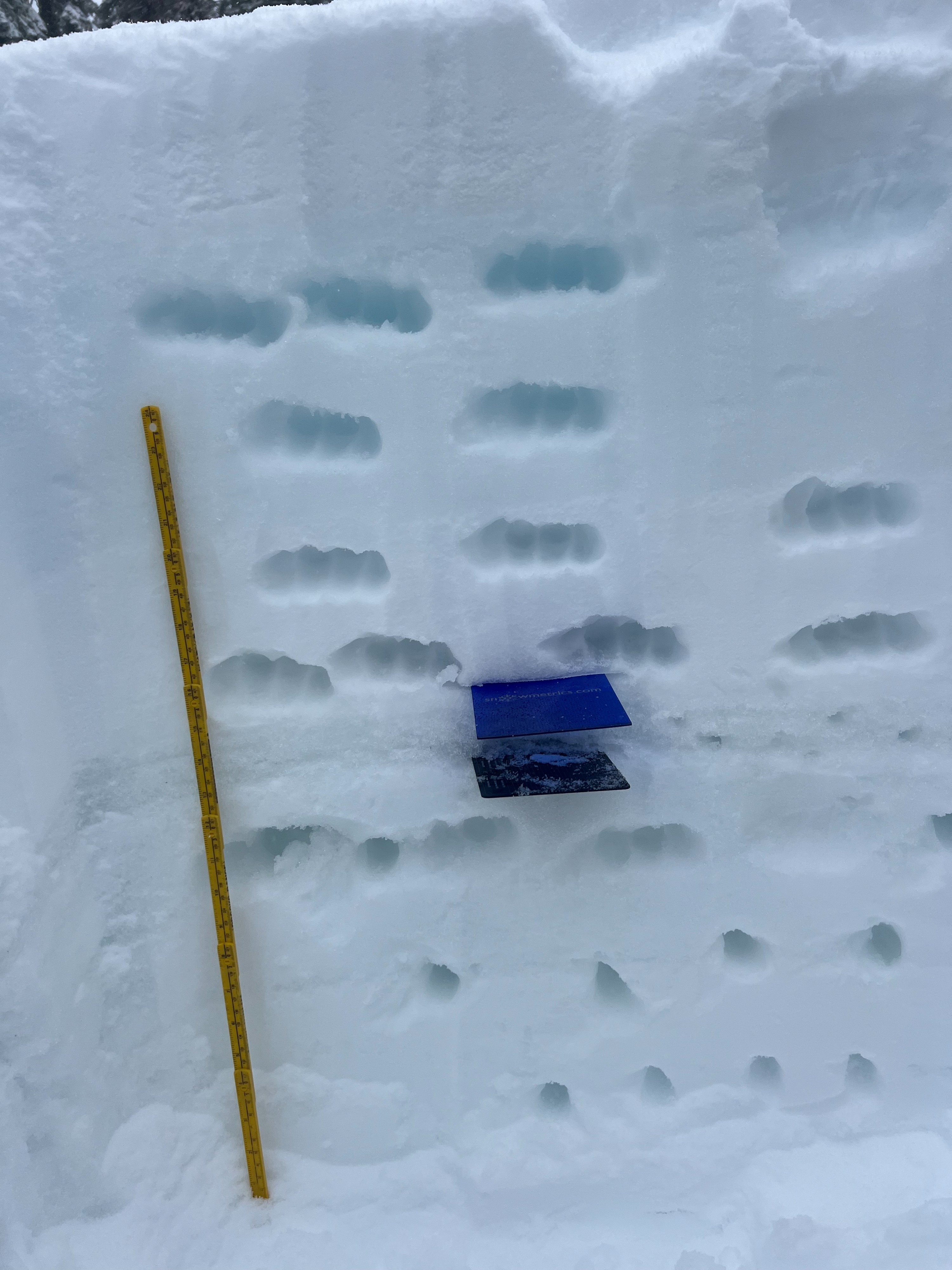
Due to winds, intense, wet snowfall and poor visibility, our AIARE Level 1 stuck to treed terrain on the E. side of Andesite today. New snow appeared to be bonding well to moist, existing snow surfaces without a detectable crust layer in between in below tree line locations. Hand shears showed no results in these wind-protected areas. We did not detect a significant melt-freeze crust at the location of this pit at 7,600' ENE on Andesite. This recently buried crust appeared more consistent and firm higher up, and paired with drier storm snow, the start of the potential dry loose interface described in this AM forecast (should the area receive higher snow totals). Higher up and closer to ridgeline, soft wind slabs were actively forming with wind drifting during our team's tour. In these specific areas, slab cohesion and cracking was observable. With snow tapering by 1200, it seems as though higher elevations received the lower end of today's possible forecasted snow. With this in mind and due to the high freezing level the last several days moistening the snowpack to ridge/summit altitudes, we had less snow available for transport.