
Tahoma/Mt Rainier - Ingraham Direct and Fuhrer Finger
Quick report
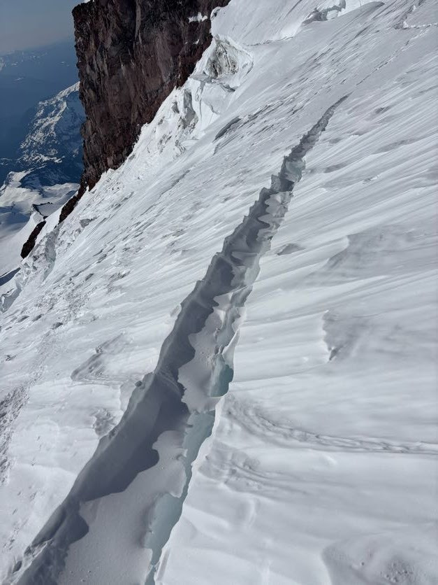
Group of travelers: 4 - mostly recreational skiers, 1 ex-ski-patrol, 1 had already skied this exact route in May 2023 Weather: summit high - 9 degrees. No clouds. Strong wind at night skinning up to Camp Muir, decreasing to breezy near the summit as the day moved on. If I recall, weather down at the bridge was a high of 60 degrees. The mid-April sun was easily softening the steep south-facing snow in the Finger, despite the air temp being below freezing. Avalanche observations: mostly supportable, plastered-on, stubborn wind board in the top 3k' on our easterly and southerly aspects. A few very small pockets of releasable, thin wind slab. Steep snow in the Finger was hot enough to occasionally pick up into small runnels, but not so hot as to turn into full-blown point-release slides. Ascent: We began skinning from Paradise at about 12:45AM. All was straightforward until the Ingraham. Leaving the Flats, we went up the steep headwall to climber's left, instead of the more mellow-looking snow near the Ice Box on climber's right. The Ingraham had no discernible boot pack, and likely still doesn't; the snow was very supportable, with mostly only crampon marks being left in the snow behind us. There were some notable hazards. We had to make a large stride to get over one large crack/small crevasse (see photo). There were a handful of smaller cracks that could be easily stepped over. Additionally, there is a very large debris pile from recent serac fall at about 12,300'. We moved through this debris to avoid a large crevasse on climber's right at a similar elevation. Above the Cleaver, there were a few very large crevasses that spanned the length of the face directly up the fall line to the summit. The summer route as shown in Caltopo typically bears climber's left eventually in this section, and we found that this was necessary to get around these large crevasses. We eventually traversed even harder left until we could see our ski line, transitioning at 14k' at about 12:45 PM. Descent: We took reference photos from the road the night before; they were nearly essential for determining where to leave the Upper Nisqually and enter the Finger. The Upper Nisqually is navigable with a few minor cracks to ski over, and a few larger crevasses to ski around. Snow was a mix of punch-able wind crust and supportable chalky wind board. We traversed skier's right just above 12,400' under a large crevasse to catch the upper flanks of the Finger. In the Finger proper, snow had transitioned to a heavy and deep corn that had small ice crystal mixed in; it is possible that the 6" or so of snow from the weekend prior hadn't fully consolidated. The Finger itself was not shedding much rock, but the Wilson headwall (above you on skier's right of the Finger exit) was. After the Finger, we followed some other ski tracks to skier's left, towards the center of the glacier. This resulted in us having to cross a large patch of dirt and rocks at about 7.4k' beneath a melting chunk of glacier. We'd recommend roughly aiming for the climber's route as marked in Caltopo. This involves bearing hard skier's right shortly after the Finger, then left again, to avoid the dirt cliffy glacier section we had to cross at 7.4k'. Getting to the bridge, we ensured to cross to the skier's left side of the river at about 4.9k' while there was still snow covering it. This resulted in a somewhat extended bushwhack at about 3,960', followed by continuous snow to the bushwhack ramp out to the road. I'm not sure if staying skiers' right of the river would have been any better.
Avalanche
Some old wet-loose point-release slides after the recent 6" of snow from the weekend. Confined mostly to the bottom half of the mountain.