
Quick report
- Cracking
- specific
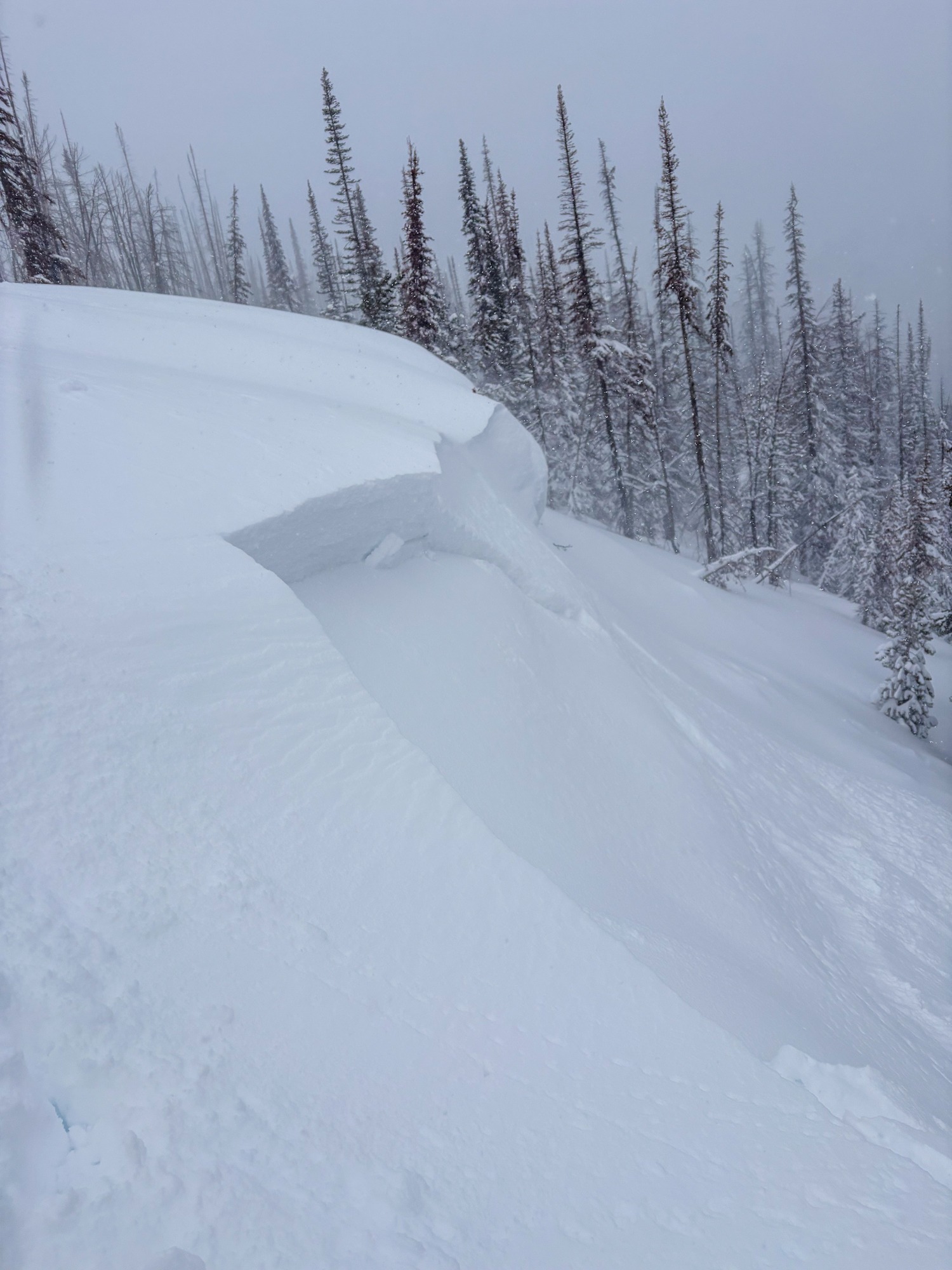
We found sensitive cornice and drifts along a wind-loaded ridgeline above 9,000 feet. Small sluffs were also easy to trigger in wind-sheltered terrain.
Cracking in soft 10 cm wind-skin began around 8,500'. Cracking and cornice breaks along a wind-loaded N-NE @ 9,200' (see photo).Weather
- Air Temp
- Teens to 20 F
- Cloud Cover
- overcast
- Wind Loading
- moderate
- Rain Elevation
- Previously over 9,000?
- Recent Snowfall
- 18 to 40+
- Snow Avail For Transport
- large amounts
Broken skies to the south of Galena Summit in the morning. Overcast in Frenchman's with some diffuse sunshine. Winds blew moderate with some stronger gusts from the SW. Snowfall, which was heavy at times, accumulated about 2" at the truck while in the field.
Snowpack
<8,000': Conditions were funky. New snow sat atop a very wet or slushy mess. Snowmobiling off-trail was not an option. Snowmobiling on packed roads even felt soft. Boot pen = ground. Ski pen was manageable.
8,000-9,000: Old snow was still wet/very wet but firming up with a weak crust at the top of the old snow. Wind affect became noticeable around 8,500' with 10 cm soft wind-skin and obvious deficit and deposition areas.
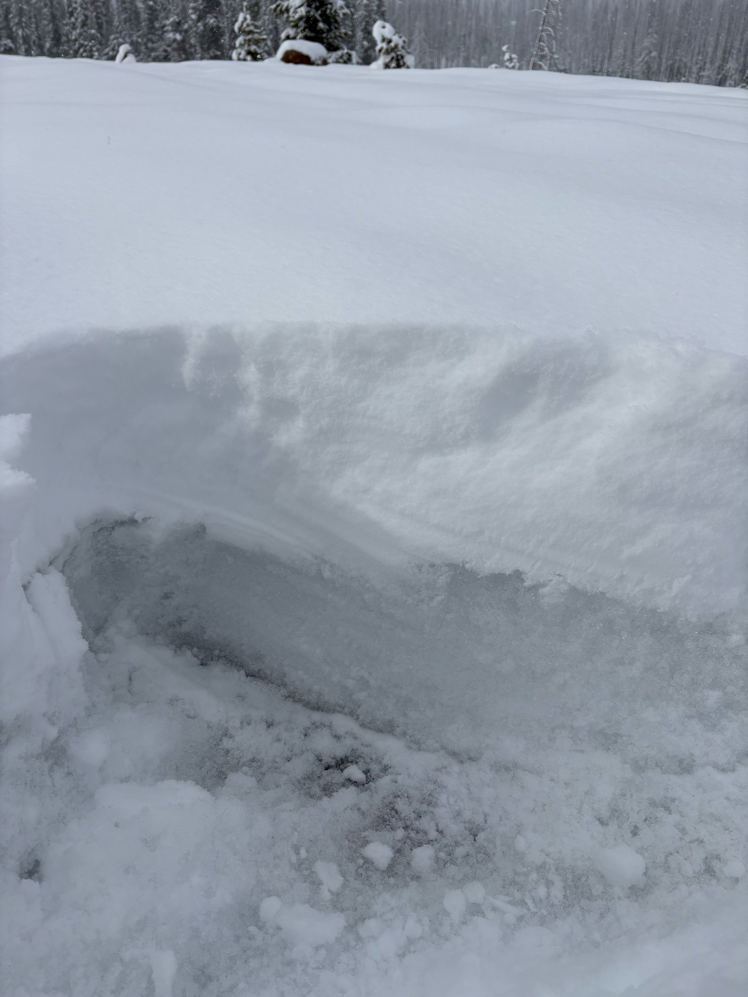
>9,000: Snow was much drier and lower density. Moderate SW wind was forming soft (4F-/4F) slabs up to ~70 cm thick. Cracking and small slabs along the ridgeline were failing at the (4/1) interface about 10-15 cm above the older wet snow (3/30). The old wet/dry snow interface (3/30) was well-bonded. Looking ahead, though, the potential exists for some ripping facet formation due to melt-layer recrystallization, particularly tonight as skies clear and temps drop.
Avalanche
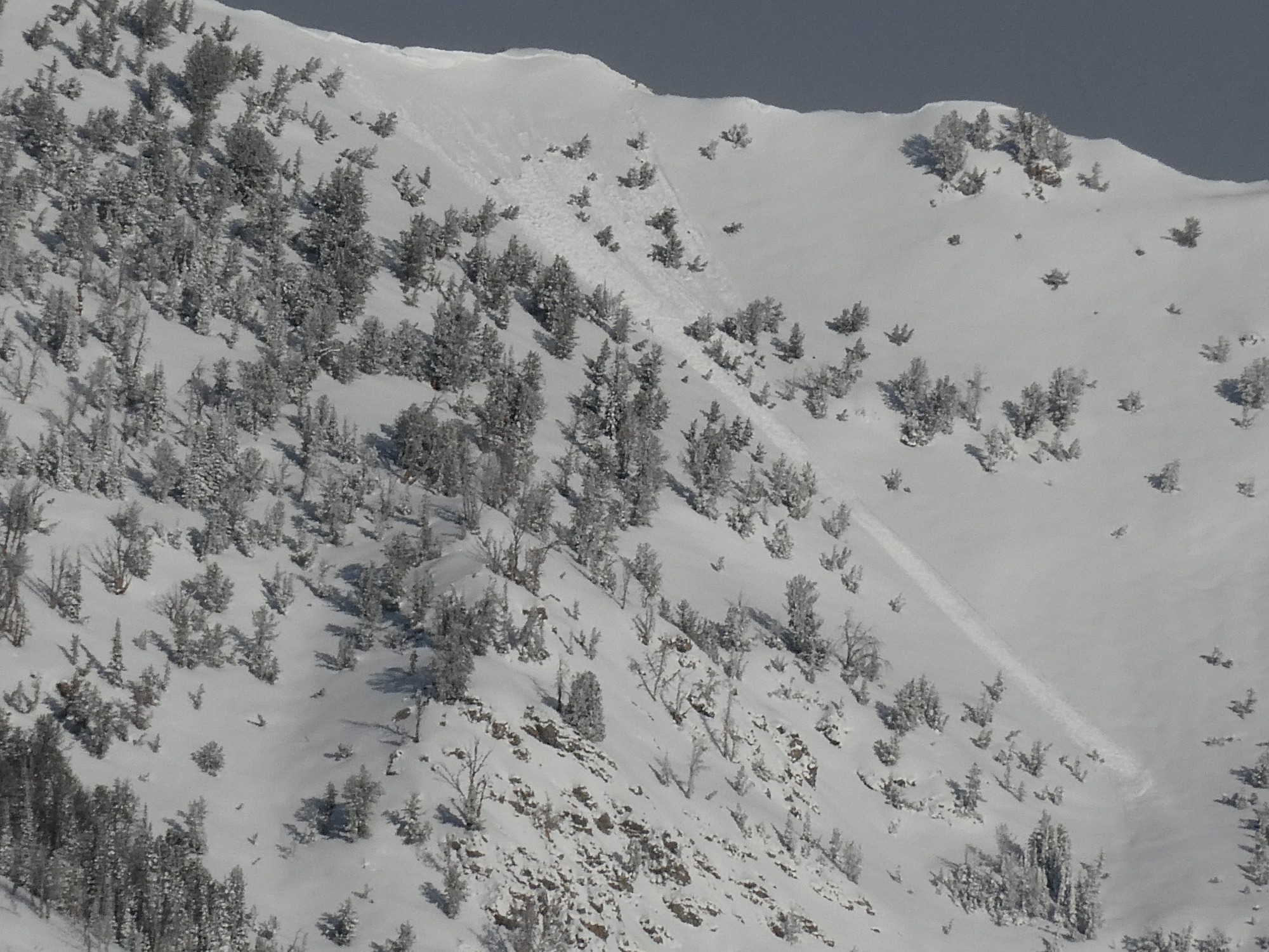
We saw one small wind slab on Goat Pk. (see photo). We had only brief windows of visibility into local terrain.